 |
|
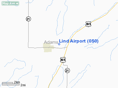
Location & QuickFacts
| FAA Information Effective: | 2008-09-25 |
| Airport Identifier: | 0S0 |
| Airport Status: | Operational |
| Longitude/Latitude: | 118-35-14.0320W/46-58-36.6310N
-118.587231/46.976842 (Estimated) |
| Elevation: | 1507 ft / 459.33 m (Estimated) |
| Land: | 140 acres |
| From nearest city: | 2 nautical miles NE of Lind, WA |
| Location: | Adams County, WA |
| Magnetic Variation: | 19E (1985) |
Owner & Manager
| Ownership: | Publicly owned |
| Owner: | Town Of Lind |
| Address: | Box F
Lind, WA 99341 |
| Phone number: | 509-677-3241 |
| Manager: | Rudy Fichtenberg |
| Address: | Po Box 70
Lind, WA 99341 |
| Phone number: | 509-677-8858 |
Airport Operations and Facilities
| Airport Use: | Open to public |
| Wind indicator: | Yes |
| Segmented Circle: | No |
| Control Tower: | No |
| Lighting Schedule: | DUSK-DAWN |
| Beacon Color: | Clear-Green (lighted land airport)
ARPT BCN OTS INDEFLY. |
| Landing fee charge: | No |
| Sectional chart: | Seattle |
| Region: | ANM - Northwest Mountain |
| Boundary ARTCC: | ZSE - Seattle |
| Tie-in FSS: | SEA - Seattle |
| FSS on Airport: | No |
| FSS Toll Free: | 1-800-WX-BRIEF |
| NOTAMs Facility: | SEA (NOTAM-d service avaliable) |
Airport Communications
Airport Services
| Airframe Repair: | NONE |
| Power Plant Repair: | NONE |
| Bottled Oxygen: | NONE |
| Bulk Oxygen: | NONE |
Runway Information
Runway 05/23
| Dimension: | 3197 x 50 ft / 974.4 x 15.2 m
EAST END OF RY HAS 800 X 50' DIRT GRADED SAFETY AREA. |
| Surface: | ASPH, Poor Condition
SPALLING ALONG RY EDGES; RY 23 TURNAROUND AREA BROKEN UP & OBSCURRED BY BRUSH. |
| Edge Lights: | Medium
RY LGTS OTS INDEFLY. |
| |
Runway 05 |
Runway 23 |
| Longitude: | 118-35-34.7030W | 118-34-53.3600W |
| Latitude: | 46-58-29.6450N | 46-58-43.6160N |
| Elevation: | 1478.00 ft | 0.00 ft |
| Alignment: | 64 | 127 |
| Traffic Pattern: | Left | Left |
| Obstruction: | , 50:1 slope to clear
RY 05 +3' FENCE 100' FM THLD. | 17 ft hill, 902.0 ft from runway, 41:1 slope to clear |
|
Radio Navigation Aids
| ID |
Type |
Name |
Ch |
Freq |
Var |
Dist |
| MW | NDB | Pelly | | 408.00 | 18E | 29.4 nm |
| MWH | VOR/DME | Moses Lake | 097X | 115.00 | 18E | 33.0 nm |
| PSC | VOR/DME | Pasco | 021X | 108.40 | 20E | 48.1 nm |
| EPH | VORTAC | Ephrata | 073X | 112.60 | 21E | 41.8 nm |
Remarks
- INTERSECTION OF TWY & ENTRANCE ROAD BREAKING UP.
- BRUSH AROUND RY LIGHTS.
- BRUSH ENCROACHMENT ALONG RY EDGES.
- ESTABD PRIOR TO 15 MAY 1959.
Images and information placed above are from
http://www.airport-data.com/airport/0S0/
We thank them for the data!
| General Info
|
| Country |
United States
|
| State |
WASHINGTON
|
| FAA ID |
0S0
|
| Latitude |
46-58-39.523N
|
| Longitude |
118-35-08.947W
|
| Elevation |
1491 feet
|
| Near City |
LIND
|
We don't guarantee the information is fresh and accurate. The data may
be wrong or outdated.
For more up-to-date information please refer to other sources.
|
|


