 |
|
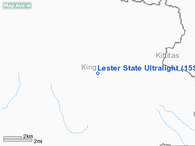
Lester State Ultralight Airport |
Location & QuickFacts
| FAA Information Effective: | 2008-09-25 |
| Airport Identifier: | 15S |
| Airport Status: | Closed Indefinitely |
| Longitude/Latitude: | 121-27-44.3370W/47-12-54.4000N
-121.462316/47.215111 (Estimated) |
| Elevation: | 1693 ft / 516.03 m (Surveyed) |
| Land: | 56 acres |
| From nearest city: | 2 nautical miles E of Lester, WA |
| Location: | King County, WA |
| Magnetic Variation: | 20E (1985) |
Owner & Manager
| Ownership: | Publicly owned |
| Owner: | Wsdot Aviation Div |
| Address: | 3704 172nd Street Ne, Suite K2, Po Box 3367
Arlington, WA 98108-6336 |
| Phone number: | 360-651-6300 |
| Manager: | Wsdot Aviation Div |
| Address: | 3704 172nd Street Ne, Suite K2, Po Box 3367
Arlington, WA 98108-6336 |
| Phone number: | 360-651-6300 |
Airport Operations and Facilities
| Airport Use: | Open to public |
| Wind indicator: | Yes |
| Segmented Circle: | No |
| Control Tower: | No |
| Landing fee charge: | No |
| Sectional chart: | Seattle |
| Region: | ANM - Northwest Mountain |
| Boundary ARTCC: | ZSE - Seattle |
| Tie-in FSS: | SEA - Seattle |
| FSS on Airport: | No |
| FSS Toll Free: | 1-800-WX-BRIEF |
| NOTAMs Facility: | SEA (NOTAM-d service avaliable) |
| Federal Agreements: | 1 |
Airport Communications
Airport Services
| Airframe Repair: | NONE |
| Power Plant Repair: | NONE |
| Bottled Oxygen: | NONE |
| Bulk Oxygen: | NONE |
Runway Information
Runway 05/23
| Dimension: | 400 x 100 ft / 121.9 x 30.5 m |
| Surface: | TURF, Poor Condition
SFC ROUGH. |
| |
Runway 05 |
Runway 23 |
| Traffic Pattern: | Left | Left |
| Obstruction: | 32 ft tree | 46 ft tree, 0.0 ft from runway, 33 ft right of centerline |
|
Helipad H1
| Dimension: | 100 x 100 ft / 30.5 x 30.5 m |
| Surface: | TURF, Fair Condition
SFC ROUGH. |
| |
Runway H1 |
Runway |
| Traffic Pattern: | Left | Left |
|
Radio Navigation Aids
| ID |
Type |
Name |
Ch |
Freq |
Var |
Dist |
| RNT | NDB | Renton | | 353.00 | 20E | 35.0 nm |
| ODD | NDB | Dondo | | 224.00 | 19E | 35.7 nm |
| LAC | NDB | Lacomas | | 328.00 | 18E | 46.5 nm |
| GR | NDB | Graye | | 216.00 | 18E | 46.8 nm |
| SEA | VORTAC | Seattle | 115X | 116.80 | 19E | 37.0 nm |
| TCM | VORTAC | Mcchord | 033X | 109.60 | 22E | 41.6 nm |
| ELN | VORTAC | Ellensburg | 126X | 117.90 | 21E | 42.6 nm |
| SEA | VOT | Seattle-tacoma | | 117.50 | | 36.9 nm |
| BFI | VOT | Boeing Field | | 108.60 | | 39.0 nm |
Remarks
- SEVERE RY EROSION FM RIVER.
- CTC WASHINGTON STATE DIVISION OF AERONAUTICS 206-764-4131 OR 1-800-552-0666 FOR FACILITY INFORMATION PRIOR TO USE.
- VEHICLES; PEDESTRIANS & ANIMALS ON & INVOF RY.
- RY SURFACE NOT MAINTAINED - VERY TALL GRASS & WEEDS.
- (ARPT STATUS) ARPT CLSD INDEFLY.
- ESTBD PRIOR TO 15 MAY 1959.
Images and information placed above are from
http://www.airport-data.com/airport/15S/
We thank them for the data!
| General Info
|
| Country |
United States
|
| State |
WASHINGTON
|
| FAA ID |
15S
|
| Latitude |
47-12-54.400N
|
| Longitude |
121-27-44.337W
|
| Elevation |
1693 feet
|
| Near City |
LESTER
|
We don't guarantee the information is fresh and accurate. The data may
be wrong or outdated.
For more up-to-date information please refer to other sources.
|
|


