 |
|
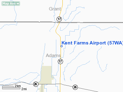
Location & QuickFacts
| FAA Information Effective: | 2008-09-25 |
| Airport Identifier: | 57WA |
| Airport Status: | Operational |
| Longitude/Latitude: | 119-07-49.0440W/46-52-24.5080N
-119.130290/46.873474 (Estimated) |
| Elevation: | 1155 ft / 352.04 m (Estimated) |
| Land: | 0 acres |
| From nearest city: | 4 nautical miles NE of Othello, WA |
| Location: | Adams County, WA |
| Magnetic Variation: | 19E (1985) |
Owner & Manager
| Ownership: | Privately owned |
| Owner: | Kent Farms, Inc. |
| Address: | 150 South Highway 17
Othello, WA 99344 |
| Phone number: | 509-488-2174 |
| Manager: | Brad W. Kent |
| Address: | 1897 West Sutton Rd
Othello, WA 99344 |
| Phone number: | 509-488-2382 |
Airport Operations and Facilities
| Airport Use: | Private |
| Wind indicator: | Yes |
| Segmented Circle: | No |
| Control Tower: | No |
| Lighting Schedule: | PHONE REQ
RWY LGTS ON REQUEST-CALL 509-488-2382. |
| Landing fee charge: | No |
| Sectional chart: | Seattle |
| Region: | ANM - Northwest Mountain |
| Boundary ARTCC: | ZSE - Seattle |
| Tie-in FSS: | SEA - Seattle |
| FSS on Airport: | No |
| FSS Toll Free: | 1-800-WX-BRIEF |
Runway Information
Runway 16/34
| Dimension: | 2600 x 40 ft / 792.5 x 12.2 m |
| Surface: | ASPH, |
| Edge Lights: | Low
AMBER COLORED RWY LGTS ON BOTH SIDES OF RWY. GREEN/BLUE END MARKER LGTS ON BOTH ENDS OF RWY. |
| |
Runway 16 |
Runway 34 |
| Traffic Pattern: | Left | Right |
| Obstruction: | , 2640.0 ft from runway | 50 ft plines, 80.0 ft from runway |
|
Radio Navigation Aids
| ID |
Type |
Name |
Ch |
Freq |
Var |
Dist |
| MW | NDB | Pelly | | 408.00 | 18E | 15.7 nm |
| MWH | VOR/DME | Moses Lake | 097X | 115.00 | 18E | 21.7 nm |
| PSC | VOR/DME | Pasco | 021X | 108.40 | 20E | 36.7 nm |
| EPH | VORTAC | Ephrata | 073X | 112.60 | 21E | 32.6 nm |
Remarks
- HANGAR IS ADJACENT TO RWY ON S END (APPROACH END OF 34) ON THE W SIDE APRX 200' FROM END.
- PRVDD MUTUALLY SATFY OPNL AGRMTS ARE ESTABD BTN KENT FARMS & TAGGARES FLD; USERS OF BOTH ARPTS ARE ADZD OF THE PROXIMITY OF THE TWO ARPTS.
Images and information placed above are from
http://www.airport-data.com/airport/57WA/
We thank them for the data!
| General Info
|
| Country |
United States
|
| State |
WASHINGTON
|
| FAA ID |
57WA
|
| Latitude |
46-52-24.508N
|
| Longitude |
119-07-49.044W
|
| Elevation |
1155 feet
|
| Near City |
OTHELLO
|
We don't guarantee the information is fresh and accurate. The data may
be wrong or outdated.
For more up-to-date information please refer to other sources.
|
|


