|
|
Jefferson County Intl Airport |
| Jefferson County International Airport |
| IATA: TWD – ICAO: none – FAA LID: 0S9 |
| Summary |
| Airport type |
Public |
| Owner |
Port of Port Townsend |
| Serves |
Port Townsend, Washington |
| Elevation AMSL |
108 ft / 33 m |
| Coordinates |
48°03′14″N 122°48′38″W / 48.05389°N 122.81056°W / 48.05389; -122.81056 |
| Website |
www.portofpt.com/... |
| Runways |
| Direction |
Length |
Surface |
| ft |
m |
| 9/27 |
3,000 |
914 |
Asphalt |
| Statistics (2009) |
| Aircraft operations |
58,000 |
| Based aircraft |
107 |
| Source: Federal Aviation Administration |
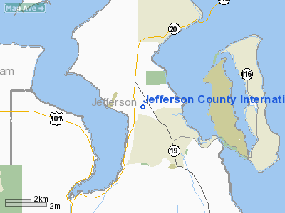
Jefferson County International Airport (IATA: TWD, FAA LID: 0S9) is a public use airport located four nautical miles (7 km) southwest of the central business district of Port Townsend, a town in Jefferson County, Washington, United States. It is owned by the Port of Port Townsend.
Facilities and aircraft
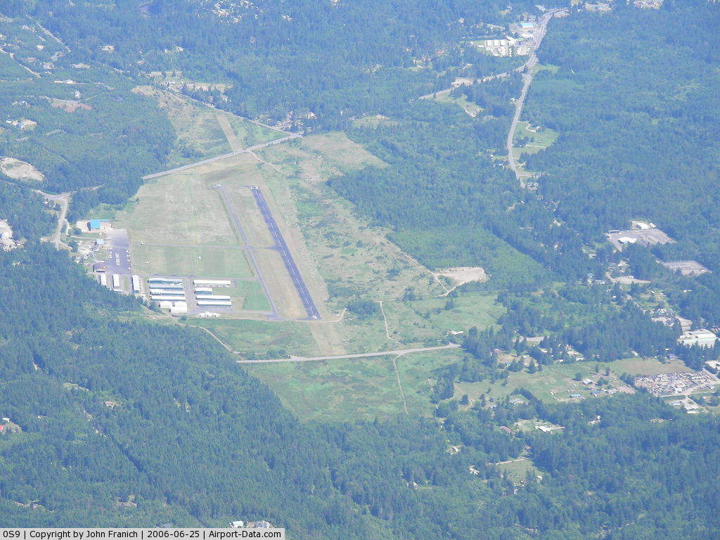
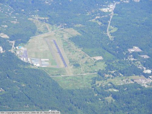
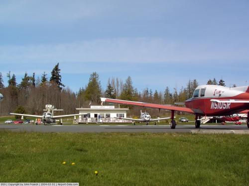
Jefferson County International Airport covers an area of 292 acres (118 ha) at an elevation of 108 feet (33 m) above mean sea level. It has one runway designated 9/27 with an asphalt surface measuring 3,000 by 75 feet (914 x 23 m).
For the 12-month period ending April 30, 2009, the airport had 58,000 aircraft operations, an average of 158 per day: 97% general aviation and 3% air taxi. At that time there were 107 aircraft based at this airport: 94% single-engine, 5% multi-engine and 1% ultralight.
The above content comes from Wikipedia and is published under free licenses – click here to read more.
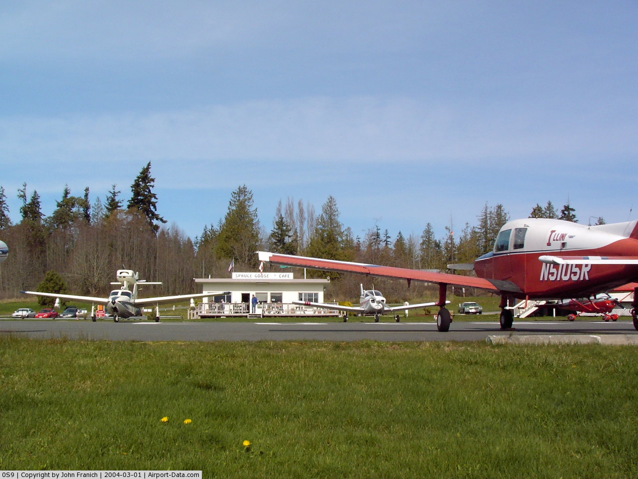
 |
(Click on the photo to enlarge) |
 |
(Click on the photo to enlarge) |
Location & QuickFacts
| FAA Information Effective: | 2008-09-25 |
| Airport Identifier: | 0S9 |
| Airport Status: | Operational |
| Longitude/Latitude: | 122-48-38.3170W/48-03-13.7110N
-122.810644/48.053809 (Estimated) |
| Elevation: | 108 ft / 32.92 m (Estimated) |
| Land: | 292 acres |
| From nearest city: | 4 nautical miles SW of Port Townsend, WA |
| Location: | Jefferson County, WA |
| Magnetic Variation: | 21E (1985) |
Owner & Manager
| Ownership: | Publicly owned |
| Owner: | Port Of Port Townsend |
| Address: | P O Box 1180
Port Townsend, WA 98368 |
| Phone number: | 360-385-0656 |
| Manager: | Larry Crockett |
| Address: | Po Box 1180
Port Townsend, WA 98368 |
| Phone number: | 360-385-2323 |
Airport Operations and Facilities
| Airport Use: | Open to public |
| Wind indicator: | Yes |
| Segmented Circle: | Yes |
| Control Tower: | No |
| Lighting Schedule: | DUSK-DAWN
ACTVT MIRL RY 09/27 - CTAF. |
| Beacon Color: | Clear-Green (lighted land airport) |
| Landing fee charge: | No |
| Sectional chart: | Seattle |
| Region: | ANM - Northwest Mountain |
| Traffic Pattern Alt: | 890 ft |
| Boundary ARTCC: | ZSE - Seattle |
| Tie-in FSS: | SEA - Seattle |
| FSS on Airport: | No |
| FSS Toll Free: | 1-800-WX-BRIEF |
| NOTAMs Facility: | SEA (NOTAM-d service avaliable) |
| Federal Agreements: | NR |
Airport Communications
| CTAF: | 123.000 |
| Unicom: | 123.000
AUTOMATED UNICOM. |
Airport Services
| Fuel available: | 100LL
100LL AVAILABLE 24 HRS WITH CREDIT CARD. NO CASH SALES. |
| Airframe Repair: | MAJOR |
| Power Plant Repair: | MAJOR |
| Bottled Oxygen: | NONE |
| Bulk Oxygen: | NONE |
Runway Information
Runway 09/27
| Dimension: | 3000 x 75 ft / 914.4 x 22.9 m |
| Surface: | ASPH, Good Condition |
| Weight Limit: | Single wheel: 12500 lbs. |
| Edge Lights: | Medium |
| |
Runway 09 |
Runway 27 |
| Longitude: | 122-48-59.7690W | 122-48-16.8520W |
| Latitude: | 48-03-17.2020N | 48-03-10.2160N |
| Traffic Pattern: | Right | Left |
| Markings: | Basic, Fair Condition | Basic, Fair Condition |
| Crossing Height: | 30.00 ft | 30.00 ft |
| VASI: | 2-light PAPI on left side | 2-light PAPI on right side |
| Visual Glide Angle: | 3.00° | 3.00° |
| Runway End Identifier: | Yes | Yes |
| Obstruction: | 348 ft hill, 9547.0 ft from runway, 26:1 slope to clear | 116 ft tree, 2005.0 ft from runway, 191 ft left of centerline, 16:1 slope to clear |
|
Radio Navigation Aids
| ID |
Type |
Name |
Ch |
Freq |
Var |
Dist |
| OPZ | NDB | Lopez Island | | 356.00 | 21E | 26.0 nm |
| BVS | NDB | Skagit/bay View | | 240.00 | 21E | 29.5 nm |
| FHR | NDB | Friday Harbor | | 284.00 | 20E | 29.7 nm |
| PWT | NDB | Kitsap | | 206.00 | 20E | 33.8 nm |
| CL | NDB | Elwha | | 515.00 | 22E | 35.0 nm |
| CAN | NDB | Carney | | 274.00 | 20E | 38.7 nm |
| RNT | NDB | Renton | | 353.00 | 20E | 41.3 nm |
| YJ | NDB | Victoria | | 200.00 | 21E | 42.6 nm |
| ODD | NDB | Dondo | | 224.00 | 19E | 46.2 nm |
| MB | NDB | Mill Bay | | 293.00 | 21E | 47.1 nm |
| MNC | NDB | Mason County | | 348.00 | 19E | 49.7 nm |
| NUW | TACAN | Whidbey Island | 085X | | 21E | 19.1 nm |
| CVV | VOR/DME | Penn Cove | 119X | 117.20 | 19E | 12.0 nm |
| PAE | VOR/DME | Paine | 043X | 110.60 | 20E | 22.9 nm |
| YYJ | VOR/DME | Victoria | 084X | 113.70 | 21E | 48.6 nm |
| SEA | VORTAC | Seattle | 115X | 116.80 | 19E | 42.3 nm |
| BFI | VOT | Boeing Field | | 108.60 | | 37.7 nm |
| SEA | VOT | Seattle-tacoma | | 117.50 | | 42.0 nm |
Remarks
- NOISE ABATEMENT PROCEDURES IN EFFECT CTC ARPT MGR 360-385-0656. TKOF AND LNDG PROHIBITED ON TURF NEXT TO RY.
Images and information placed above are from
http://www.airport-data.com/airport/0S9/
We thank them for the data!
| General Info
|
| Country |
United States
|
| State |
WASHINGTON
|
| FAA ID |
0S9
|
| Latitude |
48-03-17.330N
|
| Longitude |
122-48-34.607W
|
| Elevation |
107 feet
|
| Near City |
PORT TOWNSEND
|
We don't guarantee the information is fresh and accurate. The data may
be wrong or outdated.
For more up-to-date information please refer to other sources.
|
|