 |
|
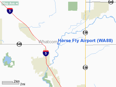
Location & QuickFacts
| FAA Information Effective: | 2008-09-25 |
| Airport Identifier: | WA88 |
| Airport Status: | Operational |
| Longitude/Latitude: | 122-33-24.6090W/48-53-34.4030N
-122.556836/48.892890 (Estimated) |
| Elevation: | 70 ft / 21.34 m (Estimated) |
| Land: | 2 acres |
| From nearest city: | 3 nautical miles NE of Ferndale, WA |
| Location: | Whatcom County, WA |
| Magnetic Variation: | 21E (1990) |
Owner & Manager
| Ownership: | Privately owned |
| Owner: | Robert D Mcfarland |
| Address: | 7022 Dahlberg Road
Ferndale, WA 98248 |
| Phone number: | 206-384-2901 |
| Manager: | Robert D Mcfarland |
| Address: | 7022 Dahlberg Road
Ferndale, WA 98248 |
| Phone number: | 206-384-2901 |
Airport Operations and Facilities
| Airport Use: | Private |
| Segmented Circle: | No |
| Control Tower: | No |
| Sectional chart: | Seattle |
| Region: | ANM - Northwest Mountain |
| Boundary ARTCC: | ZSE - Seattle |
| Tie-in FSS: | SEA - Seattle |
| FSS on Airport: | No |
| FSS Toll Free: | 1-800-WX-BRIEF |
Runway Information
Runway 07/25
| Dimension: | 2200 x 45 ft / 670.6 x 13.7 m |
| Surface: | TURF, |
| |
Runway 07 |
Runway 25 |
| Traffic Pattern: | Left | Left |
| Obstruction: | | 150 ft trees, 100.0 ft from runway, 100 ft right of centerline |
|
Radio Navigation Aids
| ID |
Type |
Name |
Ch |
Freq |
Var |
Dist |
| XX | NDB | Abbotsford | | 344.00 | 21E | 7.9 nm |
| WC | NDB | White Rock | | 332.00 | 21E | 9.6 nm |
| LU | NDB | Cultus | | 214.00 | 22E | 21.5 nm |
| VR | NDB | Vancouver | | 266.00 | 21E | 25.9 nm |
| BVS | NDB | Skagit/bay View | | 240.00 | 21E | 26.1 nm |
| OPZ | NDB | Lopez Island | | 356.00 | 21E | 28.8 nm |
| FHR | NDB | Friday Harbor | | 284.00 | 20E | 28.9 nm |
| AP | NDB | Active Pass | | 378.00 | 21E | 29.0 nm |
| V | NDB | Victor | | 368.00 | 22E | 31.7 nm |
| YJ | NDB | Victoria | | 200.00 | 21E | 36.6 nm |
| MB | NDB | Mill Bay | | 293.00 | 21E | 41.0 nm |
| NUW | TACAN | Whidbey Island | 085X | | 21E | 32.6 nm |
| YYJ | VOR/DME | Victoria | 084X | 113.70 | 21E | 38.0 nm |
| CVV | VOR/DME | Penn Cove | 119X | 117.20 | 19E | 39.5 nm |
| HUH | VORTAC | Whatcom | 077X | 113.00 | 20E | 3.3 nm |
| YVR | VORTAC | Vancouver | 44 | 115.90 | 21E | 25.9 nm |
Remarks
- RESTRICTED PATTERN FROM MEADOW MIST; SUBMIT WRITTEN AGREEMENT TO FAA FOR MUTUAL LANDING & TKOF DIRECTION ; ADVISE CANADIAN AIR TRAFFIC CONTROL OFFICIALS OF OPERATION.
Images and information placed above are from
http://www.airport-data.com/airport/WA88/
We thank them for the data!
| General Info
|
| Country |
United States
|
| State |
WASHINGTON
|
| FAA ID |
WA88
|
| Latitude |
48-53-34.403N
|
| Longitude |
122-33-24.609W
|
| Elevation |
70 feet
|
| Near City |
FERNDALE
|
We don't guarantee the information is fresh and accurate. The data may
be wrong or outdated.
For more up-to-date information please refer to other sources.
|
|


