 |
|
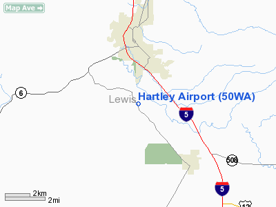
Location & QuickFacts
| FAA Information Effective: | 2008-09-25 |
| Airport Identifier: | 50WA |
| Airport Status: | Operational |
| Longitude/Latitude: | 122-57-54.4560W/46-37-11.3740N
-122.965127/46.619826 (Estimated) |
| Elevation: | 400 ft / 121.92 m (Estimated) |
| Land: | 0 acres |
| From nearest city: | 3 nautical miles SW of Chehalis, WA |
| Location: | Lewis County, WA |
| Magnetic Variation: | 20E (1985) |
Owner & Manager
| Ownership: | Privately owned |
| Owner: | Hartley Corporation |
| Address: | Po Box 1001
Chehalis, WA 98532 |
| Manager: | Bill Hartley |
| Address: | Po Box 1001
Chehalis, WA 98532 |
| Phone number: | 206-772-2000 |
Airport Operations and Facilities
| Airport Use: | Private |
| Wind indicator: | Yes |
| Segmented Circle: | No |
| Control Tower: | No |
| Landing fee charge: | No |
| Sectional chart: | Seattle |
| Region: | ANM - Northwest Mountain |
| Boundary ARTCC: | ZSE - Seattle |
| Tie-in FSS: | SEA - Seattle |
| FSS on Airport: | No |
| FSS Toll Free: | 1-800-WX-BRIEF |
Runway Information
Runway NW/SE
| Dimension: | 800 x 50 ft / 243.8 x 15.2 m |
| Surface: | TURF, |
| |
Runway NW |
Runway SE |
| Traffic Pattern: | Left | Left |
|
Radio Navigation Aids
| ID |
Type |
Name |
Ch |
Freq |
Var |
Dist |
| AST | FAN MARKER | Fort Stevens | | | 22E | 48.3 nm |
| TDO | NDB | Toledo | | 219.00 | 20E | 10.6 nm |
| LSO | NDB | Kelso | | 256.00 | 21E | 28.0 nm |
| LAC | NDB | Lacomas | | 328.00 | 18E | 28.8 nm |
| GR | NDB | Graye | | 216.00 | 18E | 35.2 nm |
| MNC | NDB | Mason County | | 348.00 | 19E | 38.1 nm |
| PEN | NDB | Karpen | | 201.00 | 20E | 38.7 nm |
| CAN | NDB | Carney | | 274.00 | 20E | 47.8 nm |
| AST | VOR/DME | Astoria | 087X | 114.00 | 19E | 46.9 nm |
| OLM | VORTAC | Olympia | 081X | 113.40 | 19E | 21.3 nm |
| TCM | VORTAC | Mcchord | 033X | 109.60 | 22E | 37.6 nm |
Remarks
- PRVDD TKOFS ARE MADE TO THE ESE/LNDGS TO THE WNW. ALL TFC PATS ARE FLOWN ON S SIDE UNLESS STRAIGHT-IN APCHS & STRAIGHT-OUT DEPS ARE EMPLOYED.
Images and information placed above are from
http://www.airport-data.com/airport/50WA/
We thank them for the data!
| General Info
|
| Country |
United States
|
| State |
WASHINGTON
|
| FAA ID |
50WA
|
| Latitude |
46-37-11.374N
|
| Longitude |
122-57-54.456W
|
| Elevation |
400 feet
|
| Near City |
CHEHALIS
|
We don't guarantee the information is fresh and accurate. The data may
be wrong or outdated.
For more up-to-date information please refer to other sources.
|
|


