 |
|
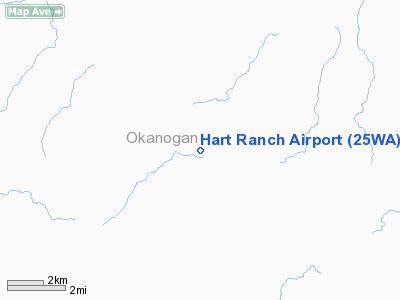
Location & QuickFacts
| FAA Information Effective: | 2008-09-25 |
| Airport Identifier: | 25WA |
| Airport Status: | Operational |
| Longitude/Latitude: | 119-03-53.1350W/48-34-35.5700N
-119.064760/48.576547 (Estimated) |
| Elevation: | 2608 ft / 794.92 m (Estimated) |
| Land: | 0 acres |
| From nearest city: | 17 nautical miles SE of Tonasket, WA |
| Location: | Okanogan County, WA |
| Magnetic Variation: | 20E (1985) |
Owner & Manager
| Ownership: | Privately owned |
| Owner: | N. Hart |
| Address: |
Tonasket, WA 98855 |
| Phone number: | 206-762-2570 |
| Address: |
|
Airport Operations and Facilities
| Airport Use: | Private |
| Wind indicator: | Yes |
| Segmented Circle: | No |
| Control Tower: | No |
| Landing fee charge: | No |
| Sectional chart: | Seattle |
| Region: | ANM - Northwest Mountain |
| Boundary ARTCC: | ZSE - Seattle |
| Tie-in FSS: | SEA - Seattle |
| FSS on Airport: | No |
| FSS Toll Free: | 1-800-WX-BRIEF |
Airport Services
| Airframe Repair: | NONE |
| Power Plant Repair: | NONE |
Runway Information
Runway E/W
| Dimension: | 2600 x 50 ft / 792.5 x 15.2 m |
| Surface: | TURF, |
| |
Runway E |
Runway W |
| Traffic Pattern: | Left | Left |
|
Radio Navigation Aids
| ID |
Type |
Name |
Ch |
Freq |
Var |
Dist |
| OMK | NDB | Omak | | 219.00 | 19E | 19.5 nm |
Remarks
Images and information placed above are from
http://www.airport-data.com/airport/25WA/
We thank them for the data!
| General Info
|
| Country |
United States
|
| State |
WASHINGTON
|
| FAA ID |
25WA
|
| Latitude |
48-34-35.570N
|
| Longitude |
119-03-53.135W
|
| Elevation |
2608 feet
|
| Near City |
TONASKET
|
We don't guarantee the information is fresh and accurate. The data may
be wrong or outdated.
For more up-to-date information please refer to other sources.
|
|


