|
|
Coordinates: 45°37′40″N 122°24′16″W / 45.62778°N 122.40444°W / 45.62778; -122.40444
| Grove Field |
| IATA: none – ICAO: none – FAA LID: 1W1 |
| Summary |
| Airport type |
Public |
| Owner |
Port of Camas - Washougal |
| Serves |
Camas, Washington |
| Elevation AMSL |
429 ft / 131 m |
| Runways |
| Direction |
Length |
Surface |
| ft |
m |
| 7/25 |
2,710 |
826 |
Asphalt |
| Statistics (2007) |
| Aircraft operations |
10,000 |
| Based aircraft |
86 |
| Source: Federal Aviation Administration |
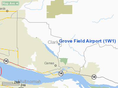
Grove Field (FAA LID: 1W1) is a public airport located three miles (5 km) north of the central business district of Camas, a city in Clark County, Washington, United States. It is located near Lacamas Lake which has a seaplane base. Due to the closing of Evergreen Field, many aircraft have moved to Grove Field. Facilities and aircraft
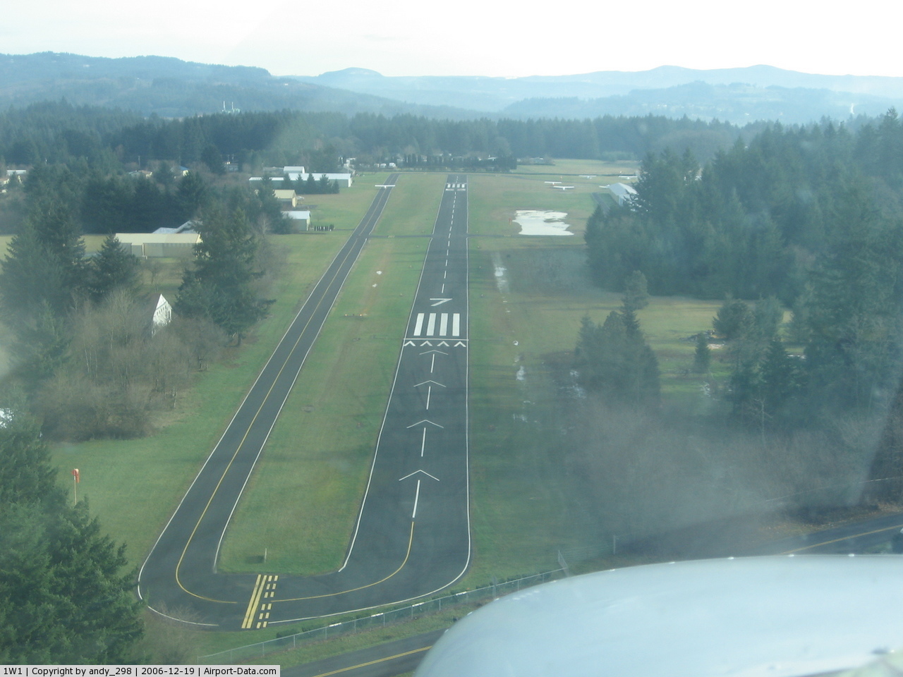
Grove Field covers an area of 23 acres (9 ha) which contains one runway (7/25) with a 2,710 x 40 ft (826 x 12 m) asphalt pavement. For the 12-month period ending May 31, 2007, the airport had 10,000 general aviation aircraft operations, an average of 27 per day. At that time there were 86 aircraft based at this airport: 99% single-engine and 1% multi-engine.
History
The air field is named for Ward Grove who built the airfield in 1945. Grove moved to Vancouver, Washington in 1924 and learned to fly in Portland, Oregon at the Rankin Flying School operated by Tex Rankin. During World War Two, Grove taught flying in California and returned to Clark County, Washington after the war.The Port of Camas-Washougal bought the airstrip from him in 1961 and in 1984, the Port Commission voted to name the field in his honor. Grove died in 1993.
The above content comes from Wikipedia and is published under free licenses – click here to read more.
 |
(Click on the photo to enlarge) |
Location & QuickFacts
| FAA Information Effective: | 2008-09-25 |
| Airport Identifier: | 1W1 |
| Airport Status: | Operational |
| Longitude/Latitude: | 122-24-15.5210W/45-37-40.1860N
-122.404311/45.627829 (Estimated) |
| Elevation: | 429 ft / 130.76 m (Estimated) |
| Land: | 23 acres |
| From nearest city: | 3 nautical miles N of Camas, WA |
| Location: | Clark County, WA |
| Magnetic Variation: | 19E (1985) |
Owner & Manager
| Ownership: | Publicly owned |
| Owner: | Camas-washougal Port Comm |
| Address: | 24 South A Street
Washougal, WA 98671 |
| Phone number: | 360-835-2196 |
| Manager: | David Ripp |
| Address: | 24 South A Street
Washougal, WA 98671 |
| Phone number: | 360-835-2196 |
Airport Operations and Facilities
| Airport Use: | Open to public |
| Wind indicator: | Yes |
| Segmented Circle: | No |
| Control Tower: | No |
| Lighting Schedule: | RDO-CTL
ACTVT ROTG BCN & MIRL RY 07/25 - CTAF. |
| Beacon Color: | Clear-Green (lighted land airport) |
| Landing fee charge: | No |
| Sectional chart: | Seattle |
| Region: | ANM - Northwest Mountain |
| Boundary ARTCC: | ZSE - Seattle |
| Tie-in FSS: | SEA - Seattle |
| FSS on Airport: | No |
| FSS Toll Free: | 1-800-WX-BRIEF |
| NOTAMs Facility: | SEA (NOTAM-d service avaliable) |
| Federal Agreements: | N |
Airport Communications
Airport Services
| Fuel available: | 100
FOR FUEL AFT HRS CREDIT CARD LOCK. |
| Airframe Repair: | MAJOR |
| Power Plant Repair: | MAJOR |
| Bottled Oxygen: | NONE |
| Bulk Oxygen: | NONE |
Runway Information
Runway 07/25
| Dimension: | 2710 x 40 ft / 826.0 x 12.2 m |
| Surface: | ASPH, Good Condition |
| Edge Lights: | Non-standard lighting system
NSTD MIRL RYS 07 & 25 DSPLCD THLDS UNLGTD. |
| |
Runway 07 |
Runway 25 |
| Longitude: | 122-24-34.5850W | 122-23-56.4570W |
| Latitude: | 45-37-40.3390N | 45-37-40.0330N |
| Elevation: | 410.00 ft | 429.00 ft |
| Traffic Pattern: | Left | Left |
| Markings: | Nonstandard, Good Condition
RYS 07 & 25 HAVE 4 THR STRIPES FALSELY INDICATING 60 FT RY WIDTH. | Nonstandard, Good Condition |
| Displaced threshold: | 493.00 ft | 413.00 ft |
| VASI: | 2-light PAPI on left side | 2-light PAPI on left side |
| Visual Glide Angle: | 5.00° | 5.00° |
| Obstruction: | 112 ft trees, 1259.0 ft from runway, 9:1 slope to clear
RWY 07 APCH SLOPE 0:1 TO +83' TREE 33' FT FM THLD, 114' LEFT OF DSPLCD THR.
RY 07 +15' ROAD 32' FM RY END. | 28 ft trees, 285.0 ft from runway, 44 ft right of centerline, 3:1 slope to clear
RWY 25 APCH SLOPE 20:1 TO DSPLCD THR.
RWY 25 4' FNC 65' FM THR AND 15' RD 85' FM THR |
|
Radio Navigation Aids
| ID |
Type |
Name |
Ch |
Freq |
Var |
Dist |
| LBH | NDB | Laker | | 332.00 | 20E | 5.8 nm |
| PND | NDB | Banks | | 356.00 | 21E | 27.0 nm |
| LSO | NDB | Kelso | | 256.00 | 21E | 38.2 nm |
| CBU | TACAN | Columbia | 029X | | 20E | 9.0 nm |
| PDX | VOR/DME | Portland | 055X | 111.80 | 20E | 8.7 nm |
| UBG | VOR/DME | Newberg | 121X | 117.40 | 21E | 29.3 nm |
| BTG | VORTAC | Battle Ground | 113X | 116.60 | 21E | 10.7 nm |
| PDX | VOT | Portland Intl | | 111.00 | | 8.4 nm |
| HIO | VOT | Portland-hillsboro | | 115.20 | | 23.5 nm |
Remarks
- NOISE ABATEMENT PROCEDURES IN EFFECT, CTC PORT OF CAMAS-WASHOUGAL AT 360-835-2196.
- ESTABD PRIOR TO 15 MAY 1959.
Images and information placed above are from
http://www.airport-data.com/airport/1W1/
We thank them for the data!
| General Info
|
| Country |
United States
|
| State |
WASHINGTON
|
| FAA ID |
1W1
|
| Latitude |
45-37-40.000N
|
| Longitude |
122-24-15.000W
|
| Elevation |
430 feet
|
| Near City |
CAMAS
|
We don't guarantee the information is fresh and accurate. The data may
be wrong or outdated.
For more up-to-date information please refer to other sources.
|
|