 |
|
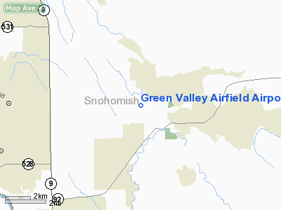
Green Valley Airfield Airport |
Location & QuickFacts
| FAA Information Effective: | 2008-09-25 |
| Airport Identifier: | WA25 |
| Airport Status: | Operational |
| Longitude/Latitude: | 122-00-56.4760W/48-05-45.3600N
-122.015688/48.095933 (Estimated) |
| Elevation: | 300 ft / 91.44 m (Estimated) |
| Land: | 37 acres |
| From nearest city: | 3 nautical miles NW of Granite Falls, WA |
| Location: | Snohomish County, WA |
| Magnetic Variation: | 21E (1985) |
Owner & Manager
| Ownership: | Privately owned |
| Owner: | C E Morris |
| Address: | Rt 1 Box 105a
Granite Falls, WA 98252 |
| Phone number: | 206-691-6913 |
| Address: |
|
Airport Operations and Facilities
| Airport Use: | Private |
| Wind indicator: | Yes |
| Segmented Circle: | No |
| Control Tower: | No |
| Landing fee charge: | No |
| Sectional chart: | Seattle |
| Region: | ANM - Northwest Mountain |
| Boundary ARTCC: | ZSE - Seattle |
| Tie-in FSS: | SEA - Seattle |
| FSS on Airport: | No |
| FSS Toll Free: | 1-800-WX-BRIEF |
Airport Communications
Airport Services
| Airframe Repair: | NONE |
| Power Plant Repair: | NONE |
Runway Information
Runway 12/30
| Dimension: | 1470 x 250 ft / 448.1 x 76.2 m |
| Surface: | TURF, |
| |
Runway 12 |
Runway 30 |
| Traffic Pattern: | Left | Right |
|
Radio Navigation Aids
| ID |
Type |
Name |
Ch |
Freq |
Var |
Dist |
| BVS | NDB | Skagit/bay View | | 240.00 | 21E | 27.6 nm |
| RNT | NDB | Renton | | 353.00 | 20E | 37.0 nm |
| OPZ | NDB | Lopez Island | | 356.00 | 21E | 42.9 nm |
| ODD | NDB | Dondo | | 224.00 | 19E | 45.6 nm |
| PWT | NDB | Kitsap | | 206.00 | 20E | 47.0 nm |
| FHR | NDB | Friday Harbor | | 284.00 | 20E | 48.0 nm |
| NUW | TACAN | Whidbey Island | 085X | | 21E | 30.2 nm |
| PAE | VOR/DME | Paine | 043X | 110.60 | 20E | 14.9 nm |
| CVV | VOR/DME | Penn Cove | 119X | 117.20 | 19E | 29.8 nm |
| SEA | VORTAC | Seattle | 115X | 116.80 | 19E | 41.4 nm |
| BFI | VOT | Boeing Field | | 108.60 | | 36.1 nm |
| SEA | VOT | Seattle-tacoma | | 117.50 | | 40.9 nm |
Remarks
- SW EDGE OF RWY HAS TREES IN TRANSITIONAL SFC.
- COYOTES & DOGS DIG HOLES IN RWY
Images and information placed above are from
http://www.airport-data.com/airport/WA25/
We thank them for the data!
| General Info
|
| Country |
United States
|
| State |
WASHINGTON
|
| FAA ID |
WA25
|
| Latitude |
48-05-45.360N
|
| Longitude |
122-00-56.476W
|
| Elevation |
300 feet
|
| Near City |
GRANITE FALLS
|
We don't guarantee the information is fresh and accurate. The data may
be wrong or outdated.
For more up-to-date information please refer to other sources.
|
|


