 |
|
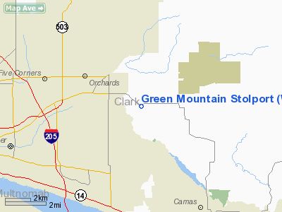
Green Mountain Stolport Airport |
Location & QuickFacts
| FAA Information Effective: | 2008-09-25 |
| Airport Identifier: | WA67 |
| Airport Status: | Operational |
| Longitude/Latitude: | 122-28-21.0000W/45-39-47.0000N
-122.472500/45.663056 (Estimated) |
| Elevation: | 270 ft / 82.30 m (Estimated) |
| Land: | 0 acres |
| From nearest city: | 9 nautical miles E of Vancouver, WA |
| Location: | Clark County, WA |
| Magnetic Variation: | 19E (1985) |
Owner & Manager
| Ownership: | Privately owned |
| Owner: | Ben & Sally Runyan |
| Address: | 5530 Ne 199th Ave
Vancouver, WA 98662 |
| Phone number: | 206-896-6316 |
| Manager: | Ben & Sally Runyan |
| Address: | 5530 Ne 199th Ave
Vancouver, WA 98662 |
| Phone number: | 206-896-6316 |
Airport Operations and Facilities
| Airport Use: | Private |
| Wind indicator: | Yes |
| Segmented Circle: | No |
| Control Tower: | No |
| Lighting Schedule: | PHONE REQ
FOR RUNWAY LGTS PPR CTC AMGR 206-896-6316. |
| Landing fee charge: | No |
| Sectional chart: | Seattle |
| Region: | ANM - Northwest Mountain |
| Boundary ARTCC: | ZSE - Seattle |
| Tie-in FSS: | SEA - Seattle |
| FSS on Airport: | No |
| FSS Toll Free: | 1-800-WX-BRIEF |
Airport Communications
Airport Services
| Fuel available: | 100LLMOGAS |
| Airframe Repair: | NONE |
| Power Plant Repair: | NONE |
| Bottled Oxygen: | NONE |
| Bulk Oxygen: | NONE |
Runway Information
Runway E/W
| Dimension: | 2000 x 35 ft / 609.6 x 10.7 m |
| Surface: | ASPH, Good Condition |
| Edge Lights: | Low
NON-STD RWY LGTS. |
| |
Runway E |
Runway W |
| Traffic Pattern: | Left | Left |
| Markings: | Nonstandard, Good Condition
YELLOW CNTRLN MARKINGS ONLY. | Nonstandard, Good Condition |
| Runway End Identifier: | No | No |
| Centerline Lights: | No | No |
| Touchdown Lights: | No | No |
| Obstruction: | 50 ft tree, 1500.0 ft from runway, 80 ft right of centerline, 30:1 slope to clear
+2' FENCE 25' FROM THR; 30' TREES 0' FROM THR 52' RIGHT & 60' LEFT OF CNTRLN; 3' STUMP 10' FORM THR; 3' WNDSOCK 35' FM THR, 22; L, +10' BLDG 8' FM THR 40' R. | 5 ft fence, 200.0 ft from runway, 53 ft right of centerline
+4' FENCE 20' FROM THR; ROAD 25' FROM THR; +5' FENCE FROM 57'-200' FM THR, 53' RIGHT. |
|
Radio Navigation Aids
| ID |
Type |
Name |
Ch |
Freq |
Var |
Dist |
| LBH | NDB | Laker | | 332.00 | 20E | 7.3 nm |
| PND | NDB | Banks | | 356.00 | 21E | 24.2 nm |
| LSO | NDB | Kelso | | 256.00 | 21E | 34.9 nm |
| CBU | TACAN | Columbia | 029X | | 20E | 7.4 nm |
| PDX | VOR/DME | Portland | 055X | 111.80 | 20E | 7.0 nm |
| UBG | VOR/DME | Newberg | 121X | 117.40 | 21E | 28.3 nm |
| BTG | VORTAC | Battle Ground | 113X | 116.60 | 21E | 7.1 nm |
| PDX | VOT | Portland Intl | | 111.00 | | 6.7 nm |
| HIO | VOT | Portland-hillsboro | | 115.20 | | 21.3 nm |
Remarks
- USE LEFT HAND TFC PAT BY GOING AROUND GREEN MTN & GETTING A GOOD LINE UP FOR LET DOWN.
- BLDGS; TREES AND PARKED ACFT IN PRIM SFC & TRANSITION SFCS.
Images and information placed above are from
http://www.airport-data.com/airport/WA67/
We thank them for the data!
| General Info
|
| Country |
United States
|
| State |
WASHINGTON
|
| FAA ID |
WA67
|
| Latitude |
45-39-47.000N
|
| Longitude |
122-28-21.000W
|
| Elevation |
270 feet
|
| Near City |
VANCOUVER
|
We don't guarantee the information is fresh and accurate. The data may
be wrong or outdated.
For more up-to-date information please refer to other sources.
|
|


