 |
|
| Gray Army Airfield |
| IATA: GRF – ICAO: KGRF |
| Summary |
| Airport type |
Military |
| Owner |
U.S. Army ATCA-ASO |
| Location |
Tacoma, Washington |
| Elevation AMSL |
302 ft / 92 m |
| Coordinates |
47°04′45.2″N 122°34′50.8″W / 47.079222°N 122.580778°W / 47.079222; -122.580778Coordinates: 47°04′45.2″N 122°34′50.8″W / 47.079222°N 122.580778°W / 47.079222; -122.580778 |
| Runways |
| Direction |
Length |
Surface |
| ft |
m |
| 15/33 |
6,125 |
1,867 |
Asphalt |
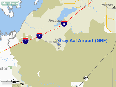
Gray Army Airfield (IATA: GRF, ICAO: KGRF), also known as Gray AAF, is a military airport located at Fort Lewis near Tacoma, Washington, USA.
It should not confused with Robert Gray Army Airfield at Fort Hood in Texas. History
Established in 1942 by United States Army Air Forces. Used by Air Technical Service Command as an aircraft maintenance and supply depot; primarily to service Lend-Lease aircraft being sent to Alaska for subsequent transfer to Soviet Union.
Retained by the Army after 1947 for observation and Liaison aircraft at Fort Lewis.
The above content comes from Wikipedia and is published under free licenses – click here to read more.
Location & QuickFacts
| FAA Information Effective: | 2008-09-25 |
| Airport Identifier: | GRF |
| Airport Status: | Operational |
| Longitude/Latitude: | 122-34-50.8000W/47-04-45.2000N
-122.580778/47.079222 (Estimated) |
| Elevation: | 300 ft / 91.44 m (Surveyed) |
| Land: | 0 acres |
| From nearest city: | 1 nautical miles E of Fort Lewis/tacoma, WA |
| Location: | Pierce County, WA |
| Magnetic Variation: | 20E (1990) |
Owner & Manager
| Ownership: | Army owned |
| Owner: | Us Army Atca-aso |
| Address: | Cameron Station
Alexandria, VA 22314 |
| Address: |
|
| Phone number: | 206-968-2904 |
Airport Operations and Facilities
| Airport Use: | Private |
| Segmented Circle: | No |
| Control Tower: | Yes |
| Lighting Schedule: | DUSK-DAWN |
| Beacon Color: | Split-Clear-Green (lighted military airport) |
| Sectional chart: | Seattle |
| Region: | ANM - Northwest Mountain |
| Boundary ARTCC: | ZSE - Seattle |
| Tie-in FSS: | SEA - Seattle |
| FSS on Airport: | No |
| FSS Toll Free: | 1-800-WX-BRIEF |
| NOTAMs Facility: | SEA (NOTAM-d service avaliable) |
| Certification type/date: | I L U 08/1990 |
Airport Communications
Runway Information
Runway 15/33
| Dimension: | 6125 x 150 ft / 1866.9 x 45.7 m |
| Surface: | ASPH, |
| Pavement Class: | 55 /F/A/W/T |
| Edge Lights: | High |
| |
Runway 15 |
Runway 33 |
| Longitude: | 122-35-00.7220W | 122-34-40.9210W |
| Latitude: | 47-05-14.6370N | 47-04-15.7280N |
| Elevation: | 289.00 ft | 300.00 ft |
| ILS Type: | ILS
| |
| Traffic Pattern: | Left | Left |
| RVR Equipment: | touchdown | |
| Approach lights: | | ODALS |
|
Radio Navigation Aids
| ID |
Type |
Name |
Ch |
Freq |
Var |
Dist |
| GR | NDB | Graye | | 216.00 | 18E | 4.4 nm |
| LAC | NDB | Lacomas | | 328.00 | 18E | 4.4 nm |
| ODD | NDB | Dondo | | 224.00 | 19E | 20.4 nm |
| CAN | NDB | Carney | | 274.00 | 20E | 22.5 nm |
| MNC | NDB | Mason County | | 348.00 | 19E | 23.0 nm |
| PWT | NDB | Kitsap | | 206.00 | 20E | 25.8 nm |
| RNT | NDB | Renton | | 353.00 | 20E | 29.1 nm |
| TDO | NDB | Toledo | | 219.00 | 20E | 37.5 nm |
| TCM | VORTAC | Mcchord | 033X | 109.60 | 22E | 6.0 nm |
| OLM | VORTAC | Olympia | 081X | 113.40 | 19E | 14.7 nm |
| SEA | VORTAC | Seattle | 115X | 116.80 | 19E | 24.1 nm |
| SEA | VOT | Seattle-tacoma | | 117.50 | | 24.6 nm |
| BFI | VOT | Boeing Field | | 108.60 | | 29.2 nm |
Remarks
- SEE FLIP AP/1 SUPPLEMENTARY ARPT RMK.
- RSTD: 48 HR PPR TRAN ACFT, DSN 357-6628/5998, C253-967-6628/ 5998.
- CAUTION: EXTV NVD TRNG AND PJE. NUMEROUS SMALL ARMS .8NM E OF FIELD. WHEN CLASS D AIRSPACE IN EFF UNMANNED AERIAL VEH (UAV OPR BLW 2000' IN TFC PAT. UAV A-G S END TWY EDUR UAV OPS.
- MISC: SPECIAL VFR DAY F/W 700-1, R/W 300- 1/2. NGT F/W NOT AUTH, R/W 500-1. ACFT CONDUCTING TACTICAL OPR ON FT LEW MIL RESERVATION CTC OPS PRIOR TO OPR. CTC GRAY TFC ON CTAF WHEN TWR CLSD. CLASS D AIRSPACE EFF CONT EXC HOL, OT CLASS E. NO HGR FOR TRANS ACFT.
- AR: CTC OPS DSN 357-3036, C253-967-3036.
- ARNG: OPR 1430-0100Z++ TUE-FRI EXC HOL. TRAN ALERT AVC NOT AVBL. LTD PRK. PPR FOR ACFT RQR FUEL AND PRK, DSN 323- 3805, C253-912-3905.
- PMSV METRO: FULL SVC CONTINUOUS, EXC HOL. FULL SVC MAY VARY WITH LCL FLT SKED.WX BRIEFING FOR TRAN AIRCREWS AVBL FM 25 OWS, DAVIS-MONTHAN AFB, DSN 228-6598.
- MISC: WX OBSVR VIS LIMITED TO 2 SM IN SOME DIRECTIONS.
- CAUTION: HIGH VOLUME OF PERSONNEL/VEHICLES WITH NEGATIVE RADIO COMMUNICATION ON GROUND CONTROL CROSSING TAXIWAYS G AND H.
- BULLSEYE RDO - 34.6 OPR CONT, EXC HOL.
- J-8 FUEL AVBL; LTD SUPPLY.
- SMALL ARMS RANGE .8 NM E OF AFLD.
- WHEN CLASS D AIRSPACE IN EFFECT UNMANNED AERIAL VEHICLE (UAV) OPR BLO 2,000 FT AGL IN TFC PATTERN. UAV ARRESTING GEAR SOUTH END OF TWY "E" DUR UAV OPS.
Images and information placed above are from
http://www.airport-data.com/airport/GRF/
We thank them for the data!
| General Info
|
| Country |
United States
|
| State |
WASHINGTON
|
| FAA ID |
GRF
|
| Latitude |
47-04-45.350N
|
| Longitude |
122-34-53.454W
|
| Elevation |
302 feet
|
| Near City |
FORT LEWIS/TACOMA
|
We don't guarantee the information is fresh and accurate. The data may
be wrong or outdated.
For more up-to-date information please refer to other sources.
|
|


