 |
|
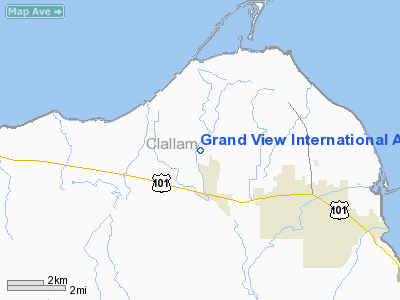
Location & QuickFacts
| FAA Information Effective: | 2008-09-25 |
| Airport Identifier: | WN23 |
| Airport Status: | Operational |
| Longitude/Latitude: | 123-10-46.6430W/48-06-06.3320N
-123.179623/48.101759 (Estimated) |
| Elevation: | 150 ft / 45.72 m (Estimated) |
| Land: | 3 acres |
| From nearest city: | 3 nautical miles NW of Sequim, WA |
| Location: | Clallam County, WA |
| Magnetic Variation: | 21E (1985) |
Owner & Manager
| Ownership: | Privately owned |
| Owner: | Richard & Carol Wehr |
| Address: | 6066 Old Olympic Hwy
Sequim, WA 98382 |
| Phone number: | 206-683-5115 |
| Manager: | Richard & Carol Wehr |
| Address: | 6066 Old Olympic Hwy
Sequim, WA 98382 |
| Phone number: | 206-683-5115 |
Airport Operations and Facilities
| Airport Use: | Private |
| Wind indicator: | Yes |
| Segmented Circle: | No |
| Control Tower: | No |
| Lighting Schedule: | PHONE REQ
FOR ARPT BCN & LIRL RWY 07/25 CALL 206-683-5115. |
| Beacon Color: | Clear-Green (lighted land airport) |
| Landing fee charge: | Yes |
| Sectional chart: | Seattle |
| Region: | ANM - Northwest Mountain |
| Boundary ARTCC: | ZSE - Seattle |
| Tie-in FSS: | SEA - Seattle |
| FSS on Airport: | No |
| FSS Toll Free: | 1-800-WX-BRIEF |
Airport Communications
Runway Information
Runway 07/25
| Dimension: | 1700 x 60 ft / 518.2 x 18.3 m |
| Surface: | TURF, |
| Edge Lights: | Low |
| |
Runway 07 |
Runway 25 |
| Traffic Pattern: | Left | Right |
| Displaced threshold: | 300.00 ft | 0.00 ft |
| Obstruction: | | 51 ft pline, 650.0 ft from runway |
|
Radio Navigation Aids
| ID |
Type |
Name |
Ch |
Freq |
Var |
Dist |
| CL | NDB | Elwha | | 515.00 | 22E | 19.9 nm |
| OPZ | NDB | Lopez Island | | 356.00 | 21E | 24.9 nm |
| FHR | NDB | Friday Harbor | | 284.00 | 20E | 26.3 nm |
| YJ | NDB | Victoria | | 200.00 | 21E | 33.8 nm |
| MB | NDB | Mill Bay | | 293.00 | 21E | 37.1 nm |
| BVS | NDB | Skagit/bay View | | 240.00 | 21E | 37.6 nm |
| PWT | NDB | Kitsap | | 206.00 | 20E | 40.4 nm |
| CAN | NDB | Carney | | 274.00 | 20E | 43.8 nm |
| AP | NDB | Active Pass | | 378.00 | 21E | 46.6 nm |
| NUW | TACAN | Whidbey Island | 085X | | 21E | 25.7 nm |
| CVV | VOR/DME | Penn Cove | 119X | 117.20 | 19E | 20.2 nm |
| PAE | VOR/DME | Paine | 043X | 110.60 | 20E | 37.9 nm |
| YYJ | VOR/DME | Victoria | 084X | 113.70 | 21E | 39.5 nm |
| BFI | VOT | Boeing Field | | 108.60 | | 49.4 nm |
Remarks
- 4' DEEP IRRIGATION DITCHES EACH END OF FIELD; RWY PASSES OVER CREEK & IS 40' WIDE AT THAT POINT; 6' FENCE ON BOTH SIDES & ENDS OF RWY.
- RWY SOFT/SLICK WHEN WET.
- DANGER: TRAFFIC PATTERN AT SEQUIM VALLEY ARPT (1350'SOUTH) OVERLAPS GRAND VIEW TRAFFIC PATTERN WEST OF FIELD. BE ALERT FOR PLANES DEPARTING SEQUIM VALLEY ARPT.NOT FLYING TRAFFIC PATTERNS SOUTH OF THAT ARPT.
Images and information placed above are from
http://www.airport-data.com/airport/WN23/
We thank them for the data!
| General Info
|
| Country |
United States
|
| State |
WASHINGTON
|
| FAA ID |
WN23
|
| Latitude |
48-06-06.332N
|
| Longitude |
123-10-46.643W
|
| Elevation |
150 feet
|
| Near City |
SEQUIM
|
We don't guarantee the information is fresh and accurate. The data may
be wrong or outdated.
For more up-to-date information please refer to other sources.
|
|


