 |
|
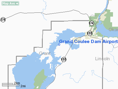
Location & QuickFacts
| FAA Information Effective: | 2008-09-25 |
| Airport Identifier: | 3W7 |
| Airport Status: | Operational |
| Longitude/Latitude: | 119-04-58.8540W/47-55-19.3640N
-119.083015/47.922046 (Estimated) |
| Elevation: | 1588 ft / 484.02 m (Estimated) |
| Land: | 220 acres |
| From nearest city: | 2 nautical miles SW of Electric City, WA |
| Location: | Grant County, WA |
| Magnetic Variation: | 20E (1985) |
Owner & Manager
| Ownership: | Publicly owned |
| Owner: | Grant Co Port Dist Nr 7 |
| Address: | C/o Commissioner Wiese, 227 D Street
Grand Coulee, WA 99133 |
| Phone number: | 509-633-2669 |
| Manager: | Robert Babler |
| Address: | P.o. Box 182
Grand Coulee, WA 99133 |
| Phone number: | 509-633-1319 |
Airport Operations and Facilities
| Airport Use: | Open to public |
| Wind indicator: | Yes |
| Segmented Circle: | Yes |
| Control Tower: | No |
| Lighting Schedule: | DUSK-DAWN
ACTVT MIRL RY 03/21 - CTAF. |
| Beacon Color: | Clear-Green (lighted land airport) |
| Landing fee charge: | No |
| Sectional chart: | Seattle |
| Region: | ANM - Northwest Mountain |
| Boundary ARTCC: | ZSE - Seattle |
| Tie-in FSS: | SEA - Seattle |
| FSS on Airport: | No |
| FSS Toll Free: | 1-800-WX-BRIEF |
| NOTAMs Facility: | SEA (NOTAM-d service avaliable) |
| Federal Agreements: | NGY |
Airport Communications
Airport Services
| Bottled Oxygen: | NONE |
| Bulk Oxygen: | NONE |
Runway Information
Runway 03/21
| Dimension: | 4199 x 75 ft / 1279.9 x 22.9 m |
| Surface: | ASPH, Good Condition |
| Weight Limit: | Single wheel: 26000 lbs. |
| Edge Lights: | Medium |
| |
Runway 03 |
Runway 21 |
| Longitude: | 119-05-22.9080W | 119-04-34.7960W |
| Latitude: | 47-55-06.4110N | 47-55-32.3150N |
| Elevation: | 1588.00 ft | 1588.00 ft |
| Alignment: | 51 | 127 |
| Traffic Pattern: | Left | Right |
| Markings: | Basic, Good Condition | Basic, Good Condition |
| VASI: | | 2-light PAPI on left side |
| Obstruction: | 490 ft hill, 9000.0 ft from runway, 17:1 slope to clear | 8 ft gnd, 421.0 ft from runway, 144 ft left of centerline, 27:1 slope to clear |
|
Radio Navigation Aids
| ID |
Type |
Name |
Ch |
Freq |
Var |
Dist |
| OMK | NDB | Omak | | 219.00 | 19E | 36.4 nm |
| MW | NDB | Pelly | | 408.00 | 18E | 49.1 nm |
| MWH | VOR/DME | Moses Lake | 097X | 115.00 | 18E | 43.8 nm |
| EPH | VORTAC | Ephrata | 073X | 112.60 | 21E | 35.5 nm |
Images and information placed above are from
http://www.airport-data.com/airport/3W7/
We thank them for the data!
| General Info
|
| Country |
United States
|
| State |
WASHINGTON
|
| FAA ID |
3W7
|
| Latitude |
47-55-24.541N
|
| Longitude |
119-04-50.084W
|
| Elevation |
1590 feet
|
| Near City |
ELECTRIC CITY
|
We don't guarantee the information is fresh and accurate. The data may
be wrong or outdated.
For more up-to-date information please refer to other sources.
|
|


