 |
|
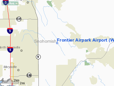
Location & QuickFacts
| FAA Information Effective: | 2008-09-25 |
| Airport Identifier: | WN53 |
| Airport Status: | Operational |
| Longitude/Latitude: | 122-03-44.4860W/48-06-37.3590N
-122.062357/48.110377 (Estimated) |
| Elevation: | 480 ft / 146.30 m (Surveyed) |
| Land: | 600 acres |
| From nearest city: | 6 nautical miles N of Lake Stevens, WA |
| Location: | Snohomish County, WA |
| Magnetic Variation: | 21E (1985) |
Owner & Manager
| Ownership: | Privately owned |
| Owner: | Rontier Airpark Owner Assn. |
| Address: | 11710-a 127th Ave. Ne
Lake Stevens, WA 98258 |
| Phone number: | 360-658-0843 |
| Manager: | Randy Vranish |
| Address: | 12312 127th Ave. Ne
Lake Stevens, WA 98258 |
| Phone number: | 360-651-8049 |
Airport Operations and Facilities
| Airport Use: | Private |
| Wind indicator: | Yes |
| Segmented Circle: | Yes |
| Control Tower: | No |
| Lighting Schedule: | DUSK-DAWN |
| Beacon Color: | Clear-Green (lighted land airport) |
| Sectional chart: | Seattle |
| Region: | ANM - Northwest Mountain |
| Boundary ARTCC: | ZSE - Seattle |
| Tie-in FSS: | SEA - Seattle |
| FSS Toll Free: | 1-800-WX-BRIEF |
Runway Information
Runway 15/33
| Dimension: | 3800 x 30 ft / 1158.2 x 9.1 m
10' GRAVEL SHOULDERS. |
| Surface: | ASPH, |
| Edge Lights: | Low |
| |
Runway 15 |
Runway 33 |
| Traffic Pattern: | Left | Left |
| Displaced threshold: | 1200.00 ft | 0.00 ft |
|
Radio Navigation Aids
| ID |
Type |
Name |
Ch |
Freq |
Var |
Dist |
| BVS | NDB | Skagit/bay View | | 240.00 | 21E | 25.8 nm |
| RNT | NDB | Renton | | 353.00 | 20E | 37.5 nm |
| OPZ | NDB | Lopez Island | | 356.00 | 21E | 40.9 nm |
| ODD | NDB | Dondo | | 224.00 | 19E | 46.0 nm |
| FHR | NDB | Friday Harbor | | 284.00 | 20E | 46.0 nm |
| PWT | NDB | Kitsap | | 206.00 | 20E | 46.5 nm |
| NUW | TACAN | Whidbey Island | 085X | | 21E | 28.1 nm |
| PAE | VOR/DME | Paine | 043X | 110.60 | 20E | 14.4 nm |
| CVV | VOR/DME | Penn Cove | 119X | 117.20 | 19E | 27.7 nm |
| SEA | VORTAC | Seattle | 115X | 116.80 | 19E | 41.8 nm |
| BFI | VOT | Boeing Field | | 108.60 | | 36.3 nm |
| SEA | VOT | Seattle-tacoma | | 117.50 | | 41.3 nm |
Remarks
- RESIDENTS AND INVITED GUEST - TAXI TO COMMUNITY CENTER OR HOME SITE.
- NOISE ABATEMENT 2 MILES TO SOUTH.
- PRVDD TFC PATS ARE ESTABD TO THE WEST OF THE RWY.
Images and information placed above are from
http://www.airport-data.com/airport/WN53/
We thank them for the data!
| General Info
|
| Country |
United States
|
| State |
WASHINGTON
|
| FAA ID |
WN53
|
| Latitude |
48-06-37.359N
|
| Longitude |
122-03-44.486W
|
| Elevation |
480 feet
|
| Near City |
LAKE STEVENS
|
We don't guarantee the information is fresh and accurate. The data may
be wrong or outdated.
For more up-to-date information please refer to other sources.
|
|


