|
|
| Friday Harbor Airport |
 |
| IATA: FRD – ICAO: KFHR – FAA LID: FHR |
| Summary |
| Airport type |
Public |
| Owner |
Port of Friday Harbor |
| Serves |
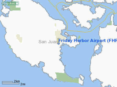
Friday Harbor, Washington |
| Elevation AMSL |
113 ft / 34 m |
| Coordinates |
48°31′19″N 123°01′28″W / 48.52194°N 123.02444°W / 48.52194; -123.02444 |
| Runways |
| Direction |
Length |
Surface |
| ft |
m |
| 16/34 |
3,402 |
1,037 |
Asphalt |
| Statistics (2005) |
| Aircraft operations |
63,405 |
| Based aircraft |
142 |
| Source: Federal Aviation Administration |
"FHR" redirects here. For Federatsiya hokkeya Rossii (Russian: Федерация хоккея России), see Ice Hockey Federation of Russia.
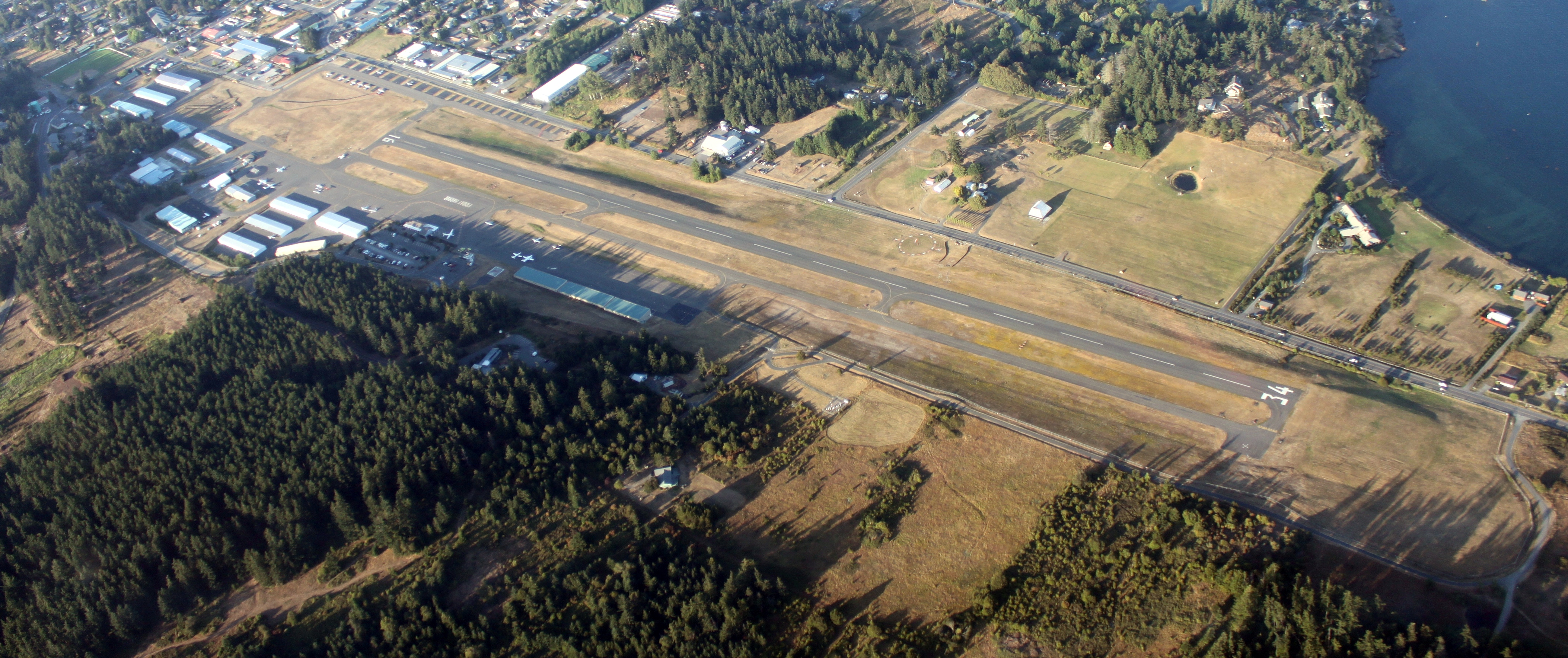
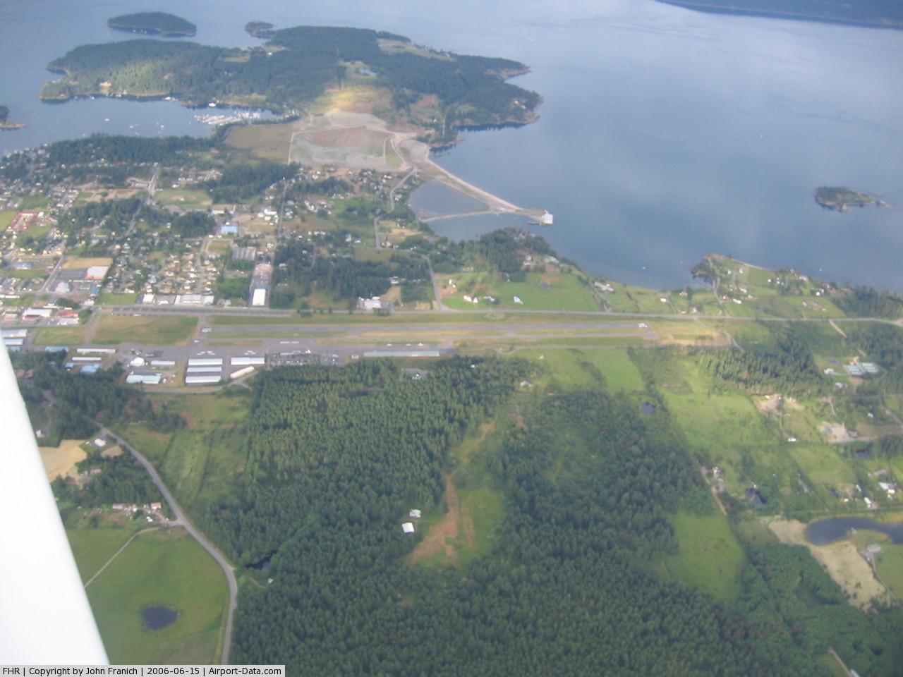
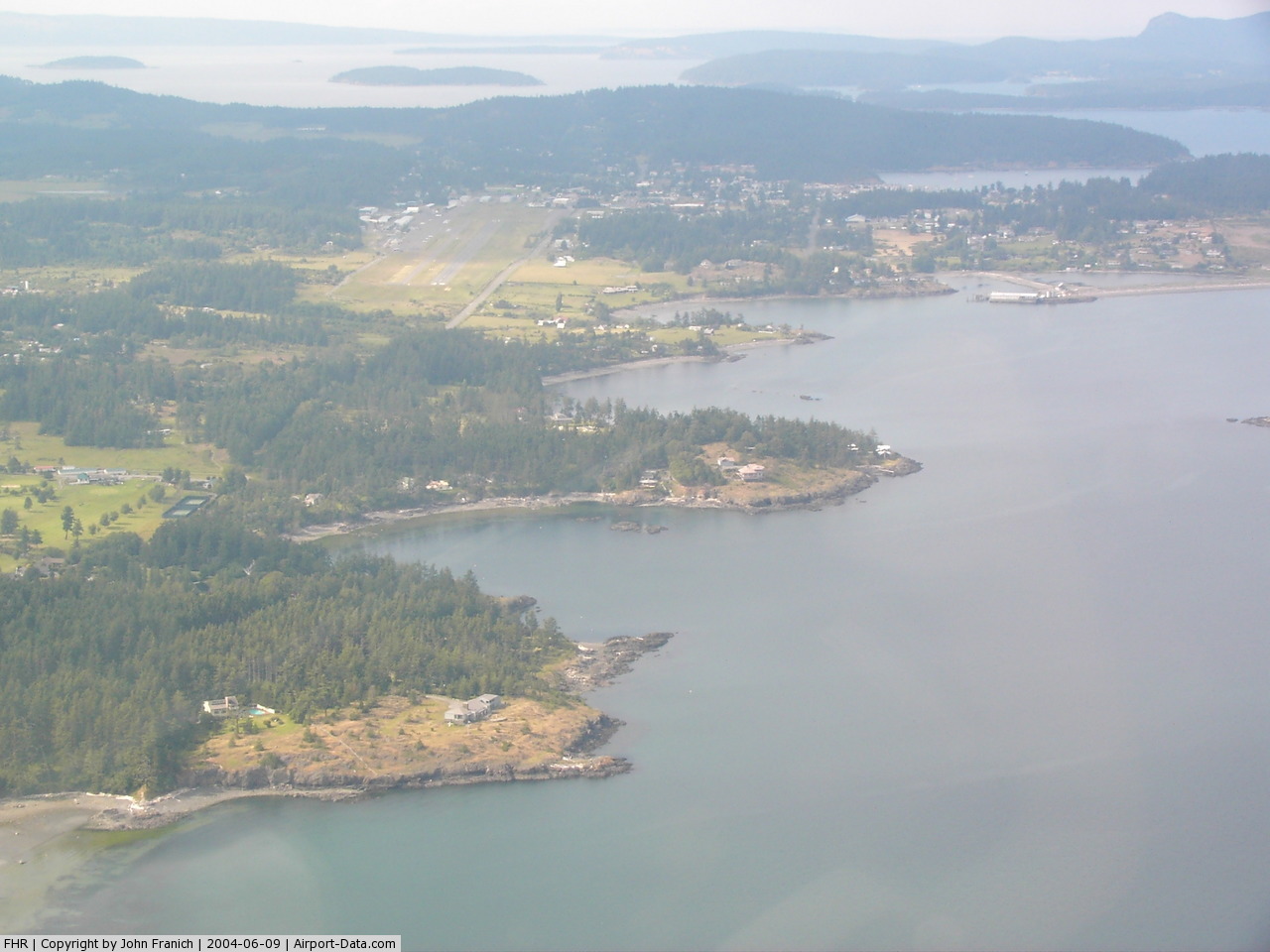
Friday Harbor Airport (IATA: FRD, ICAO: KFHR, FAA LID: FHR) is a public airport located just southwest of Friday Harbor on San Juan Island in the U.S. state of Washington. It is owned by the Port of Friday Harbor.
Friday Harbor is the default airport of Microsoft Flight Simulator X.
Although most U.S. airports use the same three-letter location identifier for the FAA and IATA, this airport is assigned FHR by the FAA and FRD by the IATA. Facilities and aircraft
Friday Harbor Airport covers an area of 145 acres (59 ha) which contains one runway (16/34) with a 3,402 x 75 ft (1,037 x 23 m) asphalt pavement. For the 12-month period ending December 31, 2005, the airport had 63,405 aircraft operations, an average of 173 per day: 67% general aviation and 33% air taxi. At that time there were 142 aircraft based at this airport: 95% single-engine and 5% multi-engine.
Airlines and destinations
| Airlines |
Destinations |
| Kenmore Air |
Roche Harbor, Seattle/Boeing Field, Seattle/Lake Union |
| San Juan Airlines |
Anacortes, Bellingham, Eastsound (Orcas Island), Lopez Island, Blakely, Decatur |
The above content comes from Wikipedia and is published under free licenses – click here to read more.
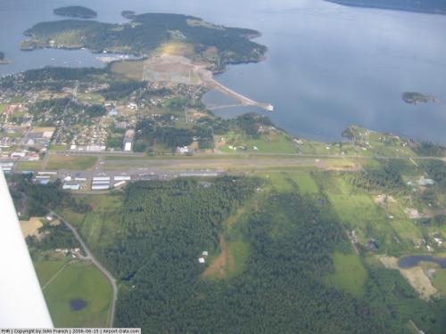 |
(Click on the photo to enlarge) |
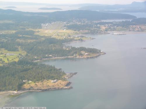 |
(Click on the photo to enlarge) |
Location & QuickFacts
| FAA Information Effective: | 2008-09-25 |
| Airport Identifier: | FHR |
| Airport Status: | Operational |
| Longitude/Latitude: | 123-01-27.7000W/48-31-19.1000N
-123.024361/48.521972 (Estimated) |
| Elevation: | 113 ft / 34.44 m (Surveyed) |
| Land: | 145 acres |
| From nearest city: | 0 nautical miles SW of Friday Harbor, WA |
| Location: | San Juan County, WA |
| Magnetic Variation: | 20E (2000) |
Owner & Manager
| Ownership: | Publicly owned |
| Owner: | Port Of Friday Harbor |
| Address: | P.o. Box 889
Friday Harbor, WA 98250 |
| Phone number: | 360-378-4664 |
| Manager: | Pat Mayo |
| Address: | 800 Franklin Dr.
Friday Harbor, WA 98250 |
| Phone number: | 360-378-4724 |
Airport Operations and Facilities
| Airport Use: | Open to public |
| Wind indicator: | Yes |
| Segmented Circle: | Yes |
| Control Tower: | No |
| Lighting Schedule: | RDO-CTL
ACTVT ROTG BCN - CTAF. |
| Beacon Color: | Clear-Green (lighted land airport) |
| Sectional chart: | Seattle |
| Region: | ANM - Northwest Mountain |
| Boundary ARTCC: | ZSE - Seattle |
| Tie-in FSS: | SEA - Seattle |
| FSS on Airport: | No |
| FSS Toll Free: | 1-800-WX-BRIEF |
| NOTAMs Facility: | FHR (NOTAM-d service avaliable) |
| Federal Agreements: | NGY |
Airport Communications
Airport Services
| Fuel available: | 100
FUEL SYSTEM SELF-SERVICE WITH CREDIT CARD. |
| Airframe Repair: | MAJOR |
| Power Plant Repair: | MAJOR |
| Bottled Oxygen: | NONE |
| Bulk Oxygen: | NONE |
Runway Information
Runway 16/34
| Dimension: | 3402 x 75 ft / 1036.9 x 22.9 m |
| Surface: | ASPH, Good Condition |
| Weight Limit: | Single wheel: 12500 lbs. |
| Edge Lights: | Medium |
| |
Runway 16 |
Runway 34 |
| Longitude: | 123-01-29.0329W | 123-01-26.4319W |
| Latitude: | 48-31-35.8395N | 48-31-02.3160N |
| Elevation: | 113.00 ft | 84.00 ft |
| Alignment: | 127 | 127 |
| Traffic Pattern: | Right | Right |
| Markings: | Basic, Good Condition | Basic, Good Condition |
| Crossing Height: | 38.00 ft | 40.00 ft |
| VASI: | 4-light PAPI on right side
PAPI BAFFLED W OF CNTRLN; LATERAL COVERAGE HAS BEEN NARROWED TO AVOID OBSTACLES DURING DESCENT; MAINTAIN HIGHEST POSSIBLE ALTITUDE AND CLOSE ALIGNMENT TO RY CNTRLN. | 4-light PAPI on left side |
| Visual Glide Angle: | 4.00° | 3.50° |
| Runway End Identifier: | | Yes |
| Obstruction: | 32 ft bldg, 904.0 ft from runway, 150 ft left of centerline, 22:1 slope to clear | 70 ft trees, 2650.0 ft from runway, 34:1 slope to clear |
|
Radio Navigation Aids
| ID |
Type |
Name |
Ch |
Freq |
Var |
Dist |
| FHR | NDB | Friday Harbor | | 284.00 | 20E | 0.3 nm |
| OPZ | NDB | Lopez Island | | 356.00 | 21E | 4.9 nm |
| YJ | NDB | Victoria | | 200.00 | 21E | 16.6 nm |
| MB | NDB | Mill Bay | | 293.00 | 21E | 22.3 nm |
| AP | NDB | Active Pass | | 378.00 | 21E | 23.6 nm |
| BVS | NDB | Skagit/bay View | | 240.00 | 21E | 24.3 nm |
| WC | NDB | White Rock | | 332.00 | 21E | 31.1 nm |
| CL | NDB | Elwha | | 515.00 | 22E | 34.1 nm |
| XX | NDB | Abbotsford | | 344.00 | 21E | 36.5 nm |
| VR | NDB | Vancouver | | 266.00 | 21E | 39.1 nm |
| V | NDB | Victor | | 368.00 | 22E | 41.0 nm |
| LU | NDB | Cultus | | 214.00 | 22E | 48.9 nm |
| YCD | NDB | Nanaimo | | 251.00 | 21E | 49.5 nm |
| NUW | TACAN | Whidbey Island | 085X | | 21E | 17.6 nm |
| CVV | VOR/DME | Penn Cove | 119X | 117.20 | 19E | 20.5 nm |
| YYJ | VOR/DME | Victoria | 084X | 113.70 | 21E | 22.0 nm |
| PAE | VOR/DME | Paine | 043X | 110.60 | 20E | 46.9 nm |
| HUH | VORTAC | Whatcom | 077X | 113.00 | 20E | 31.0 nm |
| YVR | VORTAC | Vancouver | 44 | 115.90 | 21E | 33.7 nm |
Remarks
- LTD TSNT PARKING AVBL DURING SUMMER.
- NOISE ABATEMENT PROCS IN EFFECT CTC AMGR 360-378-4724.
- SOFT GROUND BETWEEN TIE-DOWNS WEST PARKING AREA.
- PREFERRED RY 16 IN CALM WIND CONDITIONS.
- DUE TO HIGH CONCENTRATION OF TFC INVOF ARPT RECOMMEND LDG LGTS OR FORWARD VISIBILITY LGTS TURNED ON WHILE UTILIZING ARPT.
- ESTABD PRIOR TO 5/15/59.
Images and information placed above are from
http://www.airport-data.com/airport/FHR/
We thank them for the data!
| General Info
|
| Country |
United States
|
| State |
WASHINGTON
|
| FAA ID |
FHR
|
| Latitude |
48-31-19.100N
|
| Longitude |
123-01-27.700W
|
| Elevation |
113 feet
|
| Near City |
FRIDAY HARBOR
|
We don't guarantee the information is fresh and accurate. The data may
be wrong or outdated.
For more up-to-date information please refer to other sources.
|
|