 |
|
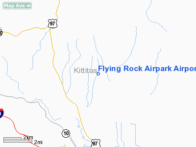
Flying Rock Airpark Airport |
Location & QuickFacts
| FAA Information Effective: | 2008-09-25 |
| Airport Identifier: | WA47 |
| Airport Status: | Operational |
| Longitude/Latitude: | 120-38-13.0600W/47-09-13.3400N
-120.636961/47.153706 (Estimated) |
| Elevation: | 2700 ft / 822.96 m (Estimated) |
| Land: | 150 acres |
| From nearest city: | 10 nautical miles W of Ellensburg, WA |
| Location: | Kittitas County, WA |
| Magnetic Variation: | () |
Owner & Manager
| Ownership: | Privately owned |
| Owner: | Dick Szuba |
| Address: | 1891 Upper Green Canyon
Ellensburg, WA 98926 |
| Phone number: | 509-925-4300 |
| Manager: | Dick Szuba |
| Address: | 1891 Upper Green Canyon
Ellensburg, WA 98926 |
| Phone number: | 509-925-4300 |
Airport Operations and Facilities
| Airport Use: | Private |
| Wind indicator: | Yes |
| Segmented Circle: | No |
| Control Tower: | No |
| Sectional chart: | Seattle |
| Region: | ANM - Northwest Mountain |
| Boundary ARTCC: | ZSE - Seattle |
| Tie-in FSS: | SEA - Seattle |
| FSS Toll Free: | 1-800-WX-BRIEF |
Runway Information
Runway 15/33
| Dimension: | 2000 x 75 ft / 609.6 x 22.9 m |
| Surface: | TURF-DIRT, |
| |
Runway 15 |
Runway 33 |
| Traffic Pattern: | Left | Left |
| Obstruction: | 4 ft fence, 10.0 ft from runway | |
|
Radio Navigation Aids
| ID |
Type |
Name |
Ch |
Freq |
Var |
Dist |
| EAT | FAN MARKER | Malaga | | | 21E | 23.9 nm |
| EAT | VOR/DME | Wenatchee | 047X | 111.00 | 19E | 22.8 nm |
| ELN | VORTAC | Ellensburg | 126X | 117.90 | 21E | 10.7 nm |
| YKM | VORTAC | Yakima | 107X | 116.00 | 21E | 36.0 nm |
Images and information placed above are from
http://www.airport-data.com/airport/WA47/
We thank them for the data!
|
|


