 |
|
Location & QuickFacts
| FAA Information Effective: | 2008-09-25 |
| Airport Identifier: | WA49 |
| Airport Status: | Operational |
| Longitude/Latitude: | 117-38-52.0000W/47-30-10.0000N
-117.647778/47.502778 (Estimated) |
| Elevation: | 2450 ft / 746.76 m (Estimated) |
| Land: | 80 acres |
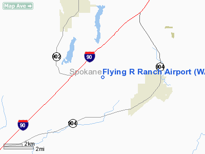
| From nearest city: | 3 nautical miles W of Cheney, WA |
| Location: | Spokane County, WA |
| Magnetic Variation: | () |
Owner & Manager
| Ownership: | Privately owned |
| Owner: | Richard L Runyon |
| Address: | 16517 S Dover Rd
Cheney, WA 99004 |
| Phone number: | 509-235-4120 |
| Manager: | Richard L Runyon |
| Address: | 16517 S Dover Rd
Cheney, WA 99004 |
| Phone number: | 509-235-4120 |
Airport Operations and Facilities
| Airport Use: | Private |
| Wind indicator: | Yes |
| Control Tower: | No |
| Sectional chart: | Seattle |
| Region: | ANM - Northwest Mountain |
| Boundary ARTCC: | ZSE - Seattle |
| Tie-in FSS: | SEA - Seattle |
| FSS Toll Free: | 1-800-WX-BRIEF |
Runway Information
Runway 18/36
| Dimension: | 2500 x 150 ft / 762.0 x 45.7 m |
| Surface: | TURF, |
| |
Runway 18 |
Runway 36 |
| Traffic Pattern: | Left | Left |
| Obstruction: | 25 ft pline, 50.0 ft from runway | 25 ft pline, 50.0 ft from runway |
|
Radio Navigation Aids
| ID |
Type |
Name |
Ch |
Freq |
Var |
Dist |
| SFF | NDB | Felts | | 365.00 | 19E | 17.5 nm |
| DPY | NDB | Deer Park | | 216.00 | 19E | 29.3 nm |
| SKA | TACAN | Fairchild | 051X | | 19E | 6.5 nm |
| COE | VOR/DME | Coeur D'alene | 025X | 108.80 | 19E | 37.3 nm |
| GEG | VORTAC | Spokane | 102X | 115.50 | 21E | 3.8 nm |
| GEG | VOT | Spokane Intl | | 109.60 | | 8.4 nm |
| SFF | VOT | Spokane/felts Field | | 114.00 | | 17.0 nm |
Remarks
- SEE AIRSPACE LTR DATED 31 MAR 2003.
Images and information placed above are from
http://www.airport-data.com/airport/WA49/
We thank them for the data!
|
|


