 |
|
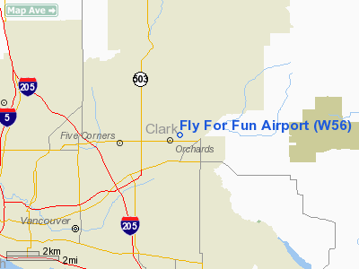
Location & QuickFacts
| FAA Information Effective: | 2008-09-25 |
| Airport Identifier: | W56 |
| Airport Status: | Operational |
| Longitude/Latitude: | 122-31-18.6710W/45-41-14.2080N
-122.521853/45.687280 (Estimated) |
| Elevation: | 297 ft / 90.53 m (Estimated) |
| Land: | 15 acres |
| From nearest city: | 4 nautical miles NE of Vancouver, WA |
| Location: | Clark County, WA |
| Magnetic Variation: | 19E (1985) |
Owner & Manager
| Ownership: | Privately owned |
| Owner: | George Manley |
| Address: | 8807 Ne 142nd Ave
Vancouver, WA 98682 |
| Phone number: | 360-253-4850 |
| Manager: | George Manley |
| Address: | 8807 Ne 142nd Ave
Vancouver, WA 98682 |
| Phone number: | 360-253-4850 |
Airport Operations and Facilities
| Airport Use: | Open to public |
| Wind indicator: | Yes |
| Segmented Circle: | No |
| Control Tower: | No |
| Sectional chart: | Seattle |
| Region: | ANM - Northwest Mountain |
| Boundary ARTCC: | ZSE - Seattle |
| Tie-in FSS: | SEA - Seattle |
| FSS on Airport: | No |
| FSS Toll Free: | 1-800-WX-BRIEF |
| NOTAMs Facility: | SEA (NOTAM-d service avaliable) |
Airport Communications
Airport Services
Runway Information
Runway 07/25
| Dimension: | 2434 x 50 ft / 741.9 x 15.2 m |
| Surface: | TURF, Fair Condition |
| |
Runway 07 |
Runway 25 |
| Longitude: | 122-31-35.8140W | 122-31-01.5270W |
| Latitude: | 45-41-14.1040N | 45-41-14.3110N |
| Traffic Pattern: | Left | Right |
| Obstruction: | 59 ft tree, 288.0 ft from runway, 4:1 slope to clear | 57 ft trees, 216.0 ft from runway, 3:1 slope to clear |
|
Radio Navigation Aids
| ID |
Type |
Name |
Ch |
Freq |
Var |
Dist |
| LBH | NDB | Laker | | 332.00 | 20E | 9.1 nm |
| PND | NDB | Banks | | 356.00 | 21E | 22.3 nm |
| LSO | NDB | Kelso | | 256.00 | 21E | 32.5 nm |
| TDO | NDB | Toledo | | 219.00 | 20E | 49.0 nm |
| CBU | TACAN | Columbia | 029X | | 20E | 7.0 nm |
| PDX | VOR/DME | Portland | 055X | 111.80 | 20E | 6.7 nm |
| UBG | VOR/DME | Newberg | 121X | 117.40 | 21E | 27.8 nm |
| BTG | VORTAC | Battle Ground | 113X | 116.60 | 21E | 4.7 nm |
| PDX | VOT | Portland Intl | | 111.00 | | 6.3 nm |
| HIO | VOT | Portland-hillsboro | | 115.20 | | 20.0 nm |
Remarks
- RY 07 CALM WIND RY FOR TKOF; RY 25 CALM WIND RY FOR LNDG.
- TAXI ON RY AND MOWED GRASS AREAS ONLY.
Images and information placed above are from
http://www.airport-data.com/airport/W56/
We thank them for the data!
| General Info
|
| Country |
United States
|
| State |
WASHINGTON
|
| FAA ID |
W56
|
| Latitude |
45-41-14.422N
|
| Longitude |
122-31-19.342W
|
| Elevation |
275 feet
|
| Near City |
VANCOUVER
|
We don't guarantee the information is fresh and accurate. The data may
be wrong or outdated.
For more up-to-date information please refer to other sources.
|
|


