 |
|
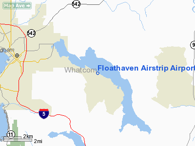
Floathaven Airstrip Airport |
Location & QuickFacts
| FAA Information Effective: | 2008-09-25 |
| Airport Identifier: | WA90 |
| Airport Status: | Operational |
| Longitude/Latitude: | 122-21-04.5900W/48-43-59.3980N
-122.351275/48.733166 (Estimated) |
| Elevation: | 325 ft / 99.06 m (Estimated) |
| Land: | 0 acres |
| From nearest city: | 7 nautical miles SE of Bellingham, WA |
| Location: | Whatcom County, WA |
| Magnetic Variation: | 21E (1985) |
Owner & Manager
| Ownership: | Privately owned |
| Owner: | Mellemark Inc |
| Address: | 14915 58th La.ne
Kenmore, WA 98028 |
| Phone number: | 425-814-2290 |
| Manager: | Mark Schoening |
| Address: | 14914 58th La. Ne
Kenmore, WA 98028 |
| Phone number: | 425-814-2290 |
Airport Operations and Facilities
| Airport Use: | Private |
| Wind indicator: | No |
| Segmented Circle: | No |
| Control Tower: | No |
| Landing fee charge: | No |
| Sectional chart: | Seattle |
| Region: | ANM - Northwest Mountain |
| Boundary ARTCC: | ZSE - Seattle |
| Tie-in FSS: | SEA - Seattle |
| FSS on Airport: | No |
| FSS Toll Free: | 1-800-WX-BRIEF |
Airport Services
| Fuel available: | 100LL |
| Airframe Repair: | MAJOR |
| Power Plant Repair: | MAJOR |
Runway Information
Runway N/S
| Dimension: | 1200 x 200 ft / 365.8 x 61.0 m |
| Surface: | TURF-GRVL, |
| |
Runway N |
Runway S |
| Traffic Pattern: | Left | Left |
|
Radio Navigation Aids
| ID |
Type |
Name |
Ch |
Freq |
Var |
Dist |
| BVS | NDB | Skagit/bay View | | 240.00 | 21E | 16.1 nm |
| XX | NDB | Abbotsford | | 344.00 | 21E | 17.8 nm |
| LU | NDB | Cultus | | 214.00 | 22E | 21.0 nm |
| WC | NDB | White Rock | | 332.00 | 21E | 22.2 nm |
| OPZ | NDB | Lopez Island | | 356.00 | 21E | 27.3 nm |
| FHR | NDB | Friday Harbor | | 284.00 | 20E | 29.6 nm |
| AP | NDB | Active Pass | | 378.00 | 21E | 38.1 nm |
| VR | NDB | Vancouver | | 266.00 | 21E | 38.4 nm |
| YJ | NDB | Victoria | | 200.00 | 21E | 41.9 nm |
| V | NDB | Victor | | 368.00 | 22E | 44.0 nm |
| MB | NDB | Mill Bay | | 293.00 | 21E | 47.2 nm |
| NUW | TACAN | Whidbey Island | 085X | | 21E | 25.9 nm |
| CVV | VOR/DME | Penn Cove | 119X | 117.20 | 19E | 32.9 nm |
| YYJ | VOR/DME | Victoria | 084X | 113.70 | 21E | 44.9 nm |
| PAE | VOR/DME | Paine | 043X | 110.60 | 20E | 49.0 nm |
| HUH | VORTAC | Whatcom | 077X | 113.00 | 20E | 15.6 nm |
| YVR | VORTAC | Vancouver | 44 | 115.90 | 21E | 37.7 nm |
Remarks
- PPR FOR USE; CTC AMGR 425-814-2290.
Images and information placed above are from
http://www.airport-data.com/airport/WA90/
We thank them for the data!
| General Info
|
| Country |
United States
|
| State |
WASHINGTON
|
| FAA ID |
WA90
|
| Latitude |
48-43-59.398N
|
| Longitude |
122-21-04.590W
|
| Elevation |
325 feet
|
| Near City |
BELLINGHAM
|
We don't guarantee the information is fresh and accurate. The data may
be wrong or outdated.
For more up-to-date information please refer to other sources.
|
|


