 |
|
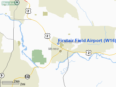
Location & QuickFacts
| FAA Information Effective: | 2008-09-25 |
| Airport Identifier: | W16 |
| Airport Status: | Operational |
| Longitude/Latitude: | 121-59-42.8780W/47-52-16.9090N
-121.995244/47.871364 (Estimated) |
| Elevation: | 50 ft / 15.24 m (Estimated) |
| Land: | 32 acres |
| From nearest city: | 2 nautical miles NW of Monroe, WA |
| Location: | Snohomish County, WA |
| Magnetic Variation: | 20E (1985) |
Owner & Manager
| Ownership: | Privately owned |
| Owner: | Daryl Habich |
| Address: | 13812 179th Ave Se
Monroe, WA 98272 |
| Phone number: | 360-794-8570 |
| Manager: | Daryl Habich |
| Address: | 13812 179th Ave Se
Monroe, WA 98272 |
| Phone number: | 360-794-8570 |
Airport Operations and Facilities
| Airport Use: | Open to public |
| Wind indicator: | Yes |
| Segmented Circle: | No |
| Control Tower: | No |
| Landing fee charge: | No |
| Sectional chart: | Seattle |
| Region: | ANM - Northwest Mountain |
| Boundary ARTCC: | ZSE - Seattle |
| Tie-in FSS: | SEA - Seattle |
| FSS on Airport: | No |
| FSS Toll Free: | 1-800-WX-BRIEF |
| NOTAMs Facility: | SEA (NOTAM-d service avaliable) |
Airport Communications
Airport Services
| Fuel available: | 100 |
| Airframe Repair: | MAJOR |
| Power Plant Repair: | MAJOR |
| Bottled Oxygen: | NONE |
| Bulk Oxygen: | NONE |
Runway Information
Runway 07/25
| Dimension: | 2087 x 34 ft / 636.1 x 10.4 m |
| Surface: | ASPH, Fair Condition |
| |
Runway 07 |
Runway 25 |
| Longitude: | 121-59-58.1780W | 121-59-27.5780W |
| Latitude: | 47-52-17.2510N | 47-52-16.5660N |
| Alignment: | 92 | 127 |
| Traffic Pattern: | Right | Left |
| Markings: | Nonstandard, Fair Condition
NUMBERS 200' E OF DSPLCD THR; NUMBERS ONLY; NO CNTRLN. WORD - MONROE - PAINTED MIDFIELD ONRY. | Nonstandard, Fair Condition |
| Displaced threshold: | 0.00 ft | 500.00 ft |
| Obstruction: | 40 ft tree, 220.0 ft from runway, 50 ft right of centerline
GRASS & WEEDS AT 70'; +4' POSTS AT 100'. | 22 ft pole, 235.0 ft from runway, 2 ft right of centerline, 1:1 slope to clear
RWY 25 APCH RATIO 28:1 FROM DSPCLD THR
6' FENCE 50' FROM END OF RWY & ROAD 90' FROM END OF RWY; 10' FENCE 135' FROM END OF RWY. |
|
Radio Navigation Aids
| ID |
Type |
Name |
Ch |
Freq |
Var |
Dist |
| RNT | NDB | Renton | | 353.00 | 20E | 24.3 nm |
| ODD | NDB | Dondo | | 224.00 | 19E | 33.0 nm |
| PWT | NDB | Kitsap | | 206.00 | 20E | 38.3 nm |
| BVS | NDB | Skagit/bay View | | 240.00 | 21E | 39.7 nm |
| CAN | NDB | Carney | | 274.00 | 20E | 44.0 nm |
| GR | NDB | Graye | | 216.00 | 18E | 49.9 nm |
| NUW | TACAN | Whidbey Island | 085X | | 21E | 39.5 nm |
| PAE | VOR/DME | Paine | 043X | 110.60 | 20E | 11.8 nm |
| CVV | VOR/DME | Penn Cove | 119X | 117.20 | 19E | 36.9 nm |
| SEA | VORTAC | Seattle | 115X | 116.80 | 19E | 29.1 nm |
| TCM | VORTAC | Mcchord | 033X | 109.60 | 22E | 47.7 nm |
| BFI | VOT | Boeing Field | | 108.60 | | 24.1 nm |
| SEA | VOT | Seattle-tacoma | | 117.50 | | 28.6 nm |
Remarks
- RWY ELEV: 25 END 46', 7 END 33'.
- NO OBJECION PROVIDED RWY 25 IS DSPLCD 500'.
Images and information placed above are from
http://www.airport-data.com/airport/W16/
We thank them for the data!
| General Info
|
| Country |
United States
|
| State |
WASHINGTON
|
| FAA ID |
W16
|
| Latitude |
47-52-17.356N
|
| Longitude |
121-59-43.453W
|
| Elevation |
50 feet
|
| Near City |
MONROE
|
We don't guarantee the information is fresh and accurate. The data may
be wrong or outdated.
For more up-to-date information please refer to other sources.
|
|


