 |
|
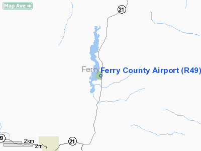
Location & QuickFacts
| FAA Information Effective: | 2008-09-25 |
| Airport Identifier: | R49 |
| Airport Status: | Operational |
| Longitude/Latitude: | 118-39-23.2970W/48-43-05.5410N
-118.656471/48.718206 (Estimated) |
| Elevation: | 2522 ft / 768.71 m (Estimated) |
| Land: | 0 acres |
| From nearest city: | 6 nautical miles NE of Republic, WA |
| Location: | Ferry County, WA |
| Magnetic Variation: | 20E (1985) |
Owner & Manager
| Ownership: | Publicly owned |
| Owner: | Ferry County |
| Address: | 350 East Delaware #8
Republic, WA 99166 |
| Phone number: | 509-775-3325 |
| Manager: | Justin Smith |
| Address: | 742 S Louisiana Ave
Republic, WA 99166 |
| Phone number: | 509-775-3911
SHERIFF OFC 509-775-3132. |
Airport Operations and Facilities
| Airport Use: | Open to public |
| Wind indicator: | Yes |
| Segmented Circle: | Yes |
| Control Tower: | No |
| Lighting Schedule: | DUSK-DAWN
ACTVT MIRL RY 17/35; VASI RY 35; REIL RYS 17 & 35 - 122.8. |
| Beacon Color: | Clear-Green (lighted land airport) |
| Landing fee charge: | No |
| Sectional chart: | Seattle |
| Region: | ANM - Northwest Mountain |
| Traffic Pattern Alt: | 800 ft |
| Boundary ARTCC: | ZSE - Seattle |
| Tie-in FSS: | SEA - Seattle |
| FSS on Airport: | No |
| FSS Toll Free: | 1-800-WX-BRIEF |
| NOTAMs Facility: | SEA (NOTAM-d service avaliable) |
Airport Communications
Airport Services
| Airframe Repair: | NONE |
| Power Plant Repair: | NONE |
| Bottled Oxygen: | NONE |
| Bulk Oxygen: | NONE |
Runway Information
Runway 17/35
| Dimension: | 3498 x 60 ft / 1066.2 x 18.3 m |
| Surface: | ASPH, Good Condition |
| Edge Lights: | Medium |
| |
Runway 17 |
Runway 35 |
| Longitude: | 118-39-20.1940W | 118-39-26.4000W |
| Latitude: | 48-43-22.6750N | 48-42-48.4060N |
| Traffic Pattern: | Right | Left |
| Markings: | Basic, Good Condition | Basic, Good Condition |
| Crossing Height: | 0.00 ft | 23.00 ft |
| VASI: | | 2-box on left side |
| Visual Glide Angle: | 0.00° | 4.00° |
| Runway End Identifier: | Yes | Yes |
| Obstruction: | 59 ft tree, 856.0 ft from runway, 16 ft right of centerline, 10:1 slope to clear | 59 ft trees, 1449.0 ft from runway, 147 ft left of centerline, 21:1 slope to clear |
|
Helipad H1
| Dimension: | 20 x 20 ft / 6.1 x 6.1 m |
| Surface: | CONC, Good Condition |
| |
Runway H1 |
Runway |
| Traffic Pattern: | Left | Left |
|
Helipad H2
| Dimension: | 20 x 20 ft / 6.1 x 6.1 m |
| Surface: | CONC, Good Condition |
| |
Runway H2 |
Runway |
| Traffic Pattern: | Left | Left |
|
Radio Navigation Aids
| ID |
Type |
Name |
Ch |
Freq |
Var |
Dist |
| OMK | NDB | Omak | | 219.00 | 19E | 37.7 nm |
| ION | NDB | Ione | | 379.00 | 21E | 49.3 nm |
Remarks
- SUGGEST NGT LNDGS BE MADE ON RY 35.
- RY 17/35 TREES LCTD ON UNLGTD UNMKD MOUNTAINOUS TRRN.
- PLINES NE OF RY 17 LGTD DUSK-DAWN.
Images and information placed above are from
http://www.airport-data.com/airport/R49/
We thank them for the data!
| General Info
|
| Country |
United States
|
| State |
WASHINGTON
|
| FAA ID |
R49
|
| Latitude |
48-43-05.596N
|
| Longitude |
118-39-22.090W
|
| Elevation |
2519 feet
|
| Near City |
REPUBLIC
|
We don't guarantee the information is fresh and accurate. The data may
be wrong or outdated.
For more up-to-date information please refer to other sources.
|
|


