|
|
| Felts Field Airport |
 |
| IATA: SFF – ICAO: KSFF |
| Summary |
| Airport type |
Public |
| Serves |
Spokane |
| Location |
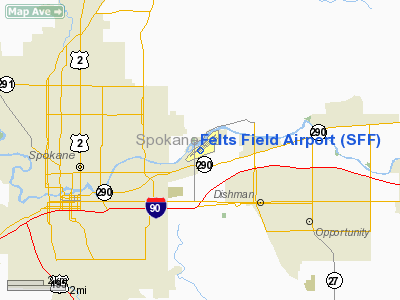
Spokane, Washington |
| Elevation AMSL |
1,953 ft / 595 m |
| Coordinates |
47°40′58.1452″N 117°19′21.2103″W / 47.682818111°N 117.322558417°W / 47.682818111; -117.322558417Coordinates: 47°40′58.1452″N 117°19′21.2103″W / 47.682818111°N 117.322558417°W / 47.682818111; -117.322558417 |
| Runways |
| Direction |
Length |
Surface |
| ft |
m |
| 3L/21R |
4,500 |
1,372 |
Concrete |
| 3R/21L |
3,059 |
932 |
Asphalt |
| 3W/21W |
6,000 |
1,829 |
Water |
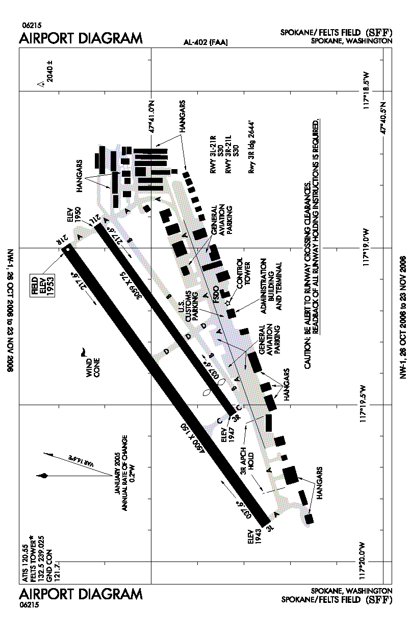
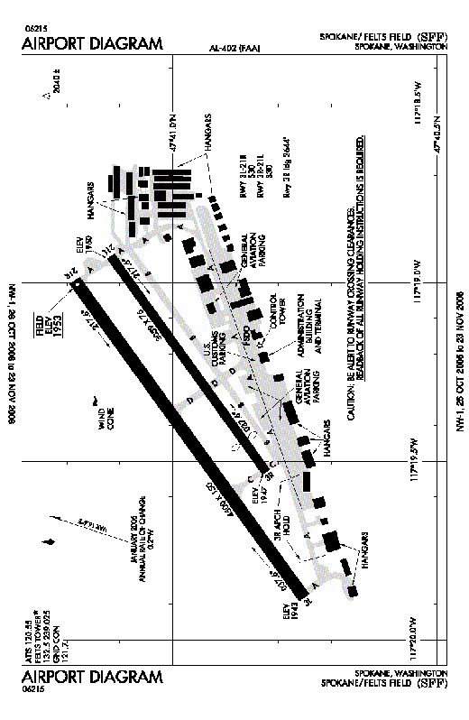
Felts Field Airport (IATA: SFF, ICAO: KSFF) is a public airport located in Spokane, WA serving Spokane County, Washington, USA. The airport has two hard surface runways and one runway on the Spokane River. Felts Field is primarily used for general aviation now, however was Spokane's primary passenger airport before the opening of Spokane International Airport. Facilities
Felts Field Airport has three runways:
- Runway 3L/21R: 4,500 x 150 ft (1,372 x 46 m). Surface: Concrete
- Runway 3R/21L: 3,059 x 75 ft (932 x 23 m). Surface: Asphalt
- Runway 3W/21W: 6,000 x 100 ft (1,829 x 30 m). Surface: Water
Additionally, there is an unofficial sod runway located between the two paved runways, between taxiways Alpha and Delta, adjacent to the north side of runways 3R/21L
The terminal building, among others at the airport are listed on the National Register of Historic Places.
History
During World War II the airfield was used by the United States Army Air Force
The above content comes from Wikipedia and is published under free licenses – click here to read more.
Location & QuickFacts
| FAA Information Effective: | 2008-09-25 |
| Airport Identifier: | SFF |
| Airport Status: | Operational |
| Longitude/Latitude: | 117-19-21.2103W/47-40-58.1452N
-117.322558/47.682818 (Estimated) |
| Elevation: | 1953 ft / 595.27 m (Surveyed)
WATERWAY ELEVATION 1910 ESTD. |
| Land: | 416 acres |
| From nearest city: | 4 nautical miles NE of Spokane, WA |
| Location: | Spokane County, WA |
| Magnetic Variation: | 19E (1990) |
Owner & Manager
| Ownership: | Publicly owned |
| Owner: | Spokane City-county |
| Address: | Airport Board, 9000 W. Airport Drive
Spokane, WA 99224 |
| Phone number: | 509-455-6455 |
| Manager: | David Crowner |
| Address: | 9000 W. Airport Drive
Spokane, WA 99224 |
| Phone number: | 509-455-6418 |
Airport Operations and Facilities
| Airport Use: | Open to public |
| Wind indicator: | Yes |
| Segmented Circle: | Yes |
| Control Tower: | Yes |
| Lighting Schedule: | DUSK-DAWN
WHEN ATCT CLSD ACTVT MALSR RY 21R - CTAF. |
| Beacon Color: | Clear-Green (lighted land airport) |
| Landing fee charge: | No |
| Sectional chart: | Seattle |
| Region: | ANM - Northwest Mountain |
| Boundary ARTCC: | ZSE - Seattle |
| Tie-in FSS: | SEA - Seattle |
| FSS on Airport: | No |
| FSS Toll Free: | 1-800-WX-BRIEF |
| NOTAMs Facility: | SFF (NOTAM-d service avaliable) |
| Federal Agreements: | NGY3 |
Airport Communications
| CTAF: | 132.500 |
| Unicom: | 122.950 |
Airport Services
| Fuel available: | 100LLA1+ |
| Airframe Repair: | MAJOR |
| Power Plant Repair: | MAJOR |
| Bottled Oxygen: | HIGH/LOW |
Runway Information
Runway 03L/21R
| Dimension: | 4500 x 150 ft / 1371.6 x 45.7 m |
| Surface: | CONC, Good Condition |
| Weight Limit: | Single wheel: 30000 lbs. |
| Edge Lights: | Medium |
| |
Runway 03L |
Runway 21R |
| Longitude: | 117-19-52.9788W | 117-18-59.6552W |
| Latitude: | 47-40-45.1260N | 47-41-11.1073N |
| Elevation: | 1943.00 ft | 1953.00 ft |
| Alignment: | 54 | 127 |
| ILS Type: | | ILS/DME
|
| Traffic Pattern: | Left | Right |
| Markings: | Non-precision instrument, Good Condition | Non-precision instrument, Good Condition |
| Crossing Height: | 50.00 ft | 59.00 ft |
| VASI: | 4-box on left side | 4-box on right side |
| Visual Glide Angle: | 3.00° | 3.50° |
| Approach lights: | | MALSR |
| Runway End Identifier: | Yes | Yes |
| Obstruction: | 17 ft road, 680.0 ft from runway, 300 ft right of centerline, 28:1 slope to clear | 90 ft tree, 1950.0 ft from runway, 400 ft left of centerline, 19:1 slope to clear |
|
Runway 03R/21L
| Dimension: | 3059 x 75 ft / 932.4 x 22.9 m |
| Surface: | ASPH, Good Condition |
| Weight Limit: | Single wheel: 30000 lbs. |
| |
Runway 03R |
Runway 21L |
| Longitude: | 117-19-31.8245W | 117-18-55.5652W |
| Latitude: | 47-40-49.3590N | 47-41-07.0123N |
| Elevation: | 1947.00 ft | 1950.00 ft |
| Alignment: | 54 | 127 |
| Traffic Pattern: | Right | Left |
| Markings: | Basic, Good Condition | Basic, Good Condition |
| Crossing Height: | 0.00 ft | 42.00 ft |
| Displaced threshold: | 415.00 ft | 0.00 ft |
| VASI: | | 4-light PAPI on left side
PAPIS UNUSABLE BYD 5 DEGREES EITHER SIDE OF CENTERLINE WITHIN 4 NM OF THRESHOLD. |
| Visual Glide Angle: | 0.00° | 3.80° |
| Obstruction: | 56 ft bldg, 1445.0 ft from runway, 25 ft right of centerline, 22:1 slope to clear | 90 ft trees, 1950.0 ft from runway, 19:1 slope to clear |
|
Runway 03W/21W
| Dimension: | 6000 x 100 ft / 1828.8 x 30.5 m |
| Surface: | WATER, |
| |
Runway 03W |
Runway 21W |
| Traffic Pattern: | Left | Right |
|
Radio Navigation Aids
| ID |
Type |
Name |
Ch |
Freq |
Var |
Dist |
| SFF | NDB | Felts | | 365.00 | 19E | 0.5 nm |
| DPY | NDB | Deer Park | | 216.00 | 19E | 17.6 nm |
| SZT | NDB | Sandpoe | | 264.00 | 20E | 47.6 nm |
| SKA | TACAN | Fairchild | 051X | | 19E | 14.4 nm |
| COE | VOR/DME | Coeur D'alene | 025X | 108.80 | 19E | 21.0 nm |
| GEG | VORTAC | Spokane | 102X | 115.50 | 21E | 14.2 nm |
| SFF | VOT | Spokane/felts Field | | 114.00 | | 0.2 nm |
| GEG | VOT | Spokane Intl | | 109.60 | | 9.5 nm |
Remarks
-
- TWR UNABLE TO PRVD ATC SVC ON PERIMETER TWY DUE TO MOVEMENT OF UNCONTROLLED GROUND TFC.
- EXTENSIVE BOATING IN AREA OF WATER RY.
- WATER LEVEL ON RIVER MAY BE LOWERED BY CORPS OF ENGINEERS. WATER AREA ADJACENT TO AIRPORT NOT CONTROLLED OR MAINTAINED BY AIRPORT.
- WATERFOWL AND BIRDS ON & INVOF ARPT.
- OBSTACLE FREE AREA FOR TWY 'A' IS DELINEATED WITH A GREEN LINE.
- LGTD CRANE 1953 MSL (200 AGL) 1.25 NM E. INDEFLY.
- CONSTRUCTED PRIOR TO MAY 1959.
Images and information placed above are from
http://www.airport-data.com/airport/SFF/
We thank them for the data!
| General Info
|
| Country |
United States
|
| State |
WASHINGTON
|
| FAA ID |
SFF
|
| Latitude |
47-40-58.145N
|
| Longitude |
117-19-21.210W
|
| Elevation |
1953 feet
|
| Near City |
SPOKANE
|
We don't guarantee the information is fresh and accurate. The data may
be wrong or outdated.
For more up-to-date information please refer to other sources.
|
|