 |
|
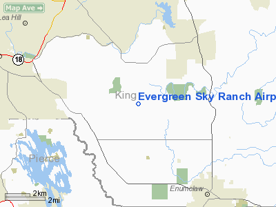
Evergreen Sky Ranch Airport |
Location & QuickFacts
| FAA Information Effective: | 2008-09-25 |
| Airport Identifier: | 51WA |
| Airport Status: | Operational |
| Longitude/Latitude: | 122-04-04.4130W/47-16-05.3620N
-122.067892/47.268156 (Estimated) |
| Elevation: | 580 ft / 176.78 m (Estimated) |
| Land: | 0 acres |
| From nearest city: | 3 nautical miles SS of Black Diamond, WA |
| Location: | King County, WA |
| Magnetic Variation: | 20E (1985) |
Owner & Manager
| Ownership: | Privately owned |
| Owner: | Avion Corporation |
| Address: | 37302 204th Ave Se
Auburn, WA 98002 |
| Phone number: | 253-939-2390 |
| Manager: | Gary L. Nelson |
| Address: | 37302 204th Ave Se
Auburn, WA 98092 |
| Phone number: | 253-939-2390 |
Airport Operations and Facilities
| Airport Use: | Private |
| Wind indicator: | Yes |
| Segmented Circle: | No |
| Control Tower: | No |
| Lighting Schedule: | PHONE REQ
RUN-UP AT MIDFIELD BEFORE TAKEOFF |
| Landing fee charge: | No |
| Sectional chart: | Seattle |
| Region: | ANM - Northwest Mountain |
| Boundary ARTCC: | ZSE - Seattle |
| Tie-in FSS: | SEA - Seattle |
| FSS on Airport: | No |
| FSS Toll Free: | 1-800-WX-BRIEF |
Runway Information
Runway 16/34
| Dimension: | 2650 x 75 ft / 807.7 x 22.9 m |
| Surface: | TURF, |
| Edge Lights: | High |
| |
Runway 16 |
Runway 34 |
| Traffic Pattern: | Left | Left |
| VASI: | non-specific system | |
| Obstruction: | | 120 ft trees, 100.0 ft from runway |
|
Radio Navigation Aids
| ID |
Type |
Name |
Ch |
Freq |
Var |
Dist |
| ODD | NDB | Dondo | | 224.00 | 19E | 11.4 nm |
| RNT | NDB | Renton | | 353.00 | 20E | 14.9 nm |
| GR | NDB | Graye | | 216.00 | 18E | 23.0 nm |
| LAC | NDB | Lacomas | | 328.00 | 18E | 25.4 nm |
| PWT | NDB | Kitsap | | 206.00 | 20E | 31.1 nm |
| CAN | NDB | Carney | | 274.00 | 20E | 32.5 nm |
| MNC | NDB | Mason County | | 348.00 | 19E | 41.6 nm |
| PAE | VOR/DME | Paine | 043X | 110.60 | 20E | 40.1 nm |
| SEA | VORTAC | Seattle | 115X | 116.80 | 19E | 14.1 nm |
| TCM | VORTAC | Mcchord | 033X | 109.60 | 22E | 18.1 nm |
| OLM | VORTAC | Olympia | 081X | 113.40 | 19E | 38.5 nm |
| SEA | VOT | Seattle-tacoma | | 117.50 | | 14.2 nm |
| BFI | VOT | Boeing Field | | 108.60 | | 18.3 nm |
Images and information placed above are from
http://www.airport-data.com/airport/51WA/
We thank them for the data!
| General Info
|
| Country |
United States
|
| State |
WASHINGTON
|
| FAA ID |
51WA
|
| Latitude |
47-16-05.362N
|
| Longitude |
122-04-04.413W
|
| Elevation |
580 feet
|
| Near City |
BLACK DIAMOND
|
We don't guarantee the information is fresh and accurate. The data may
be wrong or outdated.
For more up-to-date information please refer to other sources.
|
|


