 |
|
Location & QuickFacts
| FAA Information Effective: | 2008-09-25 |
| Airport Identifier: | WN04 |
| Airport Status: | Operational |
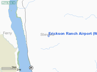
| Longitude/Latitude: | 118-05-54.9550W/48-23-32.6260N
-118.098599/48.392396 (Estimated) |
| Elevation: | 2924 ft / 891.24 m (Estimated) |
| Land: | 0 acres |
| From nearest city: | 13 nautical miles SW of Colville, WA |
| Location: | Stevens County, WA |
| Magnetic Variation: | 20E (1985) |
Owner & Manager
| Ownership: | Privately owned |
| Owner: | Marvin R. Erickson |
| Address: | Rt 1, Box 171
Rice, WA 99167 |
| Phone number: | 509-738-6787 |
| Address: |
|
Airport Operations and Facilities
| Airport Use: | Private |
| Wind indicator: | Yes |
| Segmented Circle: | No |
| Control Tower: | No |
| Landing fee charge: | No |
| Sectional chart: | Seattle |
| Region: | ANM - Northwest Mountain |
| Boundary ARTCC: | ZSE - Seattle |
| Tie-in FSS: | SEA - Seattle |
| FSS on Airport: | No |
| FSS Toll Free: | 1-800-WX-BRIEF |
Runway Information
Runway 03/21
| Dimension: | 1500 x 90 ft / 457.2 x 27.4 m |
| Surface: | GRAVEL, |
| |
Runway 03 |
Runway 21 |
| Traffic Pattern: | Left | Left |
| Obstruction: | | 345 ft hill, 2600.0 ft from runway |
|
Radio Navigation Aids
| ID |
Type |
Name |
Ch |
Freq |
Var |
Dist |
| ION | NDB | Ione | | 379.00 | 21E | 33.3 nm |
| DPY | NDB | Deer Park | | 216.00 | 19E | 37.1 nm |
Images and information placed above are from
http://www.airport-data.com/airport/WN04/
We thank them for the data!
| General Info
|
| Country |
United States
|
| State |
WASHINGTON
|
| FAA ID |
WN04
|
| Latitude |
48-23-32.626N
|
| Longitude |
118-05-54.955W
|
| Elevation |
2924 feet
|
| Near City |
COLVILLE
|
We don't guarantee the information is fresh and accurate. The data may
be wrong or outdated.
For more up-to-date information please refer to other sources.
|
|


