 |
|
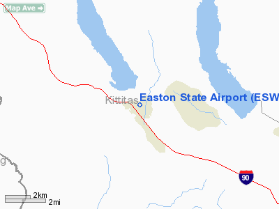
| Easton State Airport |
| IATA: ESW – ICAO: KESW – FAA LID: ESW |
| Summary |
| Airport type |
Public |
| Owner |
WSDOT Aviation Division |
| Serves |
Easton, Washington |
| Elevation AMSL |
2,226 ft / 678 m |
| Coordinates |
47°15′15″N 121°11′08″W / 47.25417°N 121.18556°W / 47.25417; -121.18556 |
| Runways |
| Direction |
Length |
Surface |
| ft |
m |
| 9/27 |
2,640 |
805 |
Turf |
| Statistics (2007) |
| Aircraft operations |
300 |
| Source: Federal Aviation Administration |
Easton State Airport (IATA: ESW, ICAO: KESW, FAA LID: ESW) is a public use airport located two nautical miles (3.7 km) north of the central business district of Easton, in Kittitas County, Washington, United States. It is owned by the Washington State DOT Aviation Division.
It was constructed in the 1930s by the federal government as an emergency field for DC-3s crossing the Cascades through Snoqualmie Pass. It was acquired by the state in 1958 to preserve it for future use. Easton remains as an important airport on the eastern approaches to Snoqualmie and Stampede Pass. Perhaps one of our most visited airports, it has the ingredients to make it a one-of-a-kind airport. This field has medium intensity runway lighting coupled with ample room for parking, camping, hiking, and just relaxing in the quiet of nature. There is a stream at the east end of the airport which runs as clear as any you have seen. A small store is approximately one mile south on the access road.
Facilities and aircraft
Easton State Airport covers an area of 28 acres (11 ha) and has a runway designated 9/27 with a turf surface measuring 2,640 by 100 feet (800 by 30 m), with a 300 feet (91 m) displaced threshold on the west end.
Field elevation is 2,226 feet (678 m), and density altitude problems can be encountered in the summer. Trees surround the airport and there are trees in both approaches close in. Deer, elk, and motorcyclists also enjoy the airport. The surface is somewhat rough, and will be soft when wet. An overflight is recommended to check field conditions and obstructions. The airport is generally open from June 1 to October 1st.
For the 12-month period ending May 31, 2007, the airport had 300 general aviation aircraft operations, an average of 25 per month. It is an excellent facility for mountain flying / soft field practice. Glider and flying clubs frequently use the field during the summer.
The above content comes from Wikipedia and is published under free licenses – click here to read more.
Location & QuickFacts
| FAA Information Effective: | 2008-09-25 |
| Airport Identifier: | ESW |
| Airport Status: | Operational |
| Longitude/Latitude: | 121-11-07.9140W/47-15-15.0620N
-121.185532/47.254184 (Estimated) |
| Elevation: | 2226 ft / 678.48 m (Estimated) |
| Land: | 28 acres |
| From nearest city: | 2 nautical miles N of Easton, WA |
| Location: | Kittitas County, WA |
| Magnetic Variation: | 20E (1985) |
Owner & Manager
| Ownership: | Publicly owned |
| Owner: | Wash State Aviation Div |
| Address: | 3704 172nd Street Ne, Suite K2, P.o. Box 3367
Arlington, WA 98223-6336 |
| Phone number: | 360-651-6300 |
| Manager: | Wash State Aviation Div |
| Address: | 3704 172nd Street Ne, Suite K2, P.o. Box 3367
Arlington, WA 98223-6336 |
| Phone number: | 360-651-6300 |
Airport Operations and Facilities
| Airport Use: | Open to public |
| Wind indicator: | Yes |
| Segmented Circle: | No |
| Control Tower: | No |
| Lighting Schedule: | DUSK-DAWN |
| Landing fee charge: | No |
| Sectional chart: | Seattle |
| Region: | ANM - Northwest Mountain |
| Boundary ARTCC: | ZSE - Seattle |
| Tie-in FSS: | SEA - Seattle |
| FSS on Airport: | No |
| FSS Toll Free: | 1-800-WX-BRIEF |
| NOTAMs Facility: | SEA (NOTAM-d service avaliable) |
| Federal Agreements: | P |
Airport Communications
Airport Services
| Airframe Repair: | NONE |
| Power Plant Repair: | NONE |
| Bottled Oxygen: | NONE |
| Bulk Oxygen: | NONE |
Runway Information
Runway 09/27
| Dimension: | 2640 x 100 ft / 804.7 x 30.5 m |
| Surface: | TURF, Fair Condition |
| Edge Lights: | Medium |
| |
Runway 09 |
Runway 27 |
| Longitude: | 121-11-24.7370W | 121-10-51.0910W |
| Latitude: | 47-15-21.2680N | 47-15-08.8560N |
| Traffic Pattern: | Left | Left |
| Obstruction: | 50 ft trees, 264.0 ft from runway, 15 ft left of centerline, 5:1 slope to clear | 67 ft trees, 309.0 ft from runway, 53 ft right of centerline, 4:1 slope to clear |
|
Radio Navigation Aids
| ID |
Type |
Name |
Ch |
Freq |
Var |
Dist |
| EAT | FAN MARKER | Malaga | | | 21E | 43.2 nm |
| RNT | NDB | Renton | | 353.00 | 20E | 44.3 nm |
| ODD | NDB | Dondo | | 224.00 | 19E | 46.3 nm |
| EAT | VOR/DME | Wenatchee | 047X | 111.00 | 19E | 40.7 nm |
| ELN | VORTAC | Ellensburg | 126X | 117.90 | 21E | 32.8 nm |
| SEA | VORTAC | Seattle | 115X | 116.80 | 19E | 47.1 nm |
| SEA | VOT | Seattle-tacoma | | 117.50 | | 46.9 nm |
| BFI | VOT | Boeing Field | | 108.60 | | 48.4 nm |
Remarks
- RY ROUGH, TWY & APRON NOT DEFINED.
- CAUTION: DENSITY ALTITUDE.
- TREES, BLDG NW END IN TRANSITION SFC.
- CAUTION: WATCH FOR PEDESTRIANS; VEHICLES & ANIMALS ON RWY.
- CTC WASHINGTON STATE DIVISION OF AERONAUTICS 360-651-6300 OR 1-800-552-0666 FOR FACILITY INFORMATION PRIOR TO USE.
- ARPT CLSD 1 OCT THRU 1 JUN.
- ESTABD PRIOR TO 15 MAY 1959.
Images and information placed above are from
http://www.airport-data.com/airport/ESW/
We thank them for the data!
| General Info
|
| Country |
United States
|
| State |
WASHINGTON
|
| FAA ID |
ESW
|
| Latitude |
47-15-14.415N
|
| Longitude |
121-11-19.325W
|
| Elevation |
2221 feet
|
| Near City |
EASTON
|
We don't guarantee the information is fresh and accurate. The data may
be wrong or outdated.
For more up-to-date information please refer to other sources.
|
|


