 |
|
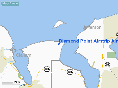
Diamond Point Airstrip Airport |
Location & QuickFacts
| FAA Information Effective: | 2008-09-25 |
| Airport Identifier: | 2WA1 |
| Airport Status: | Operational |
| Longitude/Latitude: | 122-55-42.6200W/48-05-33.3330N
-122.928506/48.092593 (Estimated) |
| Elevation: | 262 ft / 79.86 m (Estimated) |
| Land: | 28 acres |
| From nearest city: | 8 nautical miles NE of Sequim, WA |
| Location: | Clallam County, WA |
| Magnetic Variation: | 21E (1985) |
Owner & Manager
| Ownership: | Privately owned |
| Owner: | Diamond Point Arpt Assoc Inc
TRUSTEE. |
| Address: | P O Box 1241
Sequim, WA 98382 |
| Phone number: | 206-683-0033
206-683-4301 206-683-9165 |
| Manager: | Diamond Pt Arpt Assn |
| Address: | P. O. Box 1241
Sequim, WA 98382 |
| Phone number: | 206-683-0033 |
Airport Operations and Facilities
| Airport Use: | Private |
| Wind indicator: | Yes |
| Segmented Circle: | Yes |
| Control Tower: | No |
| Lighting Schedule: | DUSK-DAWN |
| Beacon Color: | Clear-Green (lighted land airport) |
| Landing fee charge: | No |
| Sectional chart: | Seattle |
| Region: | ANM - Northwest Mountain |
| Boundary ARTCC: | ZSE - Seattle |
| Tie-in FSS: | SEA - Seattle |
| FSS on Airport: | No |
| FSS Toll Free: | 1-800-WX-BRIEF |
Airport Services
| Airframe Repair: | MINOR |
| Power Plant Repair: | MINOR |
Runway Information
Runway 11/29
| Dimension: | 2335 x 24 ft / 711.7 x 7.3 m |
| Surface: | ASPH,
LENGTH HAS 5 FT GRVL SHOULDERS ON EACH SIDE. |
| Edge Lights: | Low |
| |
Runway 11 |
Runway 29 |
| Traffic Pattern: | Left | Right |
| Displaced threshold: | 100.00 ft | 200.00 ft |
| Obstruction: | | 15 ft pline, 300.0 ft from runway |
|
Radio Navigation Aids
| ID |
Type |
Name |
Ch |
Freq |
Var |
Dist |
| OPZ | NDB | Lopez Island | | 356.00 | 21E | 23.2 nm |
| FHR | NDB | Friday Harbor | | 284.00 | 20E | 26.4 nm |
| CL | NDB | Elwha | | 515.00 | 22E | 30.0 nm |
| BVS | NDB | Skagit/bay View | | 240.00 | 21E | 30.4 nm |
| PWT | NDB | Kitsap | | 206.00 | 20E | 36.7 nm |
| YJ | NDB | Victoria | | 200.00 | 21E | 38.1 nm |
| CAN | NDB | Carney | | 274.00 | 20E | 41.2 nm |
| MB | NDB | Mill Bay | | 293.00 | 21E | 42.4 nm |
| RNT | NDB | Renton | | 353.00 | 20E | 46.0 nm |
| AP | NDB | Active Pass | | 378.00 | 21E | 49.1 nm |
| NUW | TACAN | Whidbey Island | 085X | | 21E | 19.0 nm |
| CVV | VOR/DME | Penn Cove | 119X | 117.20 | 19E | 12.3 nm |
| PAE | VOR/DME | Paine | 043X | 110.60 | 20E | 28.2 nm |
| YYJ | VOR/DME | Victoria | 084X | 113.70 | 21E | 44.1 nm |
| SEA | VORTAC | Seattle | 115X | 116.80 | 19E | 46.8 nm |
| BFI | VOT | Boeing Field | | 108.60 | | 42.3 nm |
| SEA | VOT | Seattle-tacoma | | 117.50 | | 46.5 nm |
Remarks
- RY 28 PREFERRED CALM WIND RY.
- RY 10/28/ WATCH FOR DEER.
- NOISE ABATE AVD LOW ALT OVER PROTECTION ISLAND WILDLIFE REF NW.
Images and information placed above are from
http://www.airport-data.com/airport/2WA1/
We thank them for the data!
| General Info
|
| Country |
United States
|
| State |
WASHINGTON
|
| FAA ID |
2WA1
|
| Latitude |
48-05-33.333N
|
| Longitude |
122-55-42.620W
|
| Elevation |
262 feet
|
| Near City |
SEQUIM
|
We don't guarantee the information is fresh and accurate. The data may
be wrong or outdated.
For more up-to-date information please refer to other sources.
|
|


