 |
|
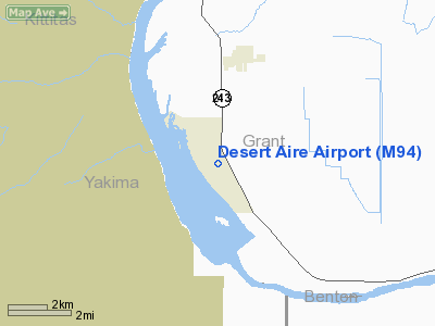
Location & QuickFacts
| FAA Information Effective: | 2008-09-25 |
| Airport Identifier: | M94 |
| Airport Status: | Operational |
| Longitude/Latitude: | 119-55-11.0140W/46-41-14.1040N
-119.919726/46.687251 (Estimated) |
| Elevation: | 586 ft / 178.61 m (Estimated) |
| Land: | 50 acres |
| From nearest city: | 3 nautical miles SW of Mattawa, WA |
| Location: | Grant County, WA |
| Magnetic Variation: | 19E (1985) |
Owner & Manager
| Ownership: | Privately owned |
| Owner: | Desert Aire Owners Ass'n |
| Address: | 115 Airport Way
Desert Aire, WA 99349 |
| Phone number: | 509-932-5642 |
| Manager: | David Strand |
| Address: | 115 Airport Way
Desert Aire, WA 99349 |
| Phone number: | 509-932-5642 |
Airport Operations and Facilities
| Airport Use: | Open to public |
| Wind indicator: | Yes |
| Segmented Circle: | Yes |
| Control Tower: | No |
| Lighting Schedule: | RDO-CTL
ACTVT MIRL RY 10/28 & ROTG BCN - CTAF. |
| Beacon Color: | Clear-Green (lighted land airport) |
| Landing fee charge: | No |
| Sectional chart: | Seattle |
| Region: | ANM - Northwest Mountain |
| Boundary ARTCC: | ZSE - Seattle |
| Tie-in FSS: | SEA - Seattle |
| FSS on Airport: | No |
| FSS Toll Free: | 1-800-WX-BRIEF |
| NOTAMs Facility: | SEA (NOTAM-d service avaliable) |
Airport Communications
| CTAF: | 122.800 |
| Unicom: | 122.800 |
Airport Services
Runway Information
Runway 10/28
| Dimension: | 3665 x 34 ft / 1117.1 x 10.4 m |
| Surface: | ASPH, Good Condition |
| Edge Lights: | Medium |
| |
Runway 10 |
Runway 28 |
| Longitude: | 119-55-34.6800W | 119-54-47.3500W |
| Latitude: | 46-41-21.9740N | 46-41-06.2330N |
| Traffic Pattern: | Left | Right |
| Markings: | Basic, Good Condition | Basic, Good Condition |
| Crossing Height: | 0.00 ft | 45.00 ft |
| VASI: | | 2-light PAPI on left side |
| Visual Glide Angle: | 0.00° | 4.00° |
| Obstruction: | 6 ft bldg, 270.0 ft from runway, 53 ft left of centerline, 11:1 slope to clear | 7 ft gnd, 217.0 ft from runway, 2:1 slope to clear |
|
Radio Navigation Aids
| ID |
Type |
Name |
Ch |
Freq |
Var |
Dist |
| EAT | FAN MARKER | Malaga | | | 21E | 41.4 nm |
| MW | NDB | Pelly | | 408.00 | 18E | 37.0 nm |
| MWH | VOR/DME | Moses Lake | 097X | 115.00 | 18E | 40.0 nm |
| PSC | VOR/DME | Pasco | 021X | 108.40 | 20E | 41.9 nm |
| EAT | VOR/DME | Wenatchee | 047X | 111.00 | 19E | 44.5 nm |
| YKM | VORTAC | Yakima | 107X | 116.00 | 21E | 22.8 nm |
| ELN | VORTAC | Ellensburg | 126X | 117.90 | 21E | 30.0 nm |
| EPH | VORTAC | Ephrata | 073X | 112.60 | 21E | 46.2 nm |
Remarks
- TWY MKD WITH RETRO-REFLECTIVE DEVICES.
- RY 10 PREFERRED LOW WIND RY (LESS THAN 05 KTS).
- NO TGL PRIOR TO 0800.
- NOISE ABATEMENT TAKE-OFF PROCEDURE POSTED AT ARPT.
Images and information placed above are from
http://www.airport-data.com/airport/M94/
We thank them for the data!
| General Info
|
| Country |
United States
|
| State |
WASHINGTON
|
| FAA ID |
M94
|
| Latitude |
46-41-14.475N
|
| Longitude |
119-55-14.161W
|
| Elevation |
570 feet
|
| Near City |
MATTAWA
|
We don't guarantee the information is fresh and accurate. The data may
be wrong or outdated.
For more up-to-date information please refer to other sources.
|
|


