 |
|
| Deer Park Airport |
| IATA: none – ICAO: KDEW – FAA LID: DEW |
| Summary |
| Airport type |
Public |
| Owner |
City of Deer Park |
| Serves |
Deer Park, Washington |
| Elevation AMSL |
2,211 ft / 674 m |
| Coordinates |
47°58′01″N 117°25′43″W / 47.96694°N 117.42861°W / 47.96694; -117.42861 |
| Runways |
| Direction |
Length |
Surface |
| ft |
m |
| 16/34 |
6,100 |
1,859 |
Asphalt |
| 4/22 |
3,200 |
975 |
Asphalt |
| Statistics (2005) |
| Aircraft operations |
23,000 |
| Based aircraft |
75 |
| Source: Federal Aviation Administration |
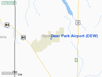
Deer Park Airport (ICAO: KDEW, FAA LID: DEW), formerly known as Deer Park Municipal Airport, is a city-owned public-use airport located three nautical miles (6 km) northeast of the central business district of Deer Park, a city in Spokane County, Washington, United States.
Although most U.S. airports use the same three-letter location identifier for the FAA and IATA, this airport is assigned DEW by the FAA but has no designation from the IATA.
Facilities and aircraft
Deer Park Airport covers an area of 1,800 acres (728 ha) at an elevation of 2,211 feet (674 m) above mean sea level. It has two asphalt paved runways: 16/34 is 6,100 by 75 feet (1,859 x 23 m) and 4/22 is 3,200 by 60 feet (975 x 18 m).
For the 12-month period ending December 31, 2005, the airport had 23,000 general aviation aircraft operations, an average of 63 per day: At that time there were 75 aircraft based at this airport: 84% single-engine, 3% multi-engine, 1% helicopter, 9% glider, 3% ultralight.
The above content comes from Wikipedia and is published under free licenses – click here to read more.
Location & QuickFacts
| FAA Information Effective: | 2008-09-25 |
| Airport Identifier: | DEW |
| Airport Status: | Operational |
| Longitude/Latitude: | 117-25-42.9000W/47-58-01.4000N
-117.428583/47.967056 (Estimated) |
| Elevation: | 2211 ft / 673.91 m (Surveyed) |
| Land: | 1800 acres |
| From nearest city: | 3 nautical miles NE of Deer Park, WA |
| Location: | Spokane County, WA |
| Magnetic Variation: | 16E (2010) |
Owner & Manager
| Ownership: | Publicly owned |
| Owner: | City Of Deer Park |
| Address: | 316 E. Crawford
Deer Park, WA 99006 |
| Phone number: | 509-276-8802 |
| Manager: | Penni Loomis |
| Address: | 1200 North Cedar Avenue
Deer Park, WA 99006 |
| Phone number: | 509-276-3379 |
Airport Operations and Facilities
| Airport Use: | Open to public |
| Wind indicator: | Yes |
| Segmented Circle: | Yes |
| Control Tower: | No |
| Lighting Schedule: | DUSK-DAWN
ACTVT MIRL RY 16/34 - CTAF. |
| Beacon Color: | Clear-Green (lighted land airport) |
| Landing fee charge: | No |
| Sectional chart: | Seattle |
| Region: | ANM - Northwest Mountain |
| Boundary ARTCC: | ZSE - Seattle |
| Tie-in FSS: | SEA - Seattle |
| FSS on Airport: | No |
| FSS Toll Free: | 1-800-WX-BRIEF |
| NOTAMs Facility: | DEW (NOTAM-d service avaliable) |
| Federal Agreements: | NGY3 |
Airport Communications
| CTAF: | 123.000 |
| Unicom: | 123.000 |
Airport Services
| Fuel available: | 100LLA
100LL AVBL 24 HRS CREDIT CARD SELF SERVICE FACILITY. CALL AHEAD FOR JET A SVC 509-276-3379. |
| Airframe Repair: | MAJOR |
| Power Plant Repair: | MAJOR |
| Bottled Oxygen: | NONE |
| Bulk Oxygen: | NONE |
Runway Information
Runway 04/22
| Dimension: | 3200 x 60 ft / 975.4 x 18.3 m |
| Surface: | ASPH, Good Condition |
| Weight Limit: | Single wheel: 12500 lbs. |
| |
Runway 04 |
Runway 22 |
| Longitude: | 117-25-45.8310W | 117-25-04.6084W |
| Latitude: | 47-57-43.4990N | 47-57-58.6835N |
| Elevation: | 2188.00 ft | 2183.00 ft |
| Alignment: | 61 | 127 |
| Traffic Pattern: | Left | Left |
| Markings: | Numbers only, Good Condition | Numbers only, Good Condition |
|
Runway 16/34
| Dimension: | 6100 x 75 ft / 1859.3 x 22.9 m |
| Surface: | ASPH, Good Condition |
| Weight Limit: | Single wheel: 21000 lbs. |
| Edge Lights: | Medium |
| |
Runway 16 |
Runway 34 |
| Longitude: | 117-25-52.3451W | 117-25-52.0415W |
| Latitude: | 47-58-36.8983N | 47-57-36.7037N |
| Elevation: | 2211.00 ft | 2186.00 ft |
| Alignment: | 127 | 127 |
| Traffic Pattern: | Left | Left |
| Markings: | Basic, Good Condition | Basic, Good Condition |
| Crossing Height: | 38.00 ft | 40.00 ft |
| VASI: | 4-light PAPI on left side | 4-light PAPI on left side |
| Visual Glide Angle: | 3.50° | 3.00° |
| Runway End Identifier: | Yes | Yes |
| Obstruction: | 100 ft trees, 2955.0 ft from runway, 47 ft right of centerline, 27:1 slope to clear | , 50:1 slope to clear |
|
Radio Navigation Aids
| ID |
Type |
Name |
Ch |
Freq |
Var |
Dist |
| SFF | NDB | Felts | | 365.00 | 19E | 17.5 nm |
| SZT | NDB | Sandpoe | | 264.00 | 20E | 39.8 nm |
| ION | NDB | Ione | | 379.00 | 21E | 44.7 nm |
| SKA | TACAN | Fairchild | 051X | | 19E | 23.4 nm |
| COE | VOR/DME | Coeur D'alene | 025X | 108.80 | 19E | 27.1 nm |
| GEG | VORTAC | Spokane | 102X | 115.50 | 21E | 25.5 nm |
| SFF | VOT | Spokane/felts Field | | 114.00 | | 17.8 nm |
| GEG | VOT | Spokane Intl | | 109.60 | | 21.2 nm |
Remarks
- MODEL AIRPLANE ACTIVITY ON ARPT.
- DEER AND COYOTES ON AND INVOF RUNWAYS.
- ULTRALIGHT ACTIVITY ON ARPT.
- RY 04/22 HEAVY GLIDER ACTIVITY ON WEEKENDS.
- FARMING OPN ACTIVE ON LAND ADJACENT TO RYS.
- NOISE ABATEMENT PROCEDURES IN EFFECT CTC AMGR 509-276-3379.
- RY 16 PREFERRED CALM WIND RY.
- ESTABD PRIOR TO 1959.
Images and information placed above are from
http://www.airport-data.com/airport/DEW/
We thank them for the data!
| General Info
|
| Country |
United States
|
| State |
WASHINGTON
|
| FAA ID |
DEW
|
| Latitude |
47-57-59.900N
|
| Longitude |
117-25-36.000W
|
| Elevation |
2210 feet
|
| Near City |
DEER PARK
|
We don't guarantee the information is fresh and accurate. The data may
be wrong or outdated.
For more up-to-date information please refer to other sources.
|
|


