 |
|
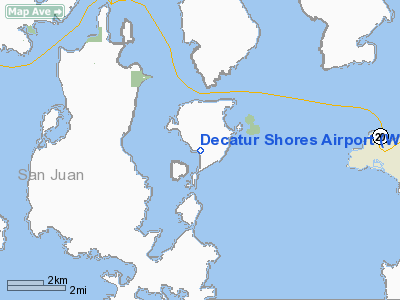
Location & QuickFacts
| FAA Information Effective: | 2008-09-25 |
| Airport Identifier: | WN07 |
| Airport Status: | Operational |
| Longitude/Latitude: | 122-48-49.6000W/48-29-59.4000N
-122.813778/48.499833 (Estimated) |
| Elevation: | 38 ft / 11.58 m (Estimated) |
| Land: | 0 acres |
| From nearest city: | 0 nautical miles W of Decatur, WA |
| Location: | San Juan County, WA |
| Magnetic Variation: | 21E (1985) |
Owner & Manager
| Ownership: | Privately owned |
| Owner: | Decatur Shores Comm. Assoc. |
| Address: | Decatur Island
Anacortes, WA 98221 |
| Phone number: | 360-375-6044 |
| Manager: | Don Hall
PRESIDENT. |
| Address: | Decatur Island
Anacortes, WA 98221 |
| Phone number: | 206-375-6730 |
Airport Operations and Facilities
| Airport Use: | Private |
| Wind indicator: | Yes |
| Segmented Circle: | No |
| Control Tower: | No |
| Lighting Schedule: | DUSK-2200 |
| Landing fee charge: | No |
| Sectional chart: | Seattle |
| Region: | ANM - Northwest Mountain |
| Boundary ARTCC: | ZSE - Seattle |
| Tie-in FSS: | SEA - Seattle |
| FSS on Airport: | No |
| FSS Toll Free: | 1-800-WX-BRIEF |
Airport Services
| Airframe Repair: | NONE |
| Power Plant Repair: | NONE |
Runway Information
Runway 15/33
| Dimension: | 2550 x 75 ft / 777.2 x 22.9 m |
| Surface: | GRVL-TURF, |
| Edge Lights: | Low |
| |
Runway 15 |
Runway 33 |
| Traffic Pattern: | Left | Right |
|
Radio Navigation Aids
| ID |
Type |
Name |
Ch |
Freq |
Var |
Dist |
| OPZ | NDB | Lopez Island | | 356.00 | 21E | 4.4 nm |
| FHR | NDB | Friday Harbor | | 284.00 | 20E | 8.7 nm |
| BVS | NDB | Skagit/bay View | | 240.00 | 21E | 15.9 nm |
| YJ | NDB | Victoria | | 200.00 | 21E | 24.9 nm |
| AP | NDB | Active Pass | | 378.00 | 21E | 29.4 nm |
| WC | NDB | White Rock | | 332.00 | 21E | 30.4 nm |
| MB | NDB | Mill Bay | | 293.00 | 21E | 30.5 nm |
| XX | NDB | Abbotsford | | 344.00 | 21E | 33.6 nm |
| CL | NDB | Elwha | | 515.00 | 22E | 40.2 nm |
| VR | NDB | Vancouver | | 266.00 | 21E | 41.6 nm |
| LU | NDB | Cultus | | 214.00 | 22E | 43.6 nm |
| V | NDB | Victor | | 368.00 | 22E | 44.6 nm |
| NUW | TACAN | Whidbey Island | 085X | | 21E | 10.6 nm |
| CVV | VOR/DME | Penn Cove | 119X | 117.20 | 19E | 15.7 nm |
| YYJ | VOR/DME | Victoria | 084X | 113.70 | 21E | 29.9 nm |
| PAE | VOR/DME | Paine | 043X | 110.60 | 20E | 40.9 nm |
| HUH | VORTAC | Whatcom | 077X | 113.00 | 20E | 28.3 nm |
| YVR | VORTAC | Vancouver | 44 | 115.90 | 21E | 37.2 nm |
Remarks
- PRVDD LCL OPNS ARE ANNOUNCED ON 122.8 BY PILOTS ARR/DEP DECATUR SHORES AND DECATUR JONES ARPTS; DECATUR SHORES FLY RGT TPA 1000' - LAND SOUTH; DEPART NORTH.
Images and information placed above are from
http://www.airport-data.com/airport/WN07/
We thank them for the data!
| General Info
|
| Country |
United States
|
| State |
WASHINGTON
|
| FAA ID |
WN07
|
| Latitude |
48-29-59.400N
|
| Longitude |
122-48-49.600W
|
| Elevation |
38 feet
|
| Near City |
DECATUR
|
We don't guarantee the information is fresh and accurate. The data may
be wrong or outdated.
For more up-to-date information please refer to other sources.
|
|


