 |
|
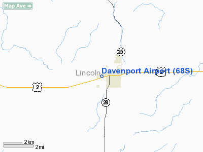
Location & QuickFacts
| FAA Information Effective: | 2008-09-25 |
| Airport Identifier: | 68S |
| Airport Status: | Operational |
| Longitude/Latitude: | 118-10-07.6215W/47-39-12.7669N
-118.168784/47.653546 (Estimated) |
| Elevation: | 2421 ft / 737.92 m (Estimated) |
| Land: | 35 acres |
| From nearest city: | 1 nautical miles W of Davenport, WA |
| Location: | Lincoln County, WA |
| Magnetic Variation: | 20E (1985) |
Owner & Manager
| Ownership: | Publicly owned |
| Owner: | City Of Davenport |
| Address: | Po Box 26
Davenport, WA 99122 |
| Phone number: | 509-725-4352 |
| Manager: | Mayor Charles Johnston |
| Address: | P.o. Box 26
Davenport, WA 99122 |
| Phone number: | 509-725-4352 |
Airport Operations and Facilities
| Airport Use: | Open to public |
| Wind indicator: | Yes |
| Segmented Circle: | No |
| Control Tower: | No |
| Lighting Schedule: | DUSK-DAWN |
| Beacon Color: | Clear-Green (lighted land airport) |
| Landing fee charge: | No |
| Sectional chart: | Seattle |
| Region: | ANM - Northwest Mountain |
| Boundary ARTCC: | ZSE - Seattle |
| Tie-in FSS: | SEA - Seattle |
| FSS on Airport: | No |
| FSS Toll Free: | 1-800-WX-BRIEF |
| NOTAMs Facility: | SEA (NOTAM-d service avaliable) |
| Federal Agreements: | N |
Airport Communications
Airport Services
| Fuel available: | 100LL |
| Airframe Repair: | NONE |
| Bottled Oxygen: | NONE |
| Bulk Oxygen: | NONE |
Runway Information
Runway 03/21
| Dimension: | 2271 x 45 ft / 692.2 x 13.7 m |
| Surface: | GRVL, Fair Condition
RY 03/21 VERY SOFT IN SPRING. |
| |
Runway 03 |
Runway 21 |
| Longitude: | 118-10-18.7130W | 118-09-51.3640W |
| Latitude: | 47-39-09.0470N | 47-39-21.7290N |
| Elevation: | 2421.00 ft | 2410.00 ft |
| Alignment: | 56 | 127 |
| Traffic Pattern: | Left | Right |
| Obstruction: | 70 ft trees, 1508.0 ft from runway, 26 ft right of centerline, 21:1 slope to clear | 35 ft trees, 625.0 ft from runway, 84 ft right of centerline, 17:1 slope to clear |
|
Runway 05/23
| Dimension: | 2747 x 50 ft / 837.3 x 15.2 m |
| Surface: | ASPH, Good Condition
RY 03/21 VERY SOFT IN SPRING. |
| Edge Lights: | Medium |
| |
Runway 05 |
Runway 23 |
| Longitude: | 118-10-28.9780W | 118-09-50.5360W |
| Latitude: | 47-39-06.7180N | 47-39-14.4820N |
| Elevation: | 2417.00 ft | 2415.00 ft |
| Alignment: | 73 | 127 |
| Traffic Pattern: | Left | Right |
| Obstruction: | , 50:1 slope to clear | 33 ft trees, 369.0 ft from runway, 48 ft left of centerline, 5:1 slope to clear
RY 23 -4 FT DITCH 25 FT FM THLD, OB. |
|
Radio Navigation Aids
| ID |
Type |
Name |
Ch |
Freq |
Var |
Dist |
| SFF | NDB | Felts | | 365.00 | 19E | 34.7 nm |
| DPY | NDB | Deer Park | | 216.00 | 19E | 35.4 nm |
| SKA | TACAN | Fairchild | 051X | | 19E | 20.7 nm |
| GEG | VORTAC | Spokane | 102X | 115.50 | 21E | 22.6 nm |
| GEG | VOT | Spokane Intl | | 109.60 | | 25.5 nm |
| SFF | VOT | Spokane/felts Field | | 114.00 | | 34.4 nm |
Remarks
- ESTABD PRIOR TO 15 MAY 1959.
Images and information placed above are from
http://www.airport-data.com/airport/68S/
We thank them for the data!
| General Info
|
| Country |
United States
|
| State |
WASHINGTON
|
| FAA ID |
68S
|
| Latitude |
47-39-14.563N
|
| Longitude |
118-10-03.907W
|
| Elevation |
2416 feet
|
| Near City |
DAVENPORT
|
We don't guarantee the information is fresh and accurate. The data may
be wrong or outdated.
For more up-to-date information please refer to other sources.
|
|


