|
|
Coordinates: 47°20′14″N 122°06′13″W / 47.33722°N 122.10361°W / 47.33722; -122.10361
| Crest Airpark |
| IATA: none – ICAO: none – FAA LID: S36 |
| Summary |
| Airport type |
Public |
| Owner |
Norm Grier |
| Location |
Kent, Washington |
| Elevation AMSL |
472 ft / 144 m |
| Runways |
| Direction |
Length |
Surface |
| ft |
m |
| 15/33 |
3,288 |
1,002 |
Asphalt |
| Statistics (2005) |
| Aircraft operations |
99,000 |
| Based aircraft |
332 |
| Source: Federal Aviation Administration |
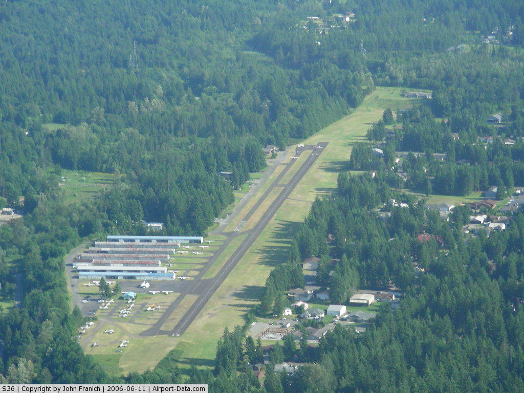
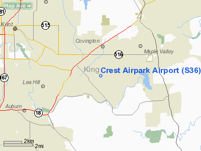
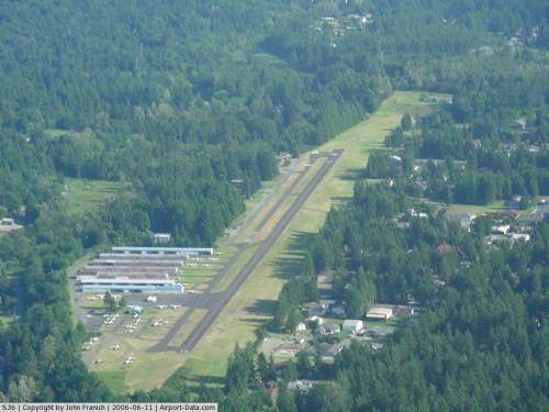
Crest Airpark (FAA LID: S36) is a public airport located five miles (8 km) southeast of the central business district of Kent, a city in King County, Washington, United States. It is privately owned by Norm Grier. The airport is on a hill and surrounded by trees. Private residences also surround the airport. Many are able to hangar an aircraft that can be taxied to the runway.
Facilities and aircraft
Crest Airpark covers an area of 66 acres (27 ha) which contains one asphalt paved runway (15/33) measuring 3,288 x 40 ft (1,002 x 12 m).
For the 12-month period ending December 31, 2005, the airport had 99,000 general aviation aircraft operations, an average of 271 per day. There are 332 aircraft based at this airport: 98% single-engine and 2% multi-engine.
The above content comes from Wikipedia and is published under free licenses – click here to read more.
 |
(Click on the photo to enlarge) |
Location & QuickFacts
| FAA Information Effective: | 2008-09-25 |
| Airport Identifier: | S36 |
| Airport Status: | Operational |
| Longitude/Latitude: | 122-06-12.7310W/47-20-13.5480N
-122.103536/47.337097 (Estimated) |
| Elevation: | 472 ft / 143.87 m (Estimated) |
| Land: | 66 acres |
| From nearest city: | 5 nautical miles SE of Kent, WA |
| Location: | King County, WA |
| Magnetic Variation: | 20E (1985) |
Owner & Manager
| Ownership: | Privately owned |
| Owner: | Norm Grier |
| Address: | 29300 179 Place Se
Kent, WA 98042 |
| Phone number: | 253-631-7100 |
| Manager: | Rikki Birge |
| Address: | 29300 179th Place Se
Kent, WA 98042 |
| Phone number: | 253-631-7100 |
Airport Operations and Facilities
| Airport Use: | Open to public |
| Wind indicator: | Yes |
| Segmented Circle: | No |
| Control Tower: | No |
| Lighting Schedule: | DUSK-DAWN |
| Beacon Color: | Clear-Green (lighted land airport) |
| Landing fee charge: | No |
| Sectional chart: | Seattle |
| Region: | ANM - Northwest Mountain |
| Traffic Pattern Alt: | 1000 ft |
| Boundary ARTCC: | ZSE - Seattle |
| Tie-in FSS: | SEA - Seattle |
| FSS on Airport: | No |
| FSS Toll Free: | 1-800-WX-BRIEF |
| NOTAMs Facility: | SEA (NOTAM-d service avaliable) |
Airport Communications
| CTAF: | 123.000 |
| Unicom: | 123.000 |
Airport Services
| Fuel available: | 100LL
24 HR CREDIT CARD FUEL AVBL. |
| Airframe Repair: | MAJOR |
| Power Plant Repair: | MAJOR |
| Bottled Oxygen: | NONE |
| Bulk Oxygen: | NONE |
Runway Information
Runway 15/33
| Dimension: | 3288 x 40 ft / 1002.2 x 12.2 m |
| Surface: | ASPH, Good Condition |
| Weight Limit: | Single wheel: 12000 lbs. |
| Edge Lights: | Low |
| |
Runway 15 |
Runway 33 |
| Longitude: | 122-06-16.4690W | 122-06-08.9930W |
| Latitude: | 47-20-29.5710N | 47-19-57.5250N |
| Traffic Pattern: | Left | Left |
| Markings: | Nonstandard, Fair Condition
15/33 NSTD MARKINGS NUMBERS & CNTRLN ONLY; FADED. | Nonstandard, Fair Condition |
| Displaced threshold: | 0.00 ft | 281.00 ft |
| Obstruction: | 108 ft trees, 700.0 ft from runway, 170 ft right of centerline, 4:1 slope to clear
TREES IN PRIM SFC AND PARKED ACFT IN PRIM SFC BOTH SIDES OF RY. | 82 ft trees, 234.0 ft from runway, 75 ft right of centerline
RWY 33 APPROACH RATIO 6:1 FROM DSPLCD THR.
+89' TREES IN PRIM SFC 0-200' FM THR, 120'R. |
|
Radio Navigation Aids
| ID |
Type |
Name |
Ch |
Freq |
Var |
Dist |
| ODD | NDB | Dondo | | 224.00 | 19E | 8.5 nm |
| RNT | NDB | Renton | | 353.00 | 20E | 10.5 nm |
| GR | NDB | Graye | | 216.00 | 18E | 23.3 nm |
| LAC | NDB | Lacomas | | 328.00 | 18E | 27.1 nm |
| PWT | NDB | Kitsap | | 206.00 | 20E | 28.2 nm |
| CAN | NDB | Carney | | 274.00 | 20E | 30.3 nm |
| MNC | NDB | Mason County | | 348.00 | 19E | 40.4 nm |
| PAE | VOR/DME | Paine | 043X | 110.60 | 20E | 35.7 nm |
| SEA | VORTAC | Seattle | 115X | 116.80 | 19E | 10.3 nm |
| TCM | VORTAC | Mcchord | 033X | 109.60 | 22E | 19.0 nm |
| OLM | VORTAC | Olympia | 081X | 113.40 | 19E | 39.3 nm |
| SEA | VOT | Seattle-tacoma | | 117.50 | | 10.3 nm |
| BFI | VOT | Boeing Field | | 108.60 | | 14.0 nm |
Remarks
- TREES BOTH SIDES OF RWY IN TRSN SFC.
- TREES ON BOTH SIDES OF RY 15/33.
- NIGHT OPS USE RY 15, WIND AND WX PMTG.
- ARPT CLOSED WHEN SNOW ON RY.
Images and information placed above are from
http://www.airport-data.com/airport/S36/
We thank them for the data!
| General Info
|
| Country |
United States
|
| State |
WASHINGTON
|
| FAA ID |
S36
|
| Latitude |
47-20-14.362N
|
| Longitude |
122-06-12.420W
|
| Elevation |
466 feet
|
| Near City |
KENT
|
We don't guarantee the information is fresh and accurate. The data may
be wrong or outdated.
For more up-to-date information please refer to other sources.
|
|