|
|
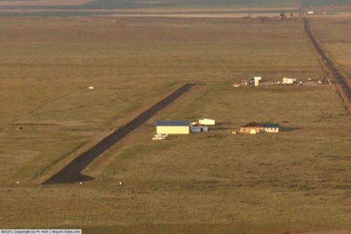 |
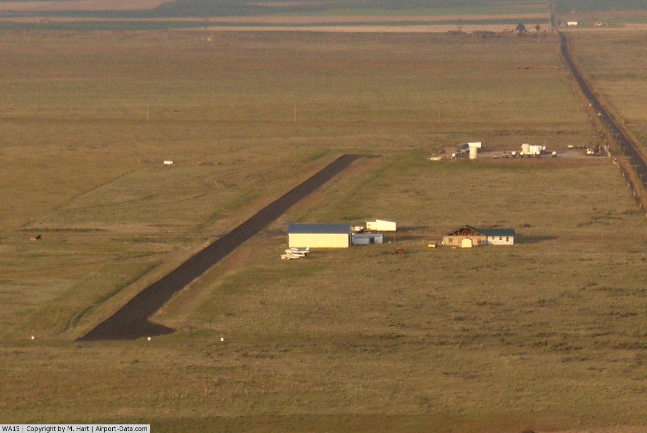
(Click on the photo to enlarge) |
Location & QuickFacts
| FAA Information Effective: | 2008-09-25 |
| Airport Identifier: | WA15 |
| Airport Status: | Operational |
| Longitude/Latitude: | 119-14-34.0920W/47-36-59.5230N
-119.242803/47.616534 (Estimated) |
| Elevation: | 1800 ft / 548.64 m (Estimated) |
| Land: | 198 acres |
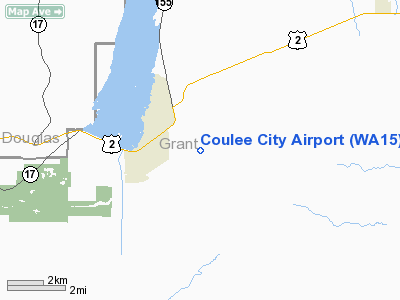
| From nearest city: | 2 nautical miles E of Coulee City, WA |
| Location: | Grant County, WA |
| Magnetic Variation: | 20E (1985) |
Owner & Manager
| Ownership: | Privately owned |
| Owner: | Richard Tigges |
| Address: | Box 415
Coulee City, WA 99115 |
| Phone number: | 509-632-5256 |
| Manager: | Richard Tigges |
| Address: | Box 415
Coulee City, WA 99115 |
| Phone number: | 509-632-5256 |
Airport Operations and Facilities
| Airport Use: | Private |
| Wind indicator: | Yes |
| Segmented Circle: | No |
| Control Tower: | No |
| Landing fee charge: | No |
| Sectional chart: | Seattle |
| Region: | ANM - Northwest Mountain |
| Boundary ARTCC: | ZSE - Seattle |
| Tie-in FSS: | SEA - Seattle |
| FSS on Airport: | No |
| FSS Toll Free: | 1-800-WX-BRIEF |
Airport Communications
Airport Services
| Airframe Repair: | NONE |
| Power Plant Repair: | NONE |
| Bottled Oxygen: | NONE |
| Bulk Oxygen: | NONE |
Runway Information
Runway 07/25
| Dimension: | 2600 x 18 ft / 792.5 x 5.5 m |
| Surface: | GRVL, |
| |
Runway 07 |
Runway 25 |
| Traffic Pattern: | Left | Left |
| Runway End Identifier: | No | No |
| Touchdown Lights: | No | No |
| Obstruction: | 33 ft pole, 1300.0 ft from runway, 34:1 slope to clear | 6 ft fence, 200.0 ft from runway |
|
Radio Navigation Aids
| ID |
Type |
Name |
Ch |
Freq |
Var |
Dist |
| EAT | FAN MARKER | Malaga | | | 21E | 39.4 nm |
| MW | NDB | Pelly | | 408.00 | 18E | 30.1 nm |
| MWH | VOR/DME | Moses Lake | 097X | 115.00 | 18E | 24.6 nm |
| EAT | VOR/DME | Wenatchee | 047X | 111.00 | 19E | 41.4 nm |
| EPH | VORTAC | Ephrata | 073X | 112.60 | 21E | 16.1 nm |
Remarks
- (E110-1) BLDGS, TIEDOWNS AND ROADS IN PRIMARY SFC.
Images and information placed above are from
http://www.airport-data.com/airport/WA15/
We thank them for the data!
| General Info
|
| Country |
United States
|
| State |
WASHINGTON
|
| FAA ID |
WA15
|
| Latitude |
47-36-59.523N
|
| Longitude |
119-14-34.092W
|
| Elevation |
1800 feet
|
| Near City |
COULEE CITY
|
We don't guarantee the information is fresh and accurate. The data may
be wrong or outdated.
For more up-to-date information please refer to other sources.
|
|