 |
|
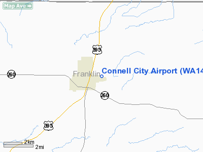
Location & QuickFacts
| FAA Information Effective: | 2008-09-25 |
| Airport Identifier: | WA14 |
| Airport Status: | Operational |
| Longitude/Latitude: | 118-49-59.9970W/46-39-44.5040N
-118.833332/46.662362 (Estimated) |
| Elevation: | 925 ft / 281.94 m (Estimated) |
| Land: | 55 acres |
| From nearest city: | 2 nautical miles E of Connell, WA |
| Location: | Franklin County, WA |
| Magnetic Variation: | 19E (1985) |
Owner & Manager
| Ownership: | Publicly owned |
| Owner: | Bernard Eskildsen |
| Address: | Po Box 667
Connell, WA 99326 |
| Phone number: | 509-234-7791 |
| Manager: | Bernard Eskildsen |
| Address: | Box 667
Connell, WA 99326 |
| Phone number: | 509-234-7791 |
Airport Operations and Facilities
| Airport Use: | Private |
| Wind indicator: | Yes |
| Segmented Circle: | No |
| Control Tower: | No |
| Lighting Schedule: | DUSK-DAWN |
| Landing fee charge: | No |
| Sectional chart: | Seattle |
| Region: | ANM - Northwest Mountain |
| Boundary ARTCC: | ZSE - Seattle |
| Tie-in FSS: | SEA - Seattle |
| FSS on Airport: | No |
| FSS Toll Free: | 1-800-WX-BRIEF |
Airport Services
| Airframe Repair: | MAJOR |
| Power Plant Repair: | MAJOR |
| Bottled Oxygen: | NONE |
| Bulk Oxygen: | NONE |
Runway Information
Runway 07/25
| Dimension: | 3070 x 50 ft / 935.7 x 15.2 m |
| Surface: | ASPH, Good Condition |
| Weight Limit: | Single wheel: 7000 lbs. |
| Edge Lights: | Non-standard lighting system
NSTD LIRL; THR LGTS ONE EACH SIDE OF RY ON ONE END & TWO LGTS EACH SIDE OF RY ON OTHER END. |
| |
Runway 07 |
Runway 25 |
| Traffic Pattern: | Left | Left |
| Markings: | Nonstandard, Poor Condition
07/25 CNTRLN STRIPE ONLY. | Nonstandard, Poor Condition |
| VASI: | | 2-box on left side |
| Approach lights: | | ODALS
NSTD ODALS; HIGH INTST STROBE LGTS. |
| Obstruction: | , 50:1 slope to clear
RD 98'; +2' BERM 78'; +3' FC 125'; +3' FC 78' 31' L&R; +3' FC & PARKING LOT 78', 100L; +5' POST 78', 100'L; +4' FC 0-78', 99' L; +5' POST 78', 99'L. | 290 ft hill, 6000.0 ft from runway, 20:1 slope to clear |
|
Radio Navigation Aids
| ID |
Type |
Name |
Ch |
Freq |
Var |
Dist |
| MW | NDB | Pelly | | 408.00 | 18E | 32.7 nm |
| PSC | VOR/DME | Pasco | 021X | 108.40 | 20E | 26.7 nm |
| MWH | VOR/DME | Moses Lake | 097X | 115.00 | 18E | 38.5 nm |
| ALW | VOR/DME | Walla Walla | 111X | 116.40 | 20E | 41.2 nm |
| EPH | VORTAC | Ephrata | 073X | 112.60 | 21E | 49.4 nm |
Remarks
- FENCE IN PRIM SFC NORTH OF RWY.
- ACFT PARKED IN PRIM SFC SOUTH OF RWY.
- RY 25 ODALS OTS INDEFLY.
Images and information placed above are from
http://www.airport-data.com/airport/WA14/
We thank them for the data!
| General Info
|
| Country |
United States
|
| State |
WASHINGTON
|
| FAA ID |
WA14
|
| Latitude |
46-39-44.504N
|
| Longitude |
118-49-59.997W
|
| Elevation |
925 feet
|
| Near City |
CONNELL
|
We don't guarantee the information is fresh and accurate. The data may
be wrong or outdated.
For more up-to-date information please refer to other sources.
|
|


