 |
|
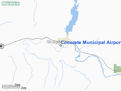
Location & QuickFacts
| FAA Information Effective: | 2008-09-25 |
| Airport Identifier: | 3W5 |
| Airport Status: | Operational |
| Longitude/Latitude: | 121-45-29.6960W/48-31-47.4180N
-121.758249/48.529838 (Estimated) |
| Elevation: | 267 ft / 81.38 m (Estimated) |
| Land: | 53 acres |
| From nearest city: | 1 nautical miles S of Concrete, WA |
| Location: | Skagit County, WA |
| Magnetic Variation: | 21E (1985) |
Owner & Manager
| Ownership: | Publicly owned |
| Owner: | City Of Concrete |
| Address: | Po Box 39
Concrete, WA 98237 |
| Phone number: | 360-853-8401 |
| Manager: | City Of Concrete
JACK MEARS: AIRPORT REPRESENTATIVE FROM TOWN COUNCIL. |
| Address: | Po Box 39
Concrete, WA 98237 |
| Phone number: | 360-853-7114 |
Airport Operations and Facilities
| Airport Use: | Open to public |
| Wind indicator: | Yes |
| Segmented Circle: | No |
| Control Tower: | No |
| Landing fee charge: | No |
| Sectional chart: | Seattle |
| Region: | ANM - Northwest Mountain |
| Boundary ARTCC: | ZSE - Seattle |
| Tie-in FSS: | SEA - Seattle |
| FSS on Airport: | No |
| FSS Toll Free: | 1-800-WX-BRIEF |
| NOTAMs Facility: | SEA (NOTAM-d service avaliable) |
| Federal Agreements: | GY |
Airport Communications
Airport Services
| Airframe Repair: | NONE |
| Power Plant Repair: | NONE |
| Bottled Oxygen: | NONE |
| Bulk Oxygen: | NONE |
Runway Information
Runway 07/25
| Dimension: | 2609 x 60 ft / 795.2 x 18.3 m |
| Surface: | ASPH, Good Condition |
| Weight Limit: | Single wheel: 12000 lbs. |
| |
Runway 07 |
Runway 25 |
| Longitude: | 121-45-49.0280W | 121-45-10.2640W |
| Latitude: | 48-31-47.5670N | 48-31-47.2690N |
| Traffic Pattern: | Right | Left |
| Markings: | Basic, Fair Condition
RY 07/25 CNTRLN FADED, ARPT NAME PAINTED ON RY AT MIDFIELD. | Basic, Fair Condition |
| Obstruction: | 57 ft trees, 660.0 ft from runway, 8:1 slope to clear | 75 ft trees, 852.0 ft from runway, 8:1 slope to clear
INFREQUENTLY USED ROAD AT 0'. +10'-+20' BRUSH 100-200' FM THR. |
|
Helipad H1
| Dimension: | 40 x 40 ft / 12.2 x 12.2 m |
| Surface: | CONC, Good Condition |
| |
Runway H1 |
Runway |
| Traffic Pattern: | Left | Left |
|
Radio Navigation Aids
| ID |
Type |
Name |
Ch |
Freq |
Var |
Dist |
| BVS | NDB | Skagit/bay View | | 240.00 | 21E | 26.6 nm |
| LU | NDB | Cultus | | 214.00 | 22E | 31.7 nm |
| XX | NDB | Abbotsford | | 344.00 | 21E | 41.1 nm |
| OPZ | NDB | Lopez Island | | 356.00 | 21E | 46.4 nm |
| WC | NDB | White Rock | | 332.00 | 21E | 48.0 nm |
| NUW | TACAN | Whidbey Island | 085X | | 21E | 37.5 nm |
| PAE | VOR/DME | Paine | 043X | 110.60 | 20E | 42.2 nm |
| CVV | VOR/DME | Penn Cove | 119X | 117.20 | 19E | 42.2 nm |
| HUH | VORTAC | Whatcom | 077X | 113.00 | 20E | 41.0 nm |
Remarks
- ALL PATTERNS SOUTH OF ARPT.
- ESTABD PRIOR TO 1959.
Images and information placed above are from
http://www.airport-data.com/airport/3W5/
We thank them for the data!
| General Info
|
| Country |
United States
|
| State |
WASHINGTON
|
| FAA ID |
3W5
|
| Latitude |
48-31-36.910N
|
| Longitude |
121-45-29.503W
|
| Elevation |
264 feet
|
| Near City |
CONCRETE
|
We don't guarantee the information is fresh and accurate. The data may
be wrong or outdated.
For more up-to-date information please refer to other sources.
|
|


