 |
|
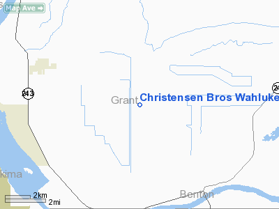
Christensen Bros Wahluke Strip Airport |
Location & QuickFacts
| FAA Information Effective: | 2008-09-25 |
| Airport Identifier: | 91WA |
| Airport Status: | Operational |
| Longitude/Latitude: | 119-48-04.1440W/46-42-29.4800N
-119.801151/46.708189 (Estimated) |
| Elevation: | 840 ft / 256.03 m (Estimated) |
| Land: | 0 acres |
| From nearest city: | 3 nautical miles SE of Mattawa, WA |
| Location: | Grant County, WA |
| Magnetic Variation: | 19E (1985) |
Owner & Manager
| Ownership: | Privately owned |
| Owner: | Christensen Bros |
| Address: | 4202 Rd. 12 Sw
Royal City, WA 99357 |
| Address: |
|
Airport Operations and Facilities
| Airport Use: | Private |
| Wind indicator: | No |
| Segmented Circle: | No |
| Control Tower: | No |
| Landing fee charge: | No |
| Sectional chart: | Seattle |
| Region: | ANM - Northwest Mountain |
| Boundary ARTCC: | ZSE - Seattle |
| Tie-in FSS: | SEA - Seattle |
| FSS on Airport: | No |
| FSS Toll Free: | 1-800-WX-BRIEF |
Runway Information
Runway 07/25
| Dimension: | 2500 x 20 ft / 762.0 x 6.1 m |
| Surface: | DIRT, |
| |
Runway 07 |
Runway 25 |
| Traffic Pattern: | Left | Left |
|
Radio Navigation Aids
| ID |
Type |
Name |
Ch |
Freq |
Var |
Dist |
| EAT | FAN MARKER | Malaga | | | 21E | 41.6 nm |
| MW | NDB | Pelly | | 408.00 | 18E | 32.7 nm |
| MWH | VOR/DME | Moses Lake | 097X | 115.00 | 18E | 36.2 nm |
| PSC | VOR/DME | Pasco | 021X | 108.40 | 20E | 39.0 nm |
| EAT | VOR/DME | Wenatchee | 047X | 111.00 | 19E | 44.8 nm |
| YKM | VORTAC | Yakima | 107X | 116.00 | 21E | 27.8 nm |
| ELN | VORTAC | Ellensburg | 126X | 117.90 | 21E | 33.0 nm |
| EPH | VORTAC | Ephrata | 073X | 112.60 | 21E | 43.1 nm |
Remarks
- E111 PRVDD MUTUALLY SATFY OPERATIONAL AGRMT IS ESTABD WITH OPERATOR OF GEARHEART FARMING PRIVATE ARPT. E111 PRVDD USERS OF WAHLUKE STRIP ARE ADVISED OF PROXIMITY OF GEARHEART FARMING PRIVATE ARPT AND RELATIVE OPERATIONAL AGRMTS.
Images and information placed above are from
http://www.airport-data.com/airport/91WA/
We thank them for the data!
| General Info
|
| Country |
United States
|
| State |
WASHINGTON
|
| FAA ID |
91WA
|
| Latitude |
46-42-29.480N
|
| Longitude |
119-48-04.144W
|
| Elevation |
840 feet
|
| Near City |
MATTAWA
|
We don't guarantee the information is fresh and accurate. The data may
be wrong or outdated.
For more up-to-date information please refer to other sources.
|
|


