 |
|
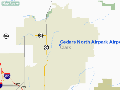
Cedars North Airpark Airport |
Location & QuickFacts
| FAA Information Effective: | 2008-09-25 |
| Airport Identifier: | W58 |
| Airport Status: | Operational |
| Longitude/Latitude: | 122-30-54.3000W/45-45-52.4000N
-122.515083/45.764556 (Estimated) |
| Elevation: | 275 ft / 83.82 m (Estimated) |
| Land: | 6 acres |
| From nearest city: | 1 nautical miles NW of Battle Ground, WA |
| Location: | Clark County, WA |
| Magnetic Variation: | 19E (1985) |
Owner & Manager
| Ownership: | Privately owned |
| Owner: | Cedars Homeowners Association |
| Address: | 19506 Ne 157 Ave
Battle Ground, WA 98604 |
| Phone number: | 360-687-1208 |
| Manager: | Mel Carstetter |
| Address: | 19506 Ne 157 Ave
Battle Ground, WA 98604 |
| Phone number: | 360-687-1208 |
Airport Operations and Facilities
| Airport Use: | Open to public |
| Wind indicator: | Yes |
| Segmented Circle: | No |
| Control Tower: | No |
| Sectional chart: | Seattle |
| Region: | ANM - Northwest Mountain |
| Boundary ARTCC: | ZSE - Seattle |
| Tie-in FSS: | SEA - Seattle |
| FSS on Airport: | No |
| FSS Toll Free: | 1-800-WX-BRIEF |
| NOTAMs Facility: | SEA (NOTAM-d service avaliable) |
Airport Communications
Airport Services
Runway Information
Runway 08/26
| Dimension: | 1960 x 50 ft / 597.4 x 15.2 m |
| Surface: | TURF, |
| |
Runway 08 |
Runway 26 |
| Traffic Pattern: | Left | Left |
| Obstruction: | 15 ft road, 10.0 ft from runway | 15 ft road, 16.0 ft from runway, 1:1 slope to clear |
|
Radio Navigation Aids
| ID |
Type |
Name |
Ch |
Freq |
Var |
Dist |
| LBH | NDB | Laker | | 332.00 | 20E | 13.6 nm |
| PND | NDB | Banks | | 356.00 | 21E | 23.7 nm |
| LSO | NDB | Kelso | | 256.00 | 21E | 28.8 nm |
| TDO | NDB | Toledo | | 219.00 | 20E | 44.6 nm |
| CBU | TACAN | Columbia | 029X | | 20E | 11.3 nm |
| PDX | VOR/DME | Portland | 055X | 111.80 | 20E | 11.0 nm |
| UBG | VOR/DME | Newberg | 121X | 117.40 | 21E | 31.5 nm |
| BTG | VORTAC | Battle Ground | 113X | 116.60 | 21E | 3.4 nm |
| PDX | VOT | Portland Intl | | 111.00 | | 10.6 nm |
| HIO | VOT | Portland-hillsboro | | 115.20 | | 22.7 nm |
Remarks
- TRANSITION BTWN RY AND TWY ON MKD TWYS ONLY.
- BIRDS ON AND INVOF ARPT.
Images and information placed above are from
http://www.airport-data.com/airport/W58/
We thank them for the data!
| General Info
|
| Country |
United States
|
| State |
WASHINGTON
|
| FAA ID |
W58
|
| Latitude |
45-45-52.400N
|
| Longitude |
122-30-54.300W
|
| Elevation |
275 feet
|
| Near City |
BATTLE GROUND
|
We don't guarantee the information is fresh and accurate. The data may
be wrong or outdated.
For more up-to-date information please refer to other sources.
|
|


