 |
|
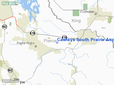
Cawleys South Prairie Airport |
Location & QuickFacts
| FAA Information Effective: | 2008-09-25 |
| Airport Identifier: | 02WA |
| Airport Status: | Operational |
| Longitude/Latitude: | 122-05-38.4100W/47-09-08.3660N
-122.094003/47.152324 (Estimated) |
| Elevation: | 690 ft / 210.31 m (Estimated) |
| Land: | 30 acres |
| From nearest city: | 1 nautical miles NE of South Prairie, WA |
| Location: | Pierce County, WA |
| Magnetic Variation: | 20E (1985) |
Owner & Manager
| Ownership: | Privately owned |
| Owner: | Glen P Cawley |
| Address: | 11805 252nd Avenue E.
Buckley, WA 98321 |
| Phone number: | 206-862-9039 |
| Manager: | Glen P Cawley |
| Address: | 11805 252nd Avenue E.
Buckley, WA 98321 |
| Phone number: | 206-862-9039 |
Airport Operations and Facilities
| Airport Use: | Private |
| Wind indicator: | Yes |
| Segmented Circle: | No |
| Control Tower: | No |
| Landing fee charge: | No |
| Sectional chart: | Seattle |
| Region: | ANM - Northwest Mountain |
| Traffic Pattern Alt: | 800 ft |
| Boundary ARTCC: | ZSE - Seattle |
| Tie-in FSS: | SEA - Seattle |
| FSS on Airport: | No |
| FSS Toll Free: | 1-800-WX-BRIEF |
Airport Services
| Fuel available: | 80 |
| Airframe Repair: | NONE |
| Power Plant Repair: | NONE |
Runway Information
Runway 16/34
| Dimension: | 2650 x 50 ft / 807.7 x 15.2 m |
| Surface: | TURF, |
| |
Runway 16 |
Runway 34 |
| Traffic Pattern: | Left | Left |
|
Radio Navigation Aids
| ID |
Type |
Name |
Ch |
Freq |
Var |
Dist |
| ODD | NDB | Dondo | | 224.00 | 19E | 15.5 nm |
| LAC | NDB | Lacomas | | 328.00 | 18E | 20.8 nm |
| GR | NDB | Graye | | 216.00 | 18E | 20.9 nm |
| RNT | NDB | Renton | | 353.00 | 20E | 21.2 nm |
| PWT | NDB | Kitsap | | 206.00 | 20E | 33.9 nm |
| CAN | NDB | Carney | | 274.00 | 20E | 34.1 nm |
| MNC | NDB | Mason County | | 348.00 | 19E | 40.9 nm |
| PAE | VOR/DME | Paine | 043X | 110.60 | 20E | 46.7 nm |
| TCM | VORTAC | Mcchord | 033X | 109.60 | 22E | 15.6 nm |
| SEA | VORTAC | Seattle | 115X | 116.80 | 19E | 19.2 nm |
| OLM | VORTAC | Olympia | 081X | 113.40 | 19E | 34.8 nm |
| SEA | VOT | Seattle-tacoma | | 117.50 | | 19.5 nm |
| BFI | VOT | Boeing Field | | 108.60 | | 24.1 nm |
Remarks
- AEROBATICS 1500' AGL EAST OF ARPT.
Images and information placed above are from
http://www.airport-data.com/airport/02WA/
We thank them for the data!
| General Info
|
| Country |
United States
|
| State |
WASHINGTON
|
| FAA ID |
02WA
|
| Latitude |
47-09-08.366N
|
| Longitude |
122-05-38.410W
|
| Elevation |
690 feet
|
| Near City |
SOUTH PRAIRIE
|
We don't guarantee the information is fresh and accurate. The data may
be wrong or outdated.
For more up-to-date information please refer to other sources.
|
|


