|
|
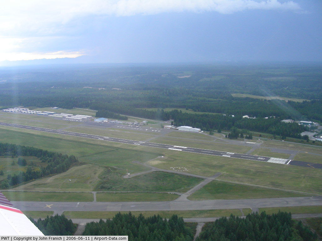
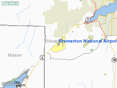
Bremerton National Airport |
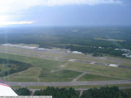 |
(Click on the photo to enlarge) |
Location & QuickFacts
| FAA Information Effective: | 2008-09-25 |
| Airport Identifier: | PWT |
| Airport Status: | Operational |
| Longitude/Latitude: | 122-45-53.3000W/47-29-24.9000N
-122.764806/47.490250 (Estimated) |
| Elevation: | 444 ft / 135.33 m (Surveyed) |
| Land: | 1729 acres |
| From nearest city: | 7 nautical miles SW of Bremerton, WA |
| Location: | Kitsap County, WA |
| Magnetic Variation: | 20E (1985) |
Owner & Manager
| Ownership: | Publicly owned |
| Owner: | Port Of Bremerton |
| Address: | 8850 Sw State Highway 3
Port Orchard, WA 98366 |
| Phone number: | 360-674-2381 |
| Manager: | Fred Salisbury |
| Address: | 8850 Sw State Highway 3
Port Orchard, WA 98366 |
| Phone number: | 360-674-2381
X17 |
Airport Operations and Facilities
| Airport Use: | Open to public |
| Wind indicator: | Yes |
| Segmented Circle: | Yes |
| Control Tower: | No |
| Lighting Schedule: | DUSK-DAWN
ACTVT MALSR RY 19, & PAPI RYS 01 & 19 - CTAF. |
| Beacon Color: | Clear-Green (lighted land airport) |
| Landing fee charge: | No
FEE FOR ACFT OVER 60000 LBS. |
| Sectional chart: | Seattle |
| Region: | ANM - Northwest Mountain |
| Traffic Pattern Alt: | 1000 ft |
| Boundary ARTCC: | ZSE - Seattle |
| Tie-in FSS: | SEA - Seattle |
| FSS on Airport: | No |
| FSS Toll Free: | 1-800-WX-BRIEF |
| NOTAMs Facility: | PWT (NOTAM-d service avaliable) |
| Federal Agreements: | NGPY3 |
Airport Communications
| CTAF: | 123.050 |
| Unicom: | 123.050 |
Airport Services
| Fuel available: | 100LLA
24 HR FUEL TERMINAL LOCATED 300 FT WSW OF TWY E. |
| Airframe Repair: | MAJOR |
| Power Plant Repair: | MAJOR |
| Bottled Oxygen: | NONE |
| Bulk Oxygen: | NONE |
Runway Information
Runway 01/19
| Dimension: | 6000 x 150 ft / 1828.8 x 45.7 m |
| Surface: | ASPH, Good Condition |
| Weight Limit: | Single wheel: 66000 lbs.
Dual wheel: 150000 lbs.
Dual tandem wheel: 336000 lbs. |
| Edge Lights: | High |
| |
Runway 01 |
Runway 19 |
| Longitude: | 122-46-16.9743W | 122-45-29.6843W |
| Latitude: | 47-28-59.9770N | 47-29-49.7710N |
| Elevation: | 444.00 ft | 441.00 ft |
| Alignment: | 33 | 127 |
| ILS Type: | | ILS
|
| Traffic Pattern: | Right | Left |
| Markings: | Non-precision instrument, Fair Condition | Precision instrument, Fair Condition |
| Crossing Height: | 45.00 ft | 48.00 ft |
| VASI: | 4-light PAPI on left side | 4-light PAPI on left side |
| Visual Glide Angle: | 3.00° | 3.00° |
| Approach lights: | | MALSR |
| Runway End Identifier: | | No |
| Obstruction: | , 50:1 slope to clear
+6' TRN 25' FM RY END & 250' R. | 33 ft fence, 1740.0 ft from runway, 300 ft left of centerline, 46:1 slope to clear
+6' FENCE 0 TO 200' FM RY END 300' R. |
|
Radio Navigation Aids
| ID |
Type |
Name |
Ch |
Freq |
Var |
Dist |
| PWT | NDB | Kitsap | | 206.00 | 20E | 0.4 nm |
| CAN | NDB | Carney | | 274.00 | 20E | 5.7 nm |
| MNC | NDB | Mason County | | 348.00 | 19E | 19.6 nm |
| ODD | NDB | Dondo | | 224.00 | 19E | 20.0 nm |
| GR | NDB | Graye | | 216.00 | 18E | 21.5 nm |
| RNT | NDB | Renton | | 353.00 | 20E | 22.3 nm |
| LAC | NDB | Lacomas | | 328.00 | 18E | 30.2 nm |
| PAE | VOR/DME | Paine | 043X | 110.60 | 20E | 32.5 nm |
| CVV | VOR/DME | Penn Cove | 119X | 117.20 | 19E | 45.4 nm |
| SEA | VORTAC | Seattle | 115X | 116.80 | 19E | 18.8 nm |
| TCM | VORTAC | Mcchord | 033X | 109.60 | 22E | 23.7 nm |
| OLM | VORTAC | Olympia | 081X | 113.40 | 19E | 31.7 nm |
| BFI | VOT | Boeing Field | | 108.60 | | 18.9 nm |
| SEA | VOT | Seattle-tacoma | | 117.50 | | 19.0 nm |
Remarks
- ALL ACFT ABOVE 70,000 LB WT CLASS ARE RQRD TO USE TWY E AND BACK TAXI ON RY WHEN DEPARTING RY 19.
- RY 19 DESIGNATED CALM WIND RY.
- FEE FOR ACFT OVER 60,000 LB.
- WILDLIFE FENCE CROSSES NORTH END OF ABANDONED RY.
- ESTABD PRIOR TO 1959.
Images and information placed above are from
http://www.airport-data.com/airport/PWT/
We thank them for the data!
| General Info
|
| Country |
United States
|
| State |
WASHINGTON
|
| FAA ID |
PWT
|
| Latitude |
47-29-33.913N
|
| Longitude |
122-45-44.743W
|
| Elevation |
439 feet
|
| Near City |
BREMERTON
|
We don't guarantee the information is fresh and accurate. The data may
be wrong or outdated.
For more up-to-date information please refer to other sources.
|
|