|
|
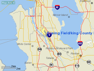
Boeing Field/king County Intl Airport |
King County International Airport
Boeing Field |
 |
| IATA: BFI – ICAO: KBFI |
| Summary |
| Airport type |
Public |
| Operator |
King County |
| Serves |
Seattle, Washington |
| Location |
Seattle / Tukwila, King County, Washington, USA |
| Elevation AMSL |
21 ft / 6 m |
| Coordinates |
47°31′48″N 122°18′07″W / 47.53°N 122.30194°W / 47.53; -122.30194 |
| Website |
www.kingcounty.gov/transportation/kcdot/Airport.aspx |
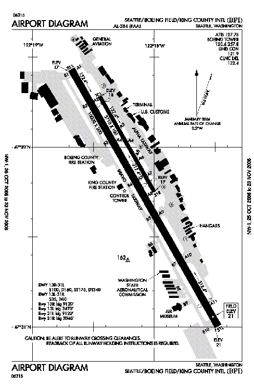
| Runways |
| Direction |
Length |
Surface |
| ft |
m |
| 13R/31L |
10,000 |
3,048 |
Asphalt |
| 13L/31R |
3,710 |
1,131 |
Asphalt |
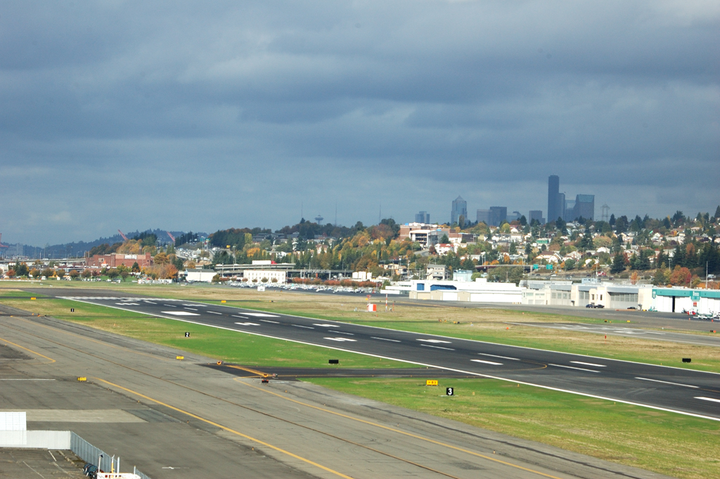
Boeing Field, officially King County International Airport (IATA: BFI, ICAO: KBFI), is a two-runway airport owned and run by King County, Washington, USA. In promotional literature, the airport is frequently referred to as KCIA, but this is not the airport identifier. The airport has some passenger service, but is mostly used by general aviation and cargo. It is named after the founder of the Boeing Company, William E. Boeing.
The airport's property is located mostly in Seattle just south of Georgetown, with its southern tip extending into Tukwila. It is 594 acres (2.4 km²) in area and handles more than 375,000 operations yearly.
With the exception of the World War II period, when it was taken over by the U.S. government, Boeing Field was Seattle's main passenger airport from its construction in 1928 until Seattle-Tacoma International Airport began operations in the late 1940s. The Boeing Company continues to use the field for testing and delivery of its airplanes, and it is still a major regional cargo hub. It is also the regional selected landing zone for Air Force One when it visits the Seattle area.
Boeing Field currently lacks any major commercial passenger airline service. A proposal by Southwest Airlines in June 2005 was submitted to King County to relocate their operations in the Seattle area from Seattle-Tacoma International Airport to Boeing Field, but was rejected by King County Executive Ron Sims in October. A similar proposal by Alaska Airlines (a response to the Southwest proposal) was also rejected. Southwest Airlines' publicized rationale for the proposed move was so they could avoid the heavy fees being levied at Sea-Tac due to its expansion program.
The transfer of ownership of Boeing Field from King County to the Port of Seattle was proposed in 2007 as part of a land swap with land owned by the Port.
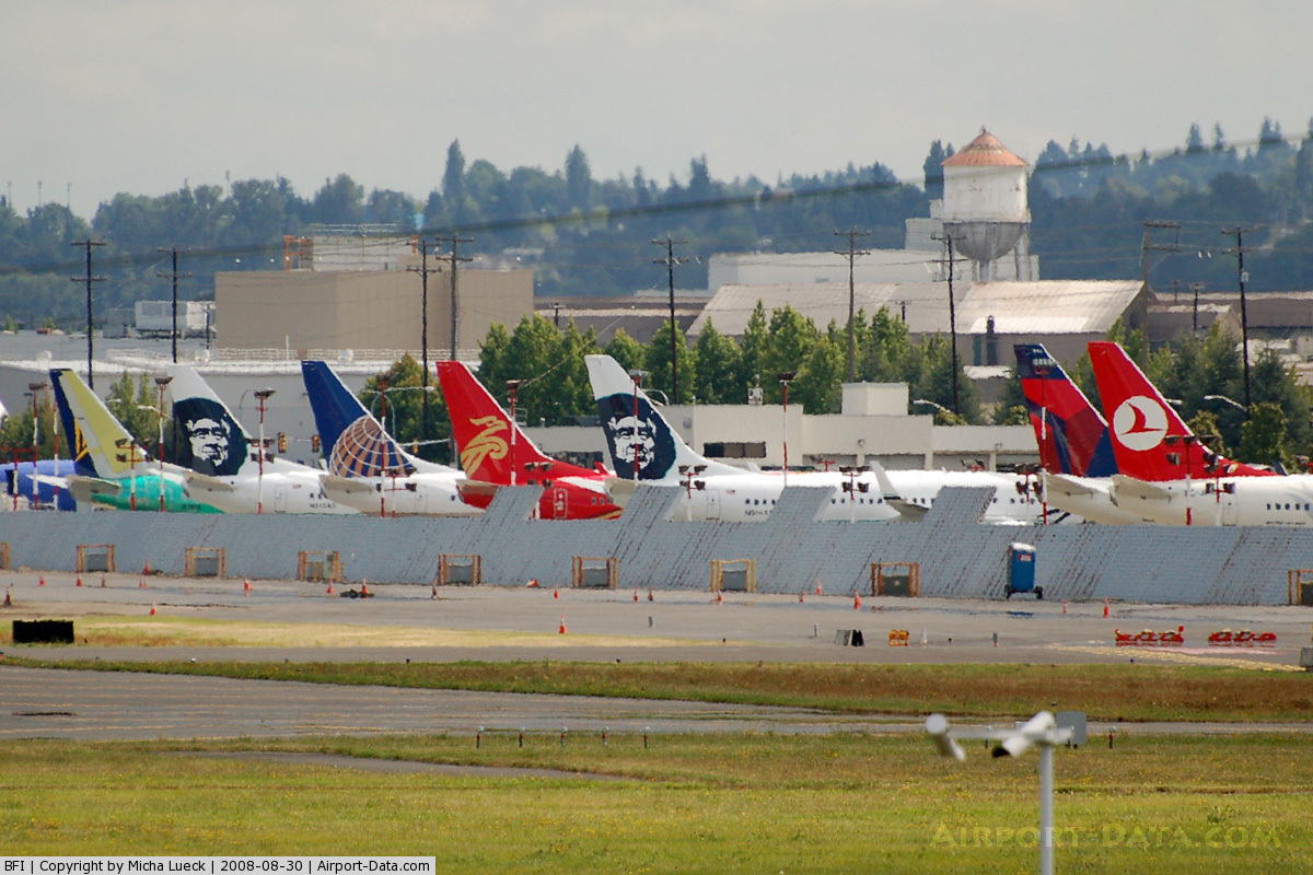
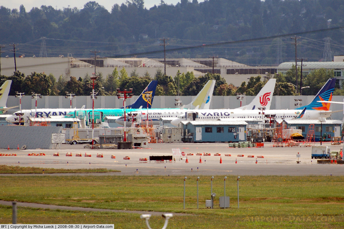
The Boeing Company has facilities at the airport. Final preparations for delivery of Boeing 737 aircraft after the first test flight are made at Boeing Field. Boeing facilities at the airport have also included a paint hangar and flight test facilities.
The initial assembly of the 737 was adjacent to Boeing Field in the 1960s because the factory in Renton was at capacity building the 707 and 727. After 271 aircraft, production was moved to Renton in late 1970. Production of military airborne early warning and control aircraft based on the 737, such as Project Wedgetail (Australia) aircraft and Peace Eagle (Turkey) aircraft is located at Boeing Field.
The Museum of Flight is located on the southwestern corner of the airfield. Among the aircraft on display include Concorde, a supersonic commercial aircraft that landed at Boeing Field on its first visit to Seattle on November 15, 1984. Aircraft movement can be easily observed from the museum.
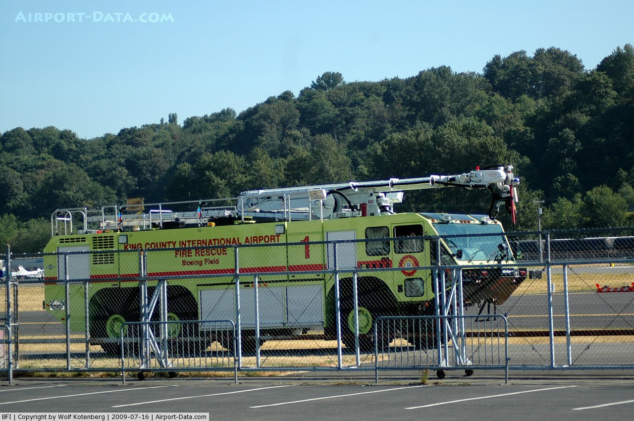
Police and Fire Response
 | |
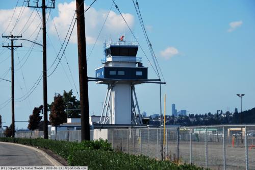
Boeing Field as seen from the Air Traffic Control Tower |
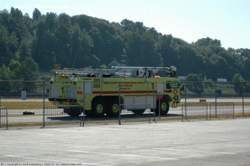
The King County International Airport contracts with the King County Sheriff's Office for police services. Deputies assigned to the airport wear a mix of both Police and Fire uniforms, turnouts etc., which includes single Police, Fire/ARFF patch, and drive King County International Airport Police patrol cars. There are currently 17 patrol officers/sergeants and one chief assigned full time to the airport. Officers assigned to the airport are also required to obtain a Washington State Fire Fighter One certification and a Emergency Medical Technician certification.
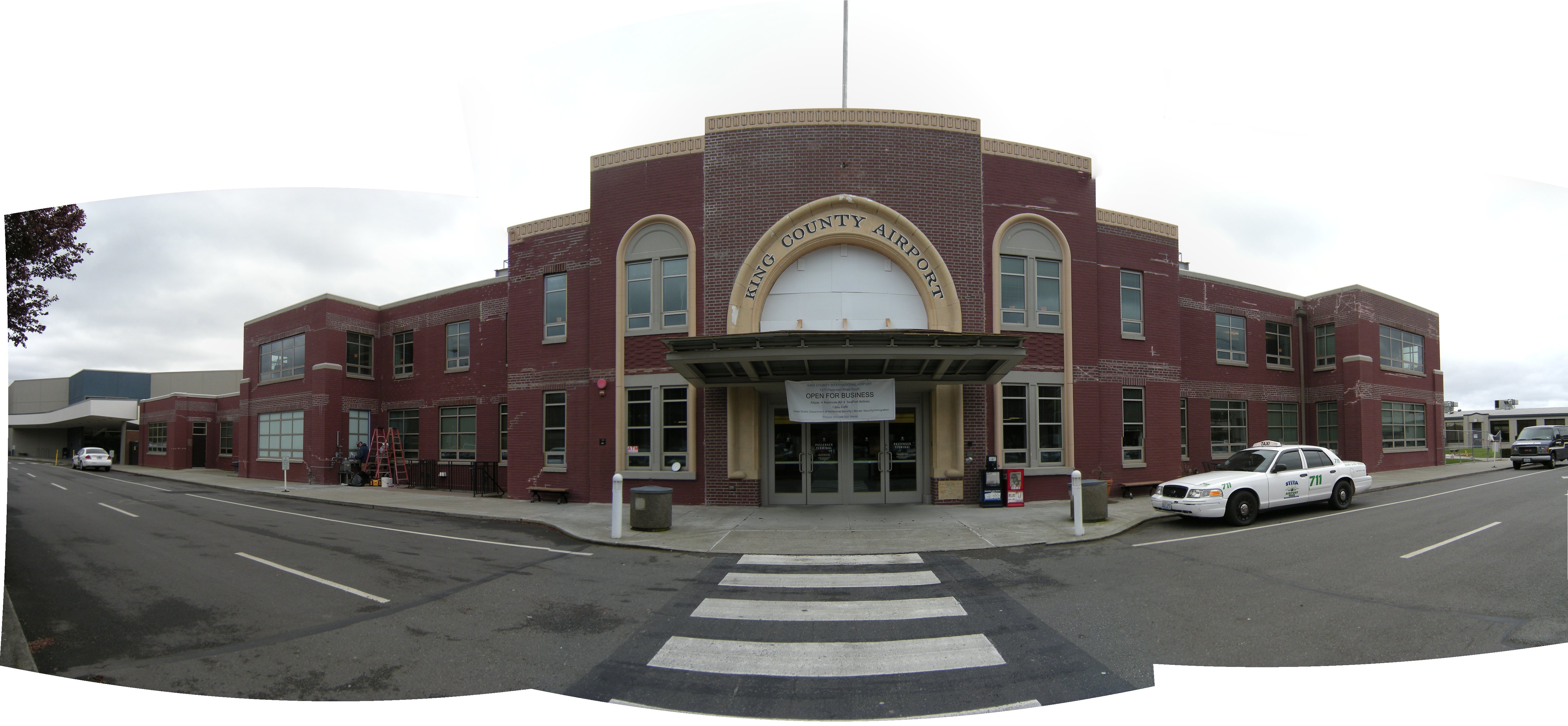
Passenger
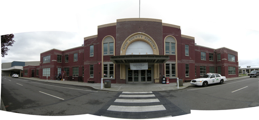 | |
Passenger terminal, Boeing Field |
| Airlines |
Destinations |
| Kenmore Air |
Eastsound, Friday Harbor, Port Angeles |
| SeaPort Airlines |
Portland (OR), Astoria (OR), and Newport (OR) |
Cargo
- Airpac Airlines
- ABX Air
- Ameriflight
- DB Schenker
- UPS Airlines
The above content comes from Wikipedia and is published under free licenses – click here to read more.
 |
(Click on the photo to enlarge) |
 |
(Click on the photo to enlarge) |
 |
(Click on the photo to enlarge) |
 |
(Click on the photo to enlarge) |
 |
(Click on the photo to enlarge) |
 |
(Click on the photo to enlarge) |
 |
(Click on the photo to enlarge) |
 |
(Click on the photo to enlarge) |
 |
(Click on the photo to enlarge) |
 |
(Click on the photo to enlarge) |
Location & QuickFacts
| FAA Information Effective: | 2008-09-25 |
| Airport Identifier: | BFI |
| Airport Status: | Operational |
| Longitude/Latitude: | 122-18-07.1000W/47-31-48.0000N
-122.301972/47.530000 (Estimated) |
| Elevation: | 21 ft / 6.40 m (Surveyed) |
| Land: | 634 acres |
| From nearest city: | 4 nautical miles S of Seattle, WA |
| Location: | King County, WA |
| Magnetic Variation: | 20E (1990) |
Owner & Manager
| Ownership: | Publicly owned |
| Owner: | King County |
| Address: | 516 Third Ave
Seattle, WA 98104 |
| Phone number: | 206-296-4040 |
| Manager: | Robert I. Burke Aae |
| Address: | 7277 Perimeter Road South
Seattle, WA 98108-3844 |
| Phone number: | 206-296-7380 |
Airport Operations and Facilities
| Airport Use: | Open to public |
| Wind indicator: | Yes |
| Segmented Circle: | No |
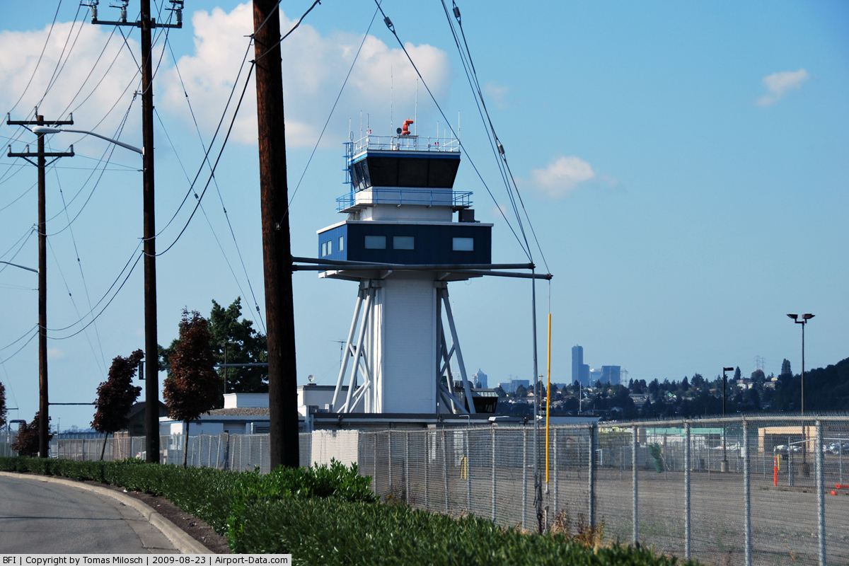
| Control Tower: | Yes |
| Lighting Schedule: | DUSK-DAWN
HIRL RY 13R/31L OPER DUSK-DAWN. MIRL RY 13L/31R OPR 2200-0700. |
| Beacon Color: | Clear-Green (lighted land airport) |
| Landing fee charge: | Yes
CONTACT ARPT OPS. |
| Sectional chart: | Seattle |
| Region: | ANM - Northwest Mountain |
| Boundary ARTCC: | ZSE - Seattle |
| Tie-in FSS: | SEA - Seattle |
| FSS on Airport: | Yes |
| FSS Toll Free: | 1-800-WX-BRIEF |
| NOTAMs Facility: | BFI (NOTAM-d service avaliable) |
| Certification type/date: | II A S 01/197 |
| Federal Agreements: | NGPY3 |
Airport Communications
Airport Services
| Fuel available: | 100LLA |
| Airframe Repair: | MAJOR |
| Power Plant Repair: | MAJOR |
| Bottled Oxygen: | HIGH/LOW |
| Bulk Oxygen: | HIGH/LOW |
Runway Information
Runway 13L/31R
| Dimension: | 3710 x 100 ft / 1130.8 x 30.5 m |
| Surface: | ASPH, Good Condition |
| Surface Treatment: | Saw-cut or plastic Grooved |
| Weight Limit: | Single wheel: 35000 lbs.
Dual wheel: 60000 lbs.
LIMITED TO USE BY ACFT UP TO 12500 LBS. |
| Edge Lights: | Medium |
| |
Runway 13L |
Runway 31R |
| Longitude: | 122-18-26.8600W | 122-17-59.9950W |
| Latitude: | 47-32-16.8642N | 47-31-45.0944N |
| Elevation: | 18.00 ft | 17.00 ft |
| Alignment: | 127 | 127 |
| Traffic Pattern: | Left | Right |
| Markings: | Basic, Good Condition | Basic, Good Condition |
| Crossing Height: | 39.00 ft | 39.00 ft |
| Displaced threshold: | 240.00 ft | 365.00 ft |
| VASI: | 2-light PAPI on left side | 2-light PAPI on left side |
| Visual Glide Angle: | 3.00° | 3.00° |
| Runway End Identifier: | Yes | Yes |
| Obstruction: | , 50:1 slope to clear | 210 ft tree, 5000.0 ft from runway, 625 ft right of centerline, 22:1 slope to clear
APCH RATIO 27:1 FM DSPLCD THLD. |
|
Runway 13R/31L
| Dimension: | 10000 x 200 ft / 3048.0 x 61.0 m |
| Surface: | ASPH, Good Condition |
| Surface Treatment: | Saw-cut or plastic Grooved |
| Weight Limit: | Single wheel: 100000 lbs.
Dual wheel: 160000 lbs.
Dual tandem wheel: 340000 lbs.
LIMITED TO USE BY ACFT UP TO 12500 LBS. |
| Edge Lights: | High |
| |
Runway 13R |
Runway 31L |
| Longitude: | 122-18-40.8813W | 122-17-28.4743W |
| Latitude: | 47-32-25.9548N | 47-31-00.3046N |
| Elevation: | 17.00 ft | 21.00 ft |
| Alignment: | 127 | 127 |
| ILS Type: | ILS/DME
| ILS/DME
|
| Traffic Pattern: | Right | Left |
| Markings: | Precision instrument, Good Condition | Precision instrument, Good Condition |
| Crossing Height: | 75.00 ft | 66.00 ft |
| Displaced threshold: | 0.00 ft | 880.00 ft |
| VASI: | 4-light PAPI on left side | 4-light PAPI on left side |
| Visual Glide Angle: | 3.00° | 3.10° |
| RVR Equipment: | touchdown | |
| Approach lights: | MALSF | |
| Runway End Identifier: | | Yes |
| Obstruction: | 12 ft fence, 240.0 ft from runway, 425 ft right of centerline, 3:1 slope to clear | 27 ft rr, 200.0 ft from runway, 375 ft right of centerline, 40:1 slope to clear
APCH SLOPE 40:1 TO DSPLCD THLD.
FENCE/ROAD/POLES/RR TRACKS WITHIN EAST EDGE OF PRIM SFC. |
| Decleard distances: | Take off run available 10001.00 ft
Take off distance available 10000.00 ft
Actual stop distance available 9120.00 ft
Landing distance available 9120.00 ft
| Take off run available 10001.00 ft
Take off distance available 10001.00 ft
Actual stop distance available 10001.00 ft
Landing distance available 9120.00 ft
|
|
Radio Navigation Aids
| ID |
Type |
Name |
Ch |
Freq |
Var |
Dist |
| RNT | NDB | Renton | | 353.00 | 20E | 4.1 nm |
| ODD | NDB | Dondo | | 224.00 | 19E | 10.0 nm |
| PWT | NDB | Kitsap | | 206.00 | 20E | 18.6 nm |
| CAN | NDB | Carney | | 274.00 | 20E | 23.0 nm |
| GR | NDB | Graye | | 216.00 | 18E | 25.9 nm |
| LAC | NDB | Lacomas | | 328.00 | 18E | 33.1 nm |
| MNC | NDB | Mason County | | 348.00 | 19E | 36.1 nm |
| PAE | VOR/DME | Paine | 043X | 110.60 | 20E | 23.5 nm |
| CVV | VOR/DME | Penn Cove | 119X | 117.20 | 19E | 46.2 nm |
| SEA | VORTAC | Seattle | 115X | 116.80 | 19E | 5.7 nm |
| TCM | VORTAC | Mcchord | 033X | 109.60 | 22E | 24.0 nm |
| OLM | VORTAC | Olympia | 081X | 113.40 | 19E | 41.5 nm |
| BFI | VOT | Boeing Field | | 108.60 | | 0.1 nm |
| SEA | VOT | Seattle-tacoma | | 117.50 | | 5.2 nm |
Remarks
- ITINERANT PARKING AVBL. CONTACT ARPT OPS.
- TWR 80 FT AGL LCTD 1200 FT N AND 900 FT W OF THLD RY 13R.
- TWY A6 CLSD INDEF. TWY B9 CLSD INDEF.
- FOR NOISE ABATEMENT PROCEDURES, CONTACT NOISE OFFICE AT (206) 296-7437.
- EXTENSIVE HELICOPTER TRAINING ACTIVITY ON TAXIWAY B.
- FOR MUSEUM OF FLIGHT TRANSIENT AIRCRAFT PARKING, PRIOR PERMISSION REQUIRED, CALL (206) 764-5710.
- TAXIWAY ZULU AND 880' SPECIAL USE PAVEMENT AVAILABLE 72 HOURS PRIOR PERMISSION REQUIRED. CONTACT AIRPORT OPERATIONS 206-296-7334.
- TPA RWY 13L/31R 1000 MSL; RWY 13R/31L 800 MSL.
- TOUCH AND GO LNDGS PROHIBITED 2200-0700.
- IF ACESS TO BOEING RAMP REQUIRED; CTC BOEING FLT DISPATCH 206-655-3421 FOR APVL DURING NORMAL DUTY HRS.
- BIRD FLOCKS WITHIN ARPT VICINITY. - CHECK LOCAL ADVISORIES.
- FLIGHT NOTIFICATION SERVICE (ADCUS) AVBL.
- 14' ANT (MKD/LGTD) 230' FM RY 13L END 125' R.
- TWY A1 & TWY A FROM A1-A3 RSTRD TO ACFT UP TO 150000 LBS AND LESS THAN 108 FT WINGSPAN.
- TWYS A2; B2; & A11 RSTD TO ACFT UP TO 60000 LBS. TWYS A3; A5; & A8 RSTD TO ACFT UP TO 12500 LBS.
- ESTABD PRIOR TO 1959.
Images and information placed above are from
http://www.airport-data.com/airport/BFI/
We thank them for the data!
| General Info
|
| Country |
United States
|
| State |
WASHINGTON
|
| FAA ID |
BFI
|
| Latitude |
47-31-47.961N
|
| Longitude |
122-18-07.042W
|
| Elevation |
18 feet
|
| Near City |
SEATTLE
|
We don't guarantee the information is fresh and accurate. The data may
be wrong or outdated.
For more up-to-date information please refer to other sources.
|
|