 |
|
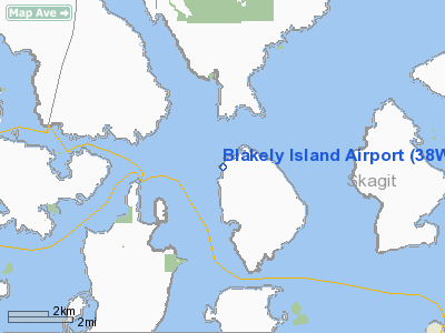
Location & QuickFacts
| FAA Information Effective: | 2008-09-25 |
| Airport Identifier: | 38WA |
| Airport Status: | Operational |
| Longitude/Latitude: | 122-49-34.6470W/48-34-44.3700N
-122.826291/48.578992 (Estimated) |
| Elevation: | 66 ft / 20.12 m (Surveyed) |
| Land: | 10 acres |
| From nearest city: | 0 nautical miles NW of Blakely Island, WA |
| Location: | San Juan County, WA |
| Magnetic Variation: | 21E (1985) |
Owner & Manager
| Ownership: | Privately owned |
| Owner: | Blakely Island Maint Com |
| Address: |
Blakely Island, WA 98222 |
| Manager: | Jim Davis |
| Address: | P. O. Box 5263
Blakley Island, WA 98222 |
| Phone number: | 360-375-6662 |
Airport Operations and Facilities
| Airport Use: | Private |
| Wind indicator: | Yes |
| Segmented Circle: | No |
| Control Tower: | No |
| Lighting Schedule: | RDO-CTL
ACTVT MIRL RY 01/19 - 122.9. |
| Sectional chart: | Seattle |
| Region: | ANM - Northwest Mountain |
| Boundary ARTCC: | ZSE - Seattle |
| Tie-in FSS: | SEA - Seattle |
| FSS on Airport: | No |
| FSS Toll Free: | 1-800-WX-BRIEF |
Runway Information
Runway 01/19
| Dimension: | 2200 x 40 ft / 670.6 x 12.2 m
ADDNL 200 X 40' OVRNS & TURBC BOTH ENDS RWY 01/19. |
| Surface: | ASPH, |
| Edge Lights: | Medium |
| |
Runway 01 |
Runway 19 |
| Traffic Pattern: | Left | Right |
| Displaced threshold: | 252.00 ft | 122.00 ft |
|
Radio Navigation Aids
| ID |
Type |
Name |
Ch |
Freq |
Var |
Dist |
| OPZ | NDB | Lopez Island | | 356.00 | 21E | 7.1 nm |
| FHR | NDB | Friday Harbor | | 284.00 | 20E | 8.6 nm |
| BVS | NDB | Skagit/bay View | | 240.00 | 21E | 17.5 nm |
| YJ | NDB | Victoria | | 200.00 | 21E | 23.1 nm |
| AP | NDB | Active Pass | | 378.00 | 21E | 25.5 nm |
| WC | NDB | White Rock | | 332.00 | 21E | 25.8 nm |
| MB | NDB | Mill Bay | | 293.00 | 21E | 28.8 nm |
| XX | NDB | Abbotsford | | 344.00 | 21E | 29.5 nm |
| VR | NDB | Vancouver | | 266.00 | 21E | 36.8 nm |
| V | NDB | Victor | | 368.00 | 22E | 40.0 nm |
| LU | NDB | Cultus | | 214.00 | 22E | 40.6 nm |
| CL | NDB | Elwha | | 515.00 | 22E | 42.4 nm |
| NUW | TACAN | Whidbey Island | 085X | | 21E | 15.0 nm |
| CVV | VOR/DME | Penn Cove | 119X | 117.20 | 19E | 20.5 nm |
| YYJ | VOR/DME | Victoria | 084X | 113.70 | 21E | 27.6 nm |
| PAE | VOR/DME | Paine | 043X | 110.60 | 20E | 45.3 nm |
| HUH | VORTAC | Whatcom | 077X | 113.00 | 20E | 24.1 nm |
| YVR | VORTAC | Vancouver | 44 | 115.90 | 21E | 32.6 nm |
Remarks
- TREES BOTH SIDES OF RWY PENT TRSNL SFC.
-
-
- ESTABLISHED PRIOR TO 5/15/59.
Images and information placed above are from
http://www.airport-data.com/airport/38WA/
We thank them for the data!
| General Info
|
| Country |
United States
|
| State |
WASHINGTON
|
| FAA ID |
38WA
|
| Latitude |
48-34-44.370N
|
| Longitude |
122-49-34.647W
|
| Elevation |
66 feet
|
| Near City |
BLAKELY ISLAND
|
We don't guarantee the information is fresh and accurate. The data may
be wrong or outdated.
For more up-to-date information please refer to other sources.
|
|


