 |
|
| Blaine Municipal Airport |
| IATA: BWS – ICAO: none – FAA LID: 4W6 |
| Summary |
| Airport type |
Public |
| Owner |
City of Blaine |
| Serves |
Blaine, Washington |
| Elevation AMSL |
75 ft / 23 m |
| Coordinates |
48°59′24″N 122°43′57″W / 48.99°N 122.7325°W / 48.99; -122.7325 |
| Runways |
| Direction |
Length |
Surface |
| ft |
m |
| 14/32 |
2,539 |
774 |
Asphalt |
| Statistics (2005) |
| Aircraft operations |
8,000 |
| Based aircraft |
23 |
| Source: Federal Aviation Administration |
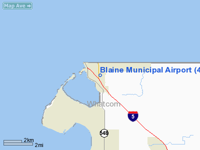
Blaine Municipal Airport (IATA: BWS, FAA LID: 4W6) was a city-owned public-use airport located one nautical mile (1.8 km) east of the central business district of Blaine, a city in Whatcom County, Washington, United States. Blaine Municipal Airport (AKA Dierks Field) was closed on December 31, 2008.
Facilities and aircraft
Blaine Municipal Airport covered an area of 42 acres (17 ha) at an elevation of 75 feet (23 m) above mean sea level. It had one runway designated 14/32 with a 2,539 by 40 feet (774 x 12 m) asphalt pavement. For the 12-month period ending December 31, 2005, the airport had 8,000 aircraft operations, an average of 21 per day, all general aviation. At that time there were 23 aircraft based at this airport: 91% single-engine and 9% multi-engine.
The above content comes from Wikipedia and is published under free licenses – click here to read more.
Location & QuickFacts
| FAA Information Effective: | 2008-09-25 |
| Airport Identifier: | 4W6 |
| Airport Status: | Operational |
| Longitude/Latitude: | 122-43-56.5290W/48-59-24.2120N
-122.732369/48.990059 (Estimated) |
| Elevation: | 75 ft / 22.86 m (Surveyed) |
| Land: | 42 acres |
| From nearest city: | 1 nautical miles E of Blaine, WA |
| Location: | Whatcom County, WA |
| Magnetic Variation: | 21E (1985) |
Owner & Manager
| Ownership: | Publicly owned |
| Owner: | City Of Blaine |
| Address: | 344 H Street
Blaine, WA 98230 |
| Phone number: | 360-332-8311 |
| Manager: | Gary Tomsic |
| Address: | 344 H Street
Blaine, WA 98230 |
| Phone number: | 360-332-8311 |
Airport Operations and Facilities
| Airport Use: | Open to public |
| Wind indicator: | Yes |
| Segmented Circle: | Yes |
| Control Tower: | No |
| Lighting Schedule: | DUSK-DAWN
ACTIVATE ON 122.8 - THREE CLICKS. |
| Beacon Color: | Clear-Green (lighted land airport) |
| Landing fee charge: | No |
| Sectional chart: | Seattle |
| Region: | ANM - Northwest Mountain |
| Traffic Pattern Alt: | 930 ft |
| Boundary ARTCC: | ZSE - Seattle |
| Responsible ARTCC: | ZVR - Vancouver |
| Tie-in FSS: | SEA - Seattle |
| FSS on Airport: | No |
| FSS Toll Free: | 1-800-WX-BRIEF |
| NOTAMs Facility: | SEA (NOTAM-d service avaliable) |
Airport Communications
| CTAF: | 122.800 |
| Unicom: | 122.800
AUTOMATED UNICOM. |
Airport Services
| Fuel available: | 100LL
100LL FUEL AVBL 24 HRS WITH MAJOR CREDIT CARD. |
| Bottled Oxygen: | NONE |
| Bulk Oxygen: | NONE |
Runway Information
Runway 14/32
| Dimension: | 2539 x 40 ft / 773.9 x 12.2 m |
| Surface: | ASPH, Good Condition |
| Edge Lights: | Medium |
| |
Runway 14 |
Runway 32 |
| Longitude: | 122-44-03.2770W | 122-43-49.7830W |
| Latitude: | 48-59-35.9270N | 48-59-12.4980N |
| Elevation: | 75.00 ft | 67.00 ft |
| Traffic Pattern: | Left | Right |
| Markings: | Basic, Good Condition
RY 14/32 2090 FT BASIC MARKINGS, DSPLCD THLDS NOT MKD. | Basic, Good Condition |
| Displaced threshold: | 300.00 ft | 132.00 ft |
| VASI: | 2-light PAPI on left side | 2-light PAPI on left side |
| Visual Glide Angle: | 3.00° | 5.00° |
| Obstruction: | 15 ft road, 203.0 ft from runway
RWY 14 APPROACH SLOPE 31:1 FROM DISP THR.
-3' DITCH 0'-200' FROM THR 65' RIGHT; ROAD & TRUCK PARK 0'-200' FROM THR 66' RIGHT. | 60 ft trees, 1152.0 ft from runway, 160 ft left of centerline, 15:1 slope to clear
RY 32 APCH SLOPE 32:1 TO DSPLCD THLD.
+10' BRUSH 100'-200' FROM THR. |
|
Radio Navigation Aids
| ID |
Type |
Name |
Ch |
Freq |
Var |
Dist |
| WC | NDB | White Rock | | 332.00 | 21E | 0.8 nm |
| XX | NDB | Abbotsford | | 344.00 | 21E | 9.8 nm |
| VR | NDB | Vancouver | | 266.00 | 21E | 16.9 nm |
| V | NDB | Victor | | 368.00 | 22E | 22.7 nm |
| AP | NDB | Active Pass | | 378.00 | 21E | 23.1 nm |
| LU | NDB | Cultus | | 214.00 | 22E | 27.0 nm |
| FHR | NDB | Friday Harbor | | 284.00 | 20E | 30.2 nm |
| OPZ | NDB | Lopez Island | | 356.00 | 21E | 31.6 nm |
| YJ | NDB | Victoria | | 200.00 | 21E | 33.6 nm |
| BVS | NDB | Skagit/bay View | | 240.00 | 21E | 33.7 nm |
| MB | NDB | Mill Bay | | 293.00 | 21E | 37.2 nm |
| YCD | NDB | Nanaimo | | 251.00 | 21E | 45.6 nm |
| NUW | TACAN | Whidbey Island | 085X | | 21E | 38.3 nm |
| YYJ | VOR/DME | Victoria | 084X | 113.70 | 21E | 33.7 nm |
| CVV | VOR/DME | Penn Cove | 119X | 117.20 | 19E | 44.8 nm |
| HUH | VORTAC | Whatcom | 077X | 113.00 | 20E | 6.6 nm |
| YVR | VORTAC | Vancouver | 44 | 115.90 | 21E | 17.2 nm |
Remarks
- ALL PATTERNS TO THE EAST.
- 3' DITCH 50' FM RWY EDGE EACH SIDE OF RWY.
- NOISE ABATEMENT: DEPART TO THE SOUTH AND LAND TO THE NORTH. WIND PERMITTING; STAY OVER HIGHWAY N AND/DOGLEG; ALL TRAFFIC E OF ARPT; AVOID FLIGHT OVER CITY.
- PARALLEL TWY 20' WIDE.
- DEER ON AND INVOF OF AIRPORT.
- ESTABD PRIOR TO 15 MAY 1959.
Images and information placed above are from
http://www.airport-data.com/airport/4W6/
We thank them for the data!
| General Info
|
| Country |
United States
|
| State |
WASHINGTON
|
| FAA ID |
4W6
|
| Latitude |
48-59-22.403N
|
| Longitude |
122-43-54.628W
|
| Elevation |
70 feet
|
| Near City |
BLAINE
|
We don't guarantee the information is fresh and accurate. The data may
be wrong or outdated.
For more up-to-date information please refer to other sources.
|
|


