 |
|
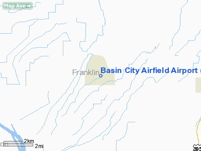
Basin City Airfield Airport |
Location & QuickFacts
| FAA Information Effective: | 2008-09-25 |
| Airport Identifier: | 97WA |
| Airport Status: | Operational |
| Longitude/Latitude: | 119-09-14.0450W/46-35-08.4970N
-119.153901/46.585694 (Estimated) |
| Elevation: | 722 ft / 220.07 m (Estimated) |
| Land: | 5 acres |
| From nearest city: | 6 nautical miles W of Mesa, WA |
| Location: | Franklin County, WA |
| Magnetic Variation: | 19E (1985) |
Owner & Manager
| Ownership: | Privately owned |
| Owner: | Mel Hood |
| Address: | 6941 R-170
Mesa, WA 99343 |
| Phone number: | 509-269-4441 |
| Manager: | Mel Hood |
| Address: | 6941 R-170
Mesa, WA 99343 |
| Phone number: | 509-269-4441 |
Airport Operations and Facilities
| Airport Use: | Private |
| Wind indicator: | Yes |
| Segmented Circle: | No |
| Control Tower: | No |
| Landing fee charge: | No |
| Sectional chart: | Seattle |
| Region: | ANM - Northwest Mountain |
| Boundary ARTCC: | ZSE - Seattle |
| Tie-in FSS: | SEA - Seattle |
| FSS on Airport: | No |
| FSS Toll Free: | 1-800-WX-BRIEF |
Airport Services
| Fuel available: | 100
FUEL AVBL EMERGENCY ONLY. |
| Airframe Repair: | MAJOR |
| Power Plant Repair: | MAJOR |
Runway Information
Runway 04/22
| Dimension: | 2200 x 50 ft / 670.6 x 15.2 m |
| Surface: | ASPH-TURF,
FIRST 1400 FT RY ON NE END ASPH; REMAINING 800 FT OF RY TURF. |
| |
Runway 04 |
Runway 22 |
| Traffic Pattern: | Left | Left |
|
Helipad H1
| Dimension: | 50 x 50 ft / 15.2 x 15.2 m |
| Surface: | ASPH,
FIRST 1400 FT RY ON NE END ASPH; REMAINING 800 FT OF RY TURF. |
| |
Runway H1 |
Runway |
| Traffic Pattern: | Left | Left |
|
Radio Navigation Aids
| ID |
Type |
Name |
Ch |
Freq |
Var |
Dist |
| MW | NDB | Pelly | | 408.00 | 18E | 32.2 nm |
| PSC | VOR/DME | Pasco | 021X | 108.40 | 20E | 19.5 nm |
| MWH | VOR/DME | Moses Lake | 097X | 115.00 | 18E | 38.2 nm |
| ALW | VOR/DME | Walla Walla | 111X | 116.40 | 20E | 46.7 nm |
| EPH | VORTAC | Ephrata | 073X | 112.60 | 21E | 48.9 nm |
Remarks
- HELICOPTERS & SPRAY PLANES WORK AREA FROM APRIL TO OCT.
Images and information placed above are from
http://www.airport-data.com/airport/97WA/
We thank them for the data!
| General Info
|
| Country |
United States
|
| State |
WASHINGTON
|
| FAA ID |
97WA
|
| Latitude |
46-35-08.497N
|
| Longitude |
119-09-14.045W
|
| Elevation |
722 feet
|
| Near City |
MESA
|
We don't guarantee the information is fresh and accurate. The data may
be wrong or outdated.
For more up-to-date information please refer to other sources.
|
|


