 |
|
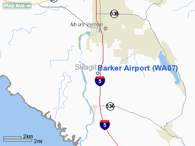
Location & QuickFacts
| FAA Information Effective: | 2008-09-25 |
| Airport Identifier: | WA07 |
| Airport Status: | Operational |
| Longitude/Latitude: | 122-20-19.5660W/48-22-29.3720N
-122.338768/48.374826 (Estimated) |
| Elevation: | 5 ft / 1.52 m (Estimated) |
| Land: | 7 acres |
| From nearest city: | 3 nautical miles S of Mount Vernon, WA |
| Location: | Skagit County, WA |
| Magnetic Variation: | 21E (1985) |
Owner & Manager
| Ownership: | Privately owned |
| Owner: | Dave Bromels |
| Address: | 1615 Dike Rd
Mount Vernon, WA 98273 |
| Manager: | Dave Bromels |
| Address: | 1615 Dike Rd
Mount Vernon, WA 98273 |
| Phone number: | 206-424-5154 |
Airport Operations and Facilities
| Airport Use: | Private |
| Wind indicator: | Yes |
| Segmented Circle: | No |
| Control Tower: | No |
| Lighting Schedule: | DUSK-DAWN |
| Landing fee charge: | No |
| Sectional chart: | Seattle |
| Region: | ANM - Northwest Mountain |
| Boundary ARTCC: | ZSE - Seattle |
| Tie-in FSS: | SEA - Seattle |
| FSS on Airport: | No |
| FSS Toll Free: | 1-800-WX-BRIEF |
Airport Services
| Airframe Repair: | NONE |
| Power Plant Repair: | NONE |
| Bottled Oxygen: | NONE |
| Bulk Oxygen: | NONE |
Runway Information
Runway 16/34
| Dimension: | 1950 x 120 ft / 594.4 x 36.6 m |
| Surface: | TURF, |
| |
Runway 16 |
Runway 34 |
| Traffic Pattern: | Left | Left |
| Markings: | None, | None, |
| Runway End Identifier: | No | No |
| Centerline Lights: | No | No |
| Touchdown Lights: | No | No |
| Obstruction: | 31 ft rr, 75 ft right of centerline | 31 ft rr, 0.0 ft from runway, 75 ft left of centerline |
|
Radio Navigation Aids
| ID |
Type |
Name |
Ch |
Freq |
Var |
Dist |
| BVS | NDB | Skagit/bay View | | 240.00 | 21E | 6.5 nm |
| OPZ | NDB | Lopez Island | | 356.00 | 21E | 24.1 nm |
| FHR | NDB | Friday Harbor | | 284.00 | 20E | 29.0 nm |
| XX | NDB | Abbotsford | | 344.00 | 21E | 39.0 nm |
| LU | NDB | Cultus | | 214.00 | 22E | 40.5 nm |
| WC | NDB | White Rock | | 332.00 | 21E | 40.9 nm |
| YJ | NDB | Victoria | | 200.00 | 21E | 45.2 nm |
| AP | NDB | Active Pass | | 378.00 | 21E | 48.3 nm |
| NUW | TACAN | Whidbey Island | 085X | | 21E | 13.0 nm |
| CVV | VOR/DME | Penn Cove | 119X | 117.20 | 19E | 17.3 nm |
| PAE | VOR/DME | Paine | 043X | 110.60 | 20E | 27.5 nm |
| HUH | VORTAC | Whatcom | 077X | 113.00 | 20E | 35.6 nm |
Remarks
- ACFT PARKING 80' RIGHT RWY 34 AT THR.
- RWY 16/34 ROUGH.
- ESTABD PRIOR TO 1959.
Images and information placed above are from
http://www.airport-data.com/airport/WA07/
We thank them for the data!
| General Info
|
| Country |
United States
|
| State |
WASHINGTON
|
| FAA ID |
WA07
|
| Latitude |
48-22-29.372N
|
| Longitude |
122-20-19.566W
|
| Elevation |
5 feet
|
| Near City |
MOUNT VERNON
|
We don't guarantee the information is fresh and accurate. The data may
be wrong or outdated.
For more up-to-date information please refer to other sources.
|
|


