 |
|
| Bandera State Airport |
| IATA: none – ICAO: none – FAA LID: 4W0 |
| Summary |
| Airport type |
Public |
| Owner |
WSDOT Aviation Division |
| Serves |
Bandera, Washington |
| Elevation AMSL |
1,636 ft / 499 m |
| Coordinates |
47°23′43″N 121°32′11″W / 47.39528°N 121.53639°W / 47.39528; -121.53639 |
| Runways |
| Direction |
Length |
Surface |
| ft |
m |
| 8/26 |
2,344 |
714 |
Turf |
| Statistics (2008) |
| Aircraft operations |
300 |
| Source: Federal Aviation Administration |
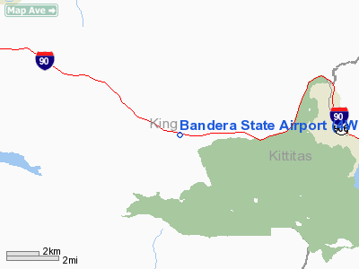
Bandera State Airport (FAA LID: 4W0) is a public use airport located in Bandera, King County, Washington, United States. It is owned by the Washington State DOT Aviation Division.
This airport was constructed in 1948 as one of the first state airports. It is located in the upper Snoqualmie Valley, 14 miles (23 km) east of North Bend, Washington. The airport is a few feet off Interstate 90. It is an excellent location for mountain flying practice. Though surrounded by mountains, the valley is wide enough for maneuvering most light aircraft. The airport is frequently used by instructors for training students in soft field work and in mountain flying. Glider clubs frequently base out of Bandera.
Facilities and aircraft
Bandera State Airport covers an area of 25 acres (10 ha) with one runway designated 8/26. The runway has a turf surface measuring 2,344 by 200 feet (714 x 61 m) which is extremely soft when wet.
Field elevation is 1,636 feet (499 m) above mean sea level, and some density altitude problems can be encountered on a summer day. Trees surround the airport close in, and there are trees close to each end of the field in the approaches. Elk, deer and motorcyclists may be encountered on the field. The surface is rough. Vehicle ruts, and frost heaved rocks are possible. The south third of the runway is almost always soft, and the runway is generally smoother the farther north you land. Overflight to check for surface damage, presence of obstructions, and height of grass is essential. The airport is usually open from June 1 to October 1.
For the 12-month period ending September 19, 2008, the airport had 300 general aviation aircraft operations, an average of 25 per month.
The above content comes from Wikipedia and is published under free licenses – click here to read more.
Location & QuickFacts
| FAA Information Effective: | 2008-09-25 |
| Airport Identifier: | 4W0 |
| Airport Status: | Operational |
| Longitude/Latitude: | 121-32-11.2990W/47-23-43.3280N
-121.536472/47.395369 (Estimated) |
| Elevation: | 1636 ft / 498.65 m (Estimated) |
| Land: | 25 acres |
| From nearest city: | 0 nautical miles W of Bandera, WA |
| Location: | King County, WA |
| Magnetic Variation: | 20E (1985) |
Owner & Manager
| Ownership: | Publicly owned |
| Owner: | Wsdot Aviation Div |
| Address: | 3704 172nd Street Ne, Suite K2, Po Box 3367
Arlington, WA 98223-6336 |
| Phone number: | 360-651-6300 |
| Manager: | Wsdot Aviation Div |
| Address: | 3704 172nd Street Ne, Suite K2, Po Box 3367
Arlington, WA 98223-6336 |
| Phone number: | 800-552-0666 |
Airport Operations and Facilities
| Airport Use: | Open to public |
| Wind indicator: | Yes |
| Segmented Circle: | No |
| Control Tower: | No |
| Landing fee charge: | No |
| Sectional chart: | Seattle |
| Region: | ANM - Northwest Mountain |
| Boundary ARTCC: | ZSE - Seattle |
| Tie-in FSS: | SEA - Seattle |
| FSS on Airport: | No |
| FSS Toll Free: | 1-800-WX-BRIEF |
| NOTAMs Facility: | SEA (NOTAM-d service avaliable) |
| Federal Agreements: | S1 |
Airport Communications
Airport Services
| Airframe Repair: | NONE |
| Power Plant Repair: | NONE |
| Bottled Oxygen: | NONE |
| Bulk Oxygen: | NONE |
Runway Information
Runway 08/26
| Dimension: | 2344 x 200 ft / 714.5 x 61.0 m |
| Surface: | TURF, Fair Condition
EXTREMELY ROUGH; RY SOFT WHEN WET. |
| |
Runway 08 |
Runway 26 |
| Longitude: | 121-32-27.9650W | 121-31-54.6330W |
| Latitude: | 47-23-45.7360N | 47-23-40.9200N |
| Traffic Pattern: | Left | Left |
| Obstruction: | 39 ft trees, 16.0 ft from runway, 125 ft right of centerline | 41 ft trees, 0.0 ft from runway, 123 ft right of centerline |
|
Radio Navigation Aids
| ID |
Type |
Name |
Ch |
Freq |
Var |
Dist |
| RNT | NDB | Renton | | 353.00 | 20E | 28.2 nm |
| ODD | NDB | Dondo | | 224.00 | 19E | 31.5 nm |
| GR | NDB | Graye | | 216.00 | 18E | 46.0 nm |
| LAC | NDB | Lacomas | | 328.00 | 18E | 47.7 nm |
| PWT | NDB | Kitsap | | 206.00 | 20E | 49.9 nm |
| PAE | VOR/DME | Paine | 043X | 110.60 | 20E | 43.5 nm |
| SEA | VORTAC | Seattle | 115X | 116.80 | 19E | 31.5 nm |
| TCM | VORTAC | Mcchord | 033X | 109.60 | 22E | 41.1 nm |
| ELN | VORTAC | Ellensburg | 126X | 117.90 | 21E | 49.3 nm |
| SEA | VOT | Seattle-tacoma | | 117.50 | | 31.3 nm |
| BFI | VOT | Boeing Field | | 108.60 | | 32.1 nm |
Remarks
- ARPT CLSD 1 OCT - 1 JUN.
- CTC WASHINGTON STATE AVIATION DIVISION 360-651-6300 OR 1-800-552-0666 WA AREA FOR FACILITY INFORMATION PRIOR TO USE.
- WATCH FOR PEDESTRIANS; VEHICLES & ANIMALS ON RY.
- ESTBD PRIOR TO MAY 1959.
Images and information placed above are from
http://www.airport-data.com/airport/4W0/
We thank them for the data!
| General Info
|
| Country |
United States
|
| State |
WASHINGTON
|
| FAA ID |
4W0
|
| Latitude |
47-23-44.396N
|
| Longitude |
121-32-12.348W
|
| Elevation |
1632 feet
|
| Near City |
BANDERA
|
We don't guarantee the information is fresh and accurate. The data may
be wrong or outdated.
For more up-to-date information please refer to other sources.
|
|


