 |
|
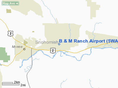
Location & QuickFacts
| FAA Information Effective: | 2008-09-25 |
| Airport Identifier: | 5WA2 |
| Airport Status: | Operational |
| Longitude/Latitude: | 121-54-04.4420W/47-51-59.3600N
-121.901234/47.866489 (Estimated) |
| Elevation: | 370 ft / 112.78 m (Estimated) |
| Land: | 0 acres |
| From nearest city: | 3 nautical miles E of Monroe, WA |
| Location: | Snohomish County, WA |
| Magnetic Variation: | 20E (1985) |
Owner & Manager
| Ownership: | Privately owned |
| Owner: | Bryant C. Jarman |
| Address: | 25414 Old Owen Road
Monroe, WA 98272 |
| Phone number: | 206-794-7506 |
| Manager: | Bryant C. Jarman |
| Address: | 25414 Old Owen Road
Monroe, WA 98272 |
| Phone number: | 206-794-7506 |
Airport Operations and Facilities
| Airport Use: | Private |
| Wind indicator: | Yes |
| Segmented Circle: | No |
| Control Tower: | No |
| Landing fee charge: | No |
| Sectional chart: | Seattle |
| Region: | ANM - Northwest Mountain |
| Boundary ARTCC: | ZSE - Seattle |
| Tie-in FSS: | SEA - Seattle |
| FSS on Airport: | No |
| FSS Toll Free: | 1-800-WX-BRIEF |
Airport Services
| Airframe Repair: | NONE |
| Power Plant Repair: | NONE |
Runway Information
Runway E/W
| Dimension: | 1800 x 90 ft / 548.6 x 27.4 m |
| Surface: | TURF, |
| |
Runway E |
Runway W |
| Traffic Pattern: | Right | Left |
|
Radio Navigation Aids
| ID |
Type |
Name |
Ch |
Freq |
Var |
Dist |
| RNT | NDB | Renton | | 353.00 | 20E | 25.7 nm |
| ODD | NDB | Dondo | | 224.00 | 19E | 34.4 nm |
| PWT | NDB | Kitsap | | 206.00 | 20E | 41.3 nm |
| BVS | NDB | Skagit/bay View | | 240.00 | 21E | 41.7 nm |
| CAN | NDB | Carney | | 274.00 | 20E | 46.8 nm |
| NUW | TACAN | Whidbey Island | 085X | | 21E | 42.3 nm |
| PAE | VOR/DME | Paine | 043X | 110.60 | 20E | 15.5 nm |
| CVV | VOR/DME | Penn Cove | 119X | 117.20 | 19E | 40.1 nm |
| SEA | VORTAC | Seattle | 115X | 116.80 | 19E | 30.7 nm |
| TCM | VORTAC | Mcchord | 033X | 109.60 | 22E | 49.1 nm |
| BFI | VOT | Boeing Field | | 108.60 | | 26.0 nm |
| SEA | VOT | Seattle-tacoma | | 117.50 | | 30.2 nm |
Remarks
- TREES E,W, NES, PLINE N-S OVR CNTR OF STRIP.
- RWY EDGES POORLY DEFINED.
Images and information placed above are from
http://www.airport-data.com/airport/5WA2/
We thank them for the data!
| General Info
|
| Country |
United States
|
| State |
WASHINGTON
|
| FAA ID |
5WA2
|
| Latitude |
47-51-59.360N
|
| Longitude |
121-54-04.442W
|
| Elevation |
370 feet
|
| Near City |
MONROE
|
We don't guarantee the information is fresh and accurate. The data may
be wrong or outdated.
For more up-to-date information please refer to other sources.
|
|


