|
|
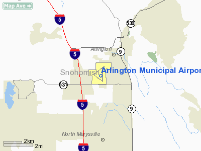
| Arlington Municipal Airport |
 |
| IATA: none – ICAO: KAWO – FAA LID: AWO |
| Summary |
| Airport type |
Public |
| Owner |
City of Arlington |
| Operator |
City of Arlington |
| Serves |
Arlington, Washington |
| Location |
3 nm southwest of the CBD |
| Elevation AMSL |
142 ft / 43 m |
| Coordinates |
48°09′39″N 122°09′32″W / 48.16083°N 122.15889°W / 48.16083; -122.15889 |
| Website |
http://www.ci.arlington.wa.us/index.asp?NID=45 |
| Runways |
| Direction |
Length |
Surface |
| ft |
m |
| 16/34 |
5,332 |
1,625 |
Asphalt |
| 11/29 |
3,498 |
1,066 |
Asphalt |
| Statistics (2009) |
| Aircraft operations |
190,000 |
| Based aircraft |
397 |
| Source: Federal Aviation Administration |
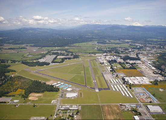
Plan view of Arlington Municipal Airport with boundaries outlined in red Arlington Municipal Airport (ICAO: KAWO, FAA LID: AWO) is a public airport located three miles (5 km) southwest of the central business district of Arlington, a city in Snohomish County, Washington, United States. It is owned and operated by the City of Arlington. History
Construction of Arlington Municipal Airport was approved on February 23, 1934. The first airplane took off on June 13, 1934 and the airport was officially dedicated on July 4, 1935.
U.S. Naval Auxiliary Air Station, Arlington, Washington was established in 1940, when the United States Navy leased the airstrip from the town of Arlington to supplement training facilities at Seattle. However, no important construction took place until 1942. In that year the Navy permitted the Army to develop the field as a strategic base for medium bombers to counteract the Japanese invasion of the Aleutian Islands. Early in 1943 the Japanese threat in the Aleutians diminished and at the same time the Naval carrier program required additional training fields within reach of gunnery ranges in the Puget Sound area. By August 14, 1945 Arlington was a well-balanced station equipped to support two light carrier Air groups for either day or night operations. No major projects were pending at that time, and it was felt that none remained to be undertaken unless a significant addition was made to the functions of the station.
At the close of World War II, the U.S. military reduced funding and operations around the United States. On October 10, 1945 notification was received from the Chief of Naval Operations that Arlington would be reduced to a caretaker status on December 1, 1945.
The airport is listed on the National Register of Historic Places.
Today
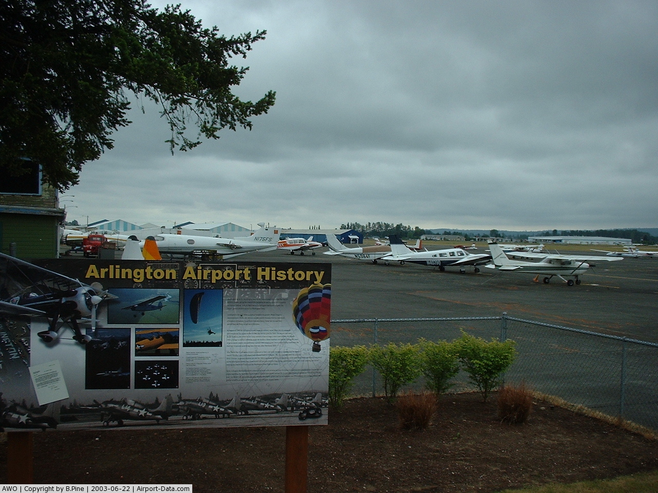
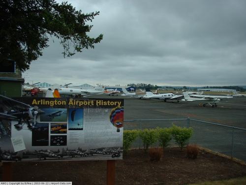
Currently, the airport is host to several businesses making significant contributions to the aviation industry. Some activities include flight instruction, emergency parachute manufacturing, kit plane and sailplane sales/manufacturing, historic and decommissioned aircraft restoration, aircraft upholstery, aircraft cover manufacturing, and much more. The airport is home to corporate & decommissioned military jets, vintage aircraft, experimental aircraft, aerobatic aircraft, helicopters, gliders, and ultralights. The grassroots aviation presence at Arlington is very strong, rivaling that of many larger airports across the United States, including nearby Paine Field (KPAE).
The City continues to support general aviation through financing, planning and development. During the 1995 Master Plan update, the City planned and developed the airport specifically for general aviation use. Items specific to general aviation included in the 2002 Master Plan Update were additional T-hangars, a 100’ by 1,000’ (50’ pavement / 50’ turf) ultralight runway, and a compass rose.
Facilities and aircraft
Arlington Municipal Airport covers an area of 1,189 acres (481 ha) which contains two asphalt paved runways: 16/34 measuring 5,332 x 100 ft (1,625 x 30 m) and 11/29 measuring 3,498 x 75 ft (1,066 x 23 m).
For the 12-month period ending January 31, 2007, the airport had 190,000 aircraft operations, an average of 520 per day: 99.7% general aviation, 0.3% air taxi and <0.1% military. On January 15, 2009, there were 397 aircraft based at Arlington: 72% single-engine, 5% multi-engine, 2% jet, 3% helicopter, 8% glider and 11% ultralight.
The above content comes from Wikipedia and is published under free licenses – click here to read more.
 |
(Click on the photo to enlarge) |
Location & QuickFacts
| FAA Information Effective: | 2008-09-25 |
| Airport Identifier: | AWO |
| Airport Status: | Operational |
| Longitude/Latitude: | 122-09-32.5000W/48-09-38.7000N
-122.159028/48.160750 (Estimated) |
| Elevation: | 142 ft / 43.28 m (Surveyed) |
| Land: | 1189 acres |
| From nearest city: | 3 nautical miles SW of Arlington, WA |
| Location: | Snohomish County, WA |
| Magnetic Variation: | 20E (1990) |
Owner & Manager
| Ownership: | Publicly owned |
| Owner: | City Of Arlington |
| Address: | City Hall, 238 N Olympic
Arlington, WA 98223 |
| Phone number: | 360-403-3421 |
| Manager: | Robert Putnam |
| Address: | 18204 59th Drive Ne
Arlington, WA 98223 |
| Phone number: | 360-403-3470 |
Airport Operations and Facilities
| Airport Use: | Open to public |
| Wind indicator: | Yes |
| Segmented Circle: | Yes |
| Control Tower: | No |
| Lighting Schedule: | DUSK-DAWN
ACTIVATE MALS RWY 34 - 122.7. PAPI RYS 11, 16, 29 AND 34, AND REIL RYS 11, 16, AND 29 OPER 24 HRS. |
| Beacon Color: | Clear-Green (lighted land airport) |
| Landing fee charge: | Yes
LNDG FEE FOR ACFT OVER 12500 LBS. |
| Sectional chart: | Seattle |
| Region: | ANM - Northwest Mountain |
| Traffic Pattern Alt: | 1058 ft |
| Boundary ARTCC: | ZSE - Seattle |
| Tie-in FSS: | SEA - Seattle |
| FSS on Airport: | No |
| FSS Toll Free: | 1-800-WX-BRIEF |
| NOTAMs Facility: | AWO (NOTAM-d service avaliable) |
| Federal Agreements: | NGPY |
Airport Communications
| CTAF: | 122.700 |
| Unicom: | 122.700 |
Airport Services
| Fuel available: | 100LLA MOGAS
SELF SVC 100LL & MOGAS AVBL 24 HRS. |
| Airframe Repair: | MAJOR |
| Power Plant Repair: | MAJOR |
| Bottled Oxygen: | NONE |
| Bulk Oxygen: | NONE |
Runway Information
Runway 11/29
| Dimension: | 3498 x 75 ft / 1066.2 x 22.9 m |
| Surface: | ASPH, Good Condition |
| Weight Limit: | Single wheel: 32000 lbs.
Dual wheel: 34000 lbs.
Dual tandem wheel: 59000 lbs. |
| |
Runway 11 |
Runway 29 |
| Longitude: | 122-10-07.6399W | 122-09-26.5392W |
| Latitude: | 48-09-42.0380N | 48-09-21.1748N |
| Elevation: | 132.00 ft | 128.00 ft |
| Alignment: | 127 | 127 |
| Traffic Pattern: | Right | Left |
| Markings: | Basic, Good Condition | Basic, Good Condition |
| Crossing Height: | 42.00 ft | 40.00 ft |
| VASI: | 2-light PAPI on left side | 2-light PAPI on left side |
| Visual Glide Angle: | 3.50° | 4.00° |
| Runway End Identifier: | Yes | Yes |
| Obstruction: | , 50:1 slope to clear | 176 ft tree, 3967.0 ft from runway, 465 ft right of centerline, 21:1 slope to clear |
|
Runway 16/34
| Dimension: | 5332 x 100 ft / 1625.2 x 30.5 m |
| Surface: | ASPH, Good Condition |
| Weight Limit: | Single wheel: 114000 lbs.
Dual wheel: 150000 lbs.
Dual tandem wheel: 270000 lbs. |
| Edge Lights: | Medium |
| |
Runway 16 |
Runway 34 |
| Longitude: | 122-09-23.4968W | 122-09-22.2573W |
| Latitude: | 48-10-09.6429N | 48-09-17.0344N |
| Elevation: | 141.00 ft | 128.00 ft |
| Alignment: | 127 | 127 |
| ILS Type: | | LOCALIZER
|
| Traffic Pattern: | Right | Left |
| Markings: | Non-precision instrument, Good Condition | Non-precision instrument, Good Condition |
| Crossing Height: | 40.00 ft | 46.00 ft |
| VASI: | 2-light PAPI on left side | 2-light PAPI on left side |
| Visual Glide Angle: | 3.00° | 3.00° |
| Approach lights: | | MALS |
| Runway End Identifier: | Yes | |
| Obstruction: | 92 ft tree, 2287.0 ft from runway, 200 ft left of centerline, 22:1 slope to clear | , 50:1 slope to clear |
|
Radio Navigation Aids
| ID |
Type |
Name |
Ch |
Freq |
Var |
Dist |
| BVS | NDB | Skagit/bay View | | 240.00 | 21E | 21.2 nm |
| OPZ | NDB | Lopez Island | | 356.00 | 21E | 36.0 nm |
| RNT | NDB | Renton | | 353.00 | 20E | 40.1 nm |
| FHR | NDB | Friday Harbor | | 284.00 | 20E | 41.1 nm |
| PWT | NDB | Kitsap | | 206.00 | 20E | 46.9 nm |
| ODD | NDB | Dondo | | 224.00 | 19E | 48.3 nm |
| NUW | TACAN | Whidbey Island | 085X | | 21E | 23.3 nm |
| PAE | VOR/DME | Paine | 043X | 110.60 | 20E | 15.2 nm |
| CVV | VOR/DME | Penn Cove | 119X | 117.20 | 19E | 23.2 nm |
| SEA | VORTAC | Seattle | 115X | 116.80 | 19E | 44.0 nm |
| BFI | VOT | Boeing Field | | 108.60 | | 38.5 nm |
| SEA | VOT | Seattle-tacoma | | 117.50 | | 43.5 nm |
Remarks
- GLIDER OPERATIONS AT ARPT DAILY.
- ULTRALIGHT OPNS DLY AT NW CORNER OF ARPT.
- OCCASIONAL HOT AIR BALLOON ACTIVITY.
- HELICOPTER TRAINING AREA; AUTOROTATIONS IN GRASS & ON SOUTH PARALLEL TAXIWAY RY 29 & ALONG TWY B. HOVERING AREA NEAR COMPASS ROSE LCTD AREA RY 29 & TWY E.
- TAXIING ACFT OVER 12500 LBS REMAIN CLR OF W SIDE OF ARPT; TWY C & RAMPS ON W SIDE OF TWY D.
- EXISTED PRIOR TO 1959.
Images and information placed above are from
http://www.airport-data.com/airport/AWO/
We thank them for the data!
| General Info
|
| Country |
United States
|
| State |
WASHINGTON
|
| FAA ID |
AWO
|
| Latitude |
48-09-38.694N
|
| Longitude |
122-09-32.475W
|
| Elevation |
137 feet
|
| Near City |
ARLINGTON
|
We don't guarantee the information is fresh and accurate. The data may
be wrong or outdated.
For more up-to-date information please refer to other sources.
|
|