 |
|
| Anderson Field |
| IATA: none – ICAO: none – FAA LID: S97 |
| Summary |
| Airport type |
Public |
| Owner |
Town of Brewster |
| Serves |
Brewster, Washington |
| Elevation AMSL |
914 ft / 279 m |
| Coordinates |
48°06′18″N 119°43′14″W / 48.105°N 119.72056°W / 48.105; -119.72056 |
| Runways |
| Direction |
Length |
Surface |
| ft |
m |
| 7/25 |
4,000 |
1,219 |
Asphalt |
| Statistics (2007) |
| Aircraft operations |
20,000 |
| Source: Federal Aviation Administration |
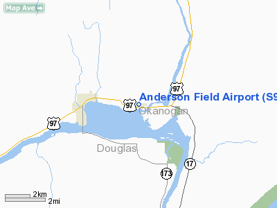
Anderson Field (FAA LID: S97) is a town-owned public-use airport located three nautical miles (6 km) east of the central business district of Brewster, a town in Okanogan County, Washington, United States.
Facilities and aircraft
Anderson Field covers an area of 64 acres (26 ha) at an elevation of 914 feet (279 m) above mean sea level. It has one asphalt paved runway designated 7/25 which measures 4,000 by 60 feet (1,219 x 18 m). For the 12-month period ending July 31, 2007, the airport had 20,000 general aviation aircraft operations, an average of 54 per day.
The above content comes from Wikipedia and is published under free licenses – click here to read more.
Location & QuickFacts
| FAA Information Effective: | 2008-09-25 |
| Airport Identifier: | S97 |
| Airport Status: | Operational |
| Longitude/Latitude: | 119-43-14.2060W/48-06-17.5250N
-119.720613/48.104868 (Estimated) |
| Elevation: | 914 ft / 278.59 m (Estimated) |
| Land: | 64 acres |
| From nearest city: | 3 nautical miles E of Brewster, WA |
| Location: | Okanogan County, WA |
| Magnetic Variation: | 20E (1985) |
Owner & Manager
| Ownership: | Publicly owned |
| Owner: | Town Of Brewster |
| Address: | Box 340
Brewster, WA 98812 |
| Phone number: | 509-689-3464 |
| Manager: | Dave Smith |
| Address: | Box 340
Brewster, WA 98812 |
| Phone number: | 509-689-2712 |
Airport Operations and Facilities
| Airport Use: | Open to public |
| Wind indicator: | Yes |
| Segmented Circle: | Yes |
| Control Tower: | No |
| Lighting Schedule: | DUSK-DAWN
ACTVT MIRL RY 07/25 - CTAF. |
| Beacon Color: | Clear-Green (lighted land airport) |
| Landing fee charge: | No |
| Sectional chart: | Seattle |
| Region: | ANM - Northwest Mountain |
| Boundary ARTCC: | ZSE - Seattle |
| Tie-in FSS: | SEA - Seattle |
| FSS on Airport: | No |
| FSS Toll Free: | 1-800-WX-BRIEF |
| NOTAMs Facility: | SEA (NOTAM-d service avaliable) |
| Federal Agreements: | NGY |
Airport Communications
| CTAF: | 122.800 |
| Unicom: | 122.800 |
Airport Services
| Fuel available: | 100LL
FUEL EMERG USE ONLY. SEE CHTR OPR WHO LIVES ON FIELD. |
| Airframe Repair: | MINOR |
| Power Plant Repair: | MAJOR |
| Bottled Oxygen: | NONE |
| Bulk Oxygen: | NONE |
Runway Information
Runway 07/25
| Dimension: | 4000 x 60 ft / 1219.2 x 18.3 m |
| Surface: | ASPH, Good Condition |
| Weight Limit: | Single wheel: 15000 lbs. |
| Edge Lights: | Medium |
| |
Runway 07 |
Runway 25 |
| Traffic Pattern: | Left | Left |
| Markings: | Basic, Good Condition | Basic, Good Condition |
|
Radio Navigation Aids
| ID |
Type |
Name |
Ch |
Freq |
Var |
Dist |
| EAT | FAN MARKER | Malaga | | | 21E | 47.8 nm |
| OMK | NDB | Omak | | 219.00 | 19E | 22.5 nm |
| EAT | VOR/DME | Wenatchee | 047X | 111.00 | 19E | 46.8 nm |
| EPH | VORTAC | Ephrata | 073X | 112.60 | 21E | 45.3 nm |
Images and information placed above are from
http://www.airport-data.com/airport/S97/
We thank them for the data!
| General Info
|
| Country |
United States
|
| State |
WASHINGTON
|
| FAA ID |
S97
|
| Latitude |
48-06-17.525N
|
| Longitude |
119-43-14.206W
|
| Elevation |
914 feet
|
| Near City |
BREWSTER
|
We don't guarantee the information is fresh and accurate. The data may
be wrong or outdated.
For more up-to-date information please refer to other sources.
|
|


