 |
|
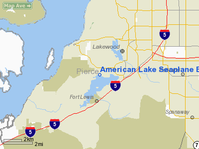
American Lake Seaplane Base Airport |
Location & QuickFacts
| FAA Information Effective: | 2008-09-25 |
| Airport Identifier: | W37 |
| Airport Status: | Operational |
| Longitude/Latitude: | 122-33-39.4520W/47-08-29.3520N
-122.560959/47.141487 (Estimated) |
| Elevation: | 235 ft / 71.63 m (Estimated) |
| Land: | 0 acres |
| From nearest city: | 7 nautical miles S of Tacoma, WA |
| Location: | Pierce County, WA |
| Magnetic Variation: | 20E (1985) |
Owner & Manager
| Ownership: | Publicly owned |
| Owner: | City Of Lakewood |
| Address: | 6000 Main St. Sw
Lakewood, WA 98498-5027 |
| Phone number: | 253-589-2489 |
| Manager: | Andrew Neiditz |
| Address: | 6000 Main St. Sw
Lakewood, WA 98498 |
| Phone number: | 253-589-2489 |
Airport Operations and Facilities
| Airport Use: | Open to public |
| Segmented Circle: | No |
| Control Tower: | No |
| Landing fee charge: | No |
| Sectional chart: | Seattle |
| Region: | ANM - Northwest Mountain |
| Boundary ARTCC: | ZSE - Seattle |
| Tie-in FSS: | SEA - Seattle |
| FSS on Airport: | No |
| FSS Toll Free: | 1-800-WX-BRIEF |
| NOTAMs Facility: | SEA (NOTAM-d service avaliable) |
Airport Communications
Runway Information
Runway 02/20
| Dimension: | 5500 x 500 ft / 1676.4 x 152.4 m |
| Surface: | WATER, |
| |
Runway 02 |
Runway 20 |
| Traffic Pattern: | Left | Left |
|
Radio Navigation Aids
| ID |
Type |
Name |
Ch |
Freq |
Var |
Dist |
| GR | NDB | Graye | | 216.00 | 18E | 1.9 nm |
| LAC | NDB | Lacomas | | 328.00 | 18E | 8.0 nm |
| ODD | NDB | Dondo | | 224.00 | 19E | 16.9 nm |
| CAN | NDB | Carney | | 274.00 | 20E | 19.7 nm |
| MNC | NDB | Mason County | | 348.00 | 19E | 22.4 nm |
| PWT | NDB | Kitsap | | 206.00 | 20E | 22.5 nm |
| RNT | NDB | Renton | | 353.00 | 20E | 25.5 nm |
| TDO | NDB | Toledo | | 219.00 | 20E | 41.4 nm |
| PAE | VOR/DME | Paine | 043X | 110.60 | 20E | 48.2 nm |
| TCM | VORTAC | Mcchord | 033X | 109.60 | 22E | 3.5 nm |
| OLM | VORTAC | Olympia | 081X | 113.40 | 19E | 17.3 nm |
| SEA | VORTAC | Seattle | 115X | 116.80 | 19E | 20.4 nm |
| SEA | VOT | Seattle-tacoma | | 117.50 | | 21.0 nm |
| BFI | VOT | Boeing Field | | 108.60 | | 25.5 nm |
Remarks
- TRAFFIC PATTERN ALTITUDE 700 FT AGL.
- ARPT UNDERLIES MCCHORD AFB CLASS D AIRSPACE.
- SWIMMERS & BOATERS IN THE AREA.
- DAY USE ONLY RECOMMENDED.
- NOISE ABATEMENT PROCEDURES IN EFFECT; CTC AMGR 253-589-2489.
Images and information placed above are from
http://www.airport-data.com/airport/W37/
We thank them for the data!
| General Info
|
| Country |
United States
|
| State |
WASHINGTON
|
| FAA ID |
W37
|
| Latitude |
47-08-29.352N
|
| Longitude |
122-33-39.452W
|
| Elevation |
235 feet
|
| Near City |
TACOMA
|
We don't guarantee the information is fresh and accurate. The data may
be wrong or outdated.
For more up-to-date information please refer to other sources.
|
|


