 |
|
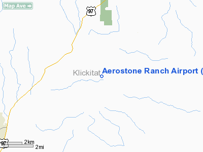
Location & QuickFacts
| FAA Information Effective: | 2008-09-25 |
| Airport Identifier: | 03WN |
| Airport Status: | Operational |
| Longitude/Latitude: | 120-40-12.0000W/45-52-30.0000N
-120.670000/45.875000 (Estimated) |
| Elevation: | 2320 ft / 707.14 m (Estimated) |
| Land: | 160 acres |
| From nearest city: | 7 nautical miles NE of Goldendale, WA |
| Location: | Klickitat County, WA |
| Magnetic Variation: | () |
Owner & Manager
| Ownership: | Privately owned |
| Owner: | Aerostone Ranch Llc |
| Address: | Po Box 1220
Goldendale, WA 98620 |
| Phone number: | 509-773-9100 |
| Manager: | Douglas Herlihy |
| Address: | Po Box 1220
Goldendale, WA 98620 |
| Phone number: | 509-773-9100 |
Airport Operations and Facilities
| Airport Use: | Private |
| Control Tower: | No |
| Sectional chart: | Seattle |
| Region: | ANM - Northwest Mountain |
| Boundary ARTCC: | ZSE - Seattle |
| Tie-in FSS: | SEA - Seattle |
| FSS Toll Free: | 1-800-WX-BRIEF |
Runway Information
Runway 07/25
| Dimension: | 2000 x 70 ft / 609.6 x 21.3 m |
| Surface: | GRVL,
COMPACTED GRVL. |
| |
Runway 07 |
Runway 25 |
| Traffic Pattern: | Left | Left |
| Obstruction: | | 40 ft pline, 500.0 ft from runway |
|
Radio Navigation Aids
| ID |
Type |
Name |
Ch |
Freq |
Var |
Dist |
| LTJ | VOR/DME | Klickitat | 070X | 112.30 | 21E | 20.5 nm |
| YKM | VORTAC | Yakima | 107X | 116.00 | 21E | 42.8 nm |
Remarks
- PLINE 30 FT AGL 600 FT EAST OF RY 25 TDZ MKD WITH RED BALLS.
Images and information placed above are from
http://www.airport-data.com/airport/03WN/
We thank them for the data!
|
|


