 |
|
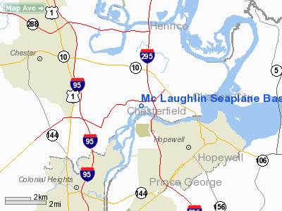
Mc Laughlin Seaplane Base Airport |
Location & QuickFacts
| FAA Information Effective: | 2008-09-25 |
| Airport Identifier: | 2G6 |
| Airport Status: | Operational |
| Longitude/Latitude: | 077-20-45.0000W/37-19-14.0000N
-77.345833/37.320556 (Estimated) |
| Elevation: | 7 ft / 2.13 m () |
| Land: | 0 acres |
| From nearest city: | 6 nautical miles E of Chester, VA |
| Location: | Chesterfield County, VA |
| Magnetic Variation: | 10W (2000) |
Owner & Manager
| Ownership: | Privately owned |
| Owner: | Barney Mclaughlin |
| Address: | 1011 E. Broadway
Hopewell,, VA 23860 |
| Phone number: | 804-541-1011 |
| Manager: | Barney Mclaughlin |
| Address: | 1011 E. Broadway
Hopewell, VA 23860 |
| Phone number: | 804-541-1011 |
Airport Operations and Facilities
| Airport Use: | Open to public |
| Segmented Circle: | No |
| Control Tower: | No |
| Sectional chart: | Washington |
| Region: | AEA - Eastern |
| Boundary ARTCC: | ZDC - Washington |
| Tie-in FSS: | DCA - Leesburg |
| FSS Toll Free: | 1-800-WX-BRIEF |
| NOTAMs Facility: | DCA (NOTAM-d service avaliable) |
Airport Communications
Runway Information
Runway 05W/23W
| Dimension: | 2500 x 150 ft / 762.0 x 45.7 m |
| Surface: | WATER, |
| |
Runway 05W |
Runway 23W |
| Traffic Pattern: | Right | Left |
|
Radio Navigation Aids
| ID |
Type |
Name |
Ch |
Freq |
Var |
Dist |
| CF | NDB | Pubbs | | 392.00 | 09W | 5.2 nm |
| PTB | NDB | Petersburg | | 284.00 | 08W | 15.8 nm |
| AKQ | NDB | Wakefield | | 274.00 | 09W | 26.2 nm |
| LJK | NDB | Ashey | | 280.00 | 09W | 27.9 nm |
| BKT | NDB | Blackstone | | 326.00 | 09W | 35.4 nm |
| FAF | NDB | Felker | | 226.00 | 08W | 36.5 nm |
| PJS | NDB | Henry | | 375.00 | 09W | 42.3 nm |
| ELQ | NDB | Emporia | | 261.00 | 10W | 42.4 nm |
| APH | NDB | A P Hill | | 396.00 | 10W | 46.1 nm |
| IQK | NDB | Louisa | | 382.00 | 09W | 48.6 nm |
| LFI | TACAN | Langley | 070X | | 10W | 49.3 nm |
| RIC | VORTAC | Richmond | 088X | 114.10 | 09W | 11.0 nm |
| HPW | VORTAC | Hopewell | 057X | 112.00 | 06W | 11.0 nm |
| FAK | VORTAC | Flat Rock | 080X | 113.30 | 06W | 26.2 nm |
| HCM | VORTAC | Harcum | 025X | 108.80 | 07W | 31.3 nm |
| FKN | VORTAC | Franklin | 043X | 110.60 | 09W | 39.8 nm |
| LVL | VORTAC | Lawrenceville | 076X | 112.90 | 08W | 40.3 nm |
Remarks
Images and information placed above are from
http://www.airport-data.com/airport/2G6/
We thank them for the data!
| General Info
|
| Country |
United States
|
| State |
VIRGINIA
|
| FAA ID |
2G6
|
| Latitude |
37-19-14.000N
|
| Longitude |
077-20-45.000W
|
| Elevation |
7 feet
|
| Near City |
CHESTER
|
We don't guarantee the information is fresh and accurate. The data may
be wrong or outdated.
For more up-to-date information please refer to other sources.
|
|


